The Spatial History Project

Screen Shot 2016-11-27 at 8.50.08 PMScreen Shot 2016-11-27 at 8.50.29 PMhttp://web.stanford.edu/group/spatialhistory/cgi-bin/site/page.php?id=1

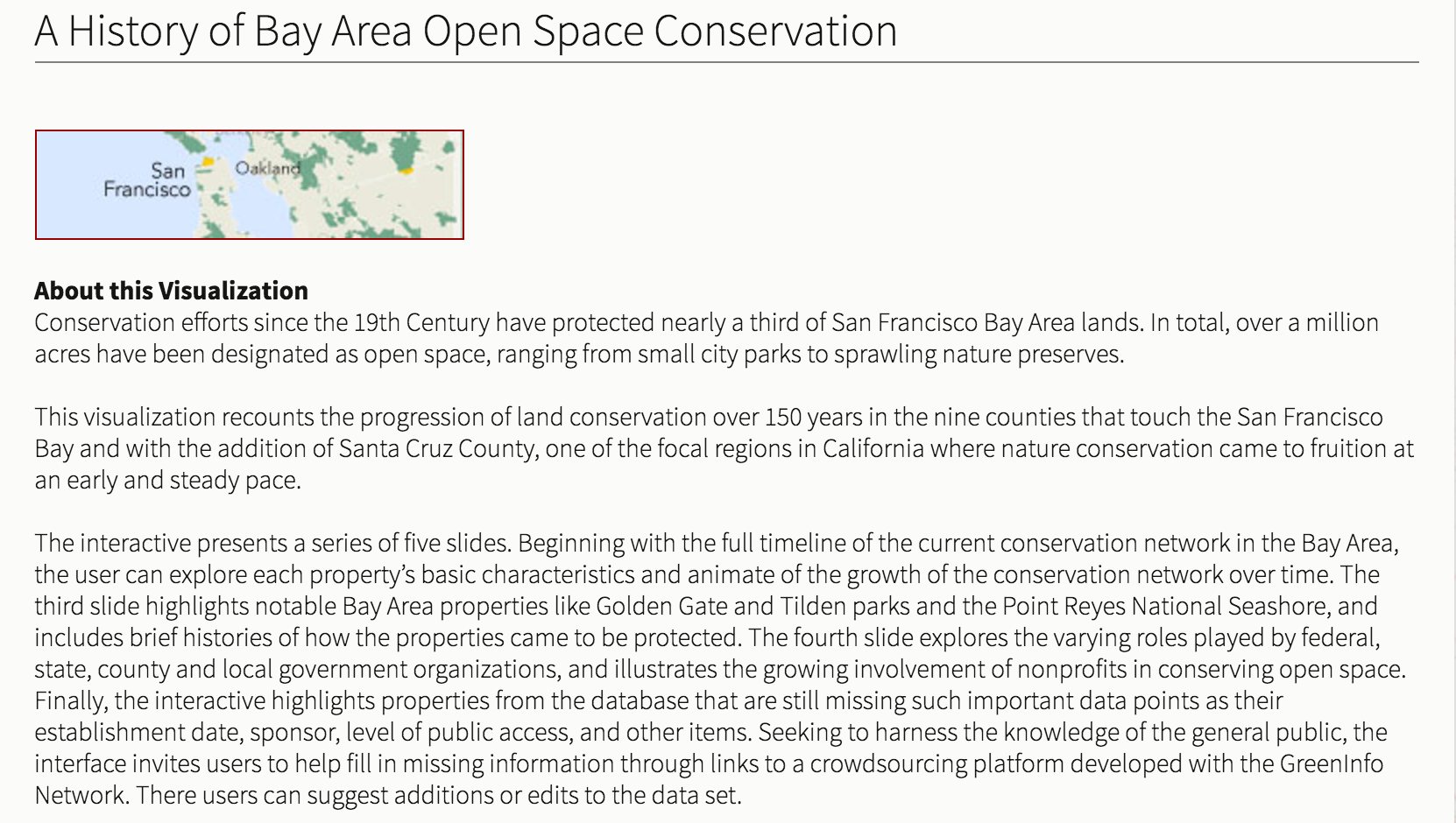
This is the website for the Spatial History Project at Stanford University, a research project run by, “principle investigators,” like tenured faculty, visiting scholars, and graduate students in collaboration with staff, research affiliates, and collaborators. The goal of this project is twofold. First: to encourage these principle investigators to craft creative research questions and to use problem solving as a method of investigating these questions. In pursuance of this the Project encourages the use of technologies in novel ways and the creation of new custom technologies. The Project believes that the spatial analysis of all topics is helpful, and so, it is common practice for their teams to aggregate and then visually analyze both spatial and other data. Not every visual on the website has yielded a finalized conclusion or peer reviewed study, nevertheless each is useful. Their second main goal is to put out easily attainable, easily digestible data. In doing this, the Spatial History Project aims to invigorate other studies and to provide a broad knowledge base for anyone interested.


“Many of our visualizations are experimental and only a few eventually become final products. We embrace visualization as a way not simply to illustrate conclusions, but a means of doing research… All that we create — including tools, data, and lessons learned — is intended for the scholarly commons to be added to, subtracted from, reworked, and recombined.”

Tracking Water Quality in the United States

Tracking Water Quality in the United States

Nicole Murgia

https://www.epa.gov/waterdata/waters-watershed-assessment-tracking-environmental-results-system

The United States Environmental Protection Agency (EPA) provides an in-depth look at water quality in the United States. Through a program referred to as the “Watershed Assessment, Tracking, and Environmental Results System” (WATERS), anyone can access details of water quality of watersheds across the country. The program was designed under the Clean Water Act to improve communications regarding water conditions among the government and citizens.

WATERS allows anyone to access information regarding the quality of the nation’s surface water through a variety of different data tools. The data program provides information such as the designated uses of bodies of water, water quality monitoring results, and assessments of water qualities.

One of the helpful programs that is included on the site is called “How’s My Waterway”. This tool allows the user to enter their current location and observe the water conditions of nearby bodies of waters. Once selected, one can view updated condition and pollution reports of the waterways near them. In addition to the technical report, the EPA provides an option to read the report in an edited, “Plain English” version that makes the scientific terms used understandable for the average citizen. https://watersgeo.epa.gov/mywaterway/mywaterway.html

Programs like WATERS allows everyone to stay informed on the quality of the waters around them as well as the hydrosphere as a whole.

Plate Tectonics Map

This map, provided by Geography.com is an interactive map of the major Tectonic plates of the world and how/when they are known to move. Each dropped pin states the name of the plate as well as it’s recent history.

It also designates whether or not it is a plate boundary and specifies the difference between volcanic chains, faults, and other tectonic movement/action. It also has links to informative articles on the different plate types and different fault lines around the world.

It also details the different types of boundaries (divergent, convergent, transform) and teaches about Earth’s Internal Structure.

Overall, a very useful website for those looking to better understand Plate Tectonics and how/where they affect the world.


Link: http://geology.com/plate-tectonics.shtml


Gap Analysis Program (GAP) Protected Areas and Land Cover Data Viewer

This geographic website is for the Gap Analysis Program (GAP) Viewer of the USGS for Protected Areas and Land Cover Data.

Separated into two different viewers for user clarity, the viewers provide users ranging from the public to professional land managers a spatially explicit inventory of the Protected Areas of the United States and a consistent nation-wide inventory of vegetation and land-use patterns for the United States.

This compilation of data types for the Gap Analysis Program is being served by the United States Geological Survey for aid in conservation, land management, planning, and recreation, amongst other uses.  In order to increase collective knowledge, these interactive maps are designed to disseminate up to date, concise, and specific data to facilitate the planning and management of biological diversity on a local, regional, and national scale.

Data viewers like these can be exceptionally helpful to both grab data and see data without the need to use any local semblance of a Geographical Information System.  In accordance with our national park projects and our final projects, I could see these viewers becoming exceedingly helpful in data gathering and analysis.  I encourage you to check them out and see how you can utilize them!

PAD: https://maps.usgs.gov/padus/

LCD: https://maps.usgs.gov/padus/

Water Use in the United States

This section of the United States Geographic Survey website deals specifically with the water use in the United States. The National Water-Use Information program collects and spreads the data. This data is gathered at county levels and then compiled by state, leading to the final culmination at the national-level.

By analyzing this data, we gain a better understanding of the hydrosphere. We can see where and how this resource is being utilized by exploring the different water use categories. These categories include, public supply, domestic, irrigation, thermoelectric power, industrial, mining, livestock and aquaculture. This data also accounts for surface & groundwater use as well as trends in water use. Looking at this data on a state level helps us understand why certain states differ so vastly compared to others. Not only can we analyze current data, but the section for trends helps us see how we have recently decreased freshwater withdrawal.

With the limited amount of available freshwater, it is important for us to be aware of our current water use and freshwater withdrawal overtime. This is the main objective of the USGS Water-Use Data and Research program. The importance of the data has led the program to develop improved water-use data through state water-use resources. This has to be a priority if we want to maintain our hydrosphere.


Website: http://water.usgs.gov/watuse/

Observe the sea ice extent everyday-MASIE

Winter is coming, and North Pole is about to reach to its coldest time. The ice extent will be very noticeable, and it can reflect the climate change when we compare the data over the range.

As temperature drops, the Oceanic seawater gets frozen and extends in size as ice. In the polar area where the temperature can drop to extremely low temperature, the daily changing in the size of the extent can be observable . MASIE-NH https://nsidc.org/data/masie,stands for the Multisensor Analyzed Sea Ice Extent – Northern Hemisphere, is operated by National Ice Center (NIC) in cooperation with the NOAA and U.S Navy . Unlike Sea Ice Index(SII) that only use passive microwave data to give graphical view of the ice extent, MASIE uses data from the Interactive Multisensor Snow and Ice Mapping System(IMS) which also relies on visible imagery with higher degree of resolution(4km instead of 10km) so the ice edge would probably be more accurate.

MASIE divides the region into sixteen pieces that covers furthest to Russia and Canada for people to see the difference. The area marked as white is where the ice is extended. Time series plot on yearly basis is also provided on https://nsidc.org/data/masie/masie_plots.Not surprisingly, the extent is decreasing in speed and getting later for the event to start every year during pre-winter time, such phenomenon should more or less bring up further questions and researches towards the relationship between ice extent and climate change.

Retreat of Glaciers in Glacier National Park

https://www.usgs.gov/centers/norock/science/retreat-glaciers-glacier-national-park?qt-science_center_objects=1#qt-science_center_objects

This article, by the USGS, discusses how glaciers in Glacier National Park reveal the “big picture” of climate change in the hydrosphere. Because glaciers are unable to adapt similar to living creatures, they are a good indicator of the impacts of climate change throughout the park. Weather data analyses shows an increase in summer temperatures and a decrease in winter snowpack (that forms and maintains glaciers), resulting in glacial melt. The mean annual temperature for Glacier National Park and the surrounding region has increased 1.33C (1.8 times greater than the global mean increase) according to USGS. This has consequently resulted in rain, rather than snow, increasing with precipitation over the past century. The fact that glaciers have continued to shrink in the region shows that the snowpack is not enough to counteract the temperature increase.

Climate proxies that we have talked about in class, such as tree-ring data, were used to obtain the temperature records for this study. Tree-ring based climate records indicate Pacific Decadal Oscillation impacts such as 20-30 year periods of “hot, dry summers coupled with decreased winter snowpack.” These proxies are important because they help scientists determine the causes for the induced rapid recession of the glaciers which now influence the current rate of recession. However, it has also been observed that even during the cooler phases of the PDO, the glaciers have continued to shrink – leading us to believe that this melt is not caused by natural cycles alone but by anthropogenic causes. In the end, the continual loss of glaciers in Glacier National Park will have significant consequences on the park’s ecosystems, as well as impact the landscape aesthetics valued by park visitors.

Hurricane and Tropical Storm Tracker-Weather Underground

Weather Underground (https://www.wunderground.com/hurricane/atlantic/2016/Invest-90L?map=model), a weather forecasting website, has many different options for tracking weather systems around the world. The platform that stood out most to me was a global map that tracks hurricanes, tropical cyclones, and all active tropical storm advisories. This global map shows areas of low pressure and global sea surface temperatures. There is also satellite imagery and details of the specific storm activity in the North Atlantic, East Pacific, Western Pacific, Central Pacific, and Indian Ocean.

The most interesting part of Weather Underground is the archive that they have of past hurricanes and tropical storms. All previous storms year by year are listed and the maximum winds and minimum pressure are listed. For all previous storms you are also able to track them on a map of the ocean they occurred in.

Below is a picture of the active tropical storm advisories for Sunday, November 20th. We are able to see one low pressure area around South America.

Screen Shot 2016-11-20 at 2.06.58 PM

Personal Water Footprint Calculator: The Results May Surprise You

Have you ever wondered how much water you use? Even though the average American uses 100 gallons a day, the actual amount you use may vary greatly. National Geographic has created this interactive (and in my opinion, pretty entertaining) water footprint calculator. It can be found at:

http://environment.nationalgeographic.com/environment/freshwater/change-the-course/water-footprint-calculator/

This is a very thorough questionnaire. It start off by asking where your zip code, household size, year of your house, and what water using amenities you have in it such as sinks, toilets, showers. It even asks if any of them have been replaced recently to use less water. It then asks you about your usage habits of these and any other things you may have that use water such as a dishwasher.

It doesn’t just stop there. It asks you about your eating habits because it takes a lot of water to feed America whether it is to water livestock or plants. It then follows that with your energy usage, and finally, the things you buy (especially clothing and paper products). You’re able to see how your water consumption changes as you answer each question and you can see the average American usage statistic for each question.

At the end, it’ll tell you your usage summary. For me, I use less water, on average, in my home in Charlottesville, my food consumption, and the things I buy. However, I can reduce transportation and energy usage. I urge all of you to try this: it takes 5 minutes and you may be shocked at how much water you’re actually using.

This directly relates to the hydrosphere and human water consumption. Because we only have 0.3% of freshwater available to us, we need to be smart about our usage. Additionally, our water resources vary based on the area we live in so there may be an abundance or shortage if people are using water without having an idea of how much.

Live Earthquakes Map

Website: http://quakes.globalincidentmap.com/

This website maps earthquakes from around the world using data from the US Geological Survey feed. It provides information about the location, the date and time (including how long ago it happened from the current viewing time),  the magnitude, and the depth of the quake in a table below the map. On the map itself, dots corresponding to the magnitude of the earthquake are placed at the geographic location of the quake, providing a clear visual display of where recent earthquakes have occurred.

This website clearly relates to our class discussion on the lithosphere and earthquakes specifically. Being able to visualize the location and magnitude of recent quakes drives home the theory of plate tectonics (thanks Alfred Wegener) because you can see that earthquakes most often occur along certain, invisible boundaries. I also like that this map shows how frequently earthquakes occur, even smaller ones that are not necessarily detectable without technology. I think this drives home the point that earthquakes are a common phenomenon that frequently, and often heavily, impact human life.