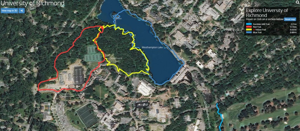
Most of us have used Google Street View–maybe Google Earth–at one point or another to get a sense or the route they need to take, what’s the area like around their vacation destination or for general information. Prior to finding out about Terrain360, there were times where I wished I would be able to virtually walk a trail before physically walking it to get a sense of what was to come or to plan a trip.
Well, “terrain360.com is your interactive guide to the natural world, providing 360‐degree, panoramic image maps of some of the most beautiful trails, waterways and cherished landscapes in the World” (Terrain360).
Recently, the software was used at the University of Richmond to provide an interactive view of the trail around the Westhampton Lake, the Gambles Mill Trail, a running trail around campus, and the route to Huguenot Flat Water. All of the trails are accessible by mobile device (with an internet connection) as well as by computer.
Take a look for yourself, just follow the link and click which trail you would like to explore:
University of Richmond Terrain360 Website

