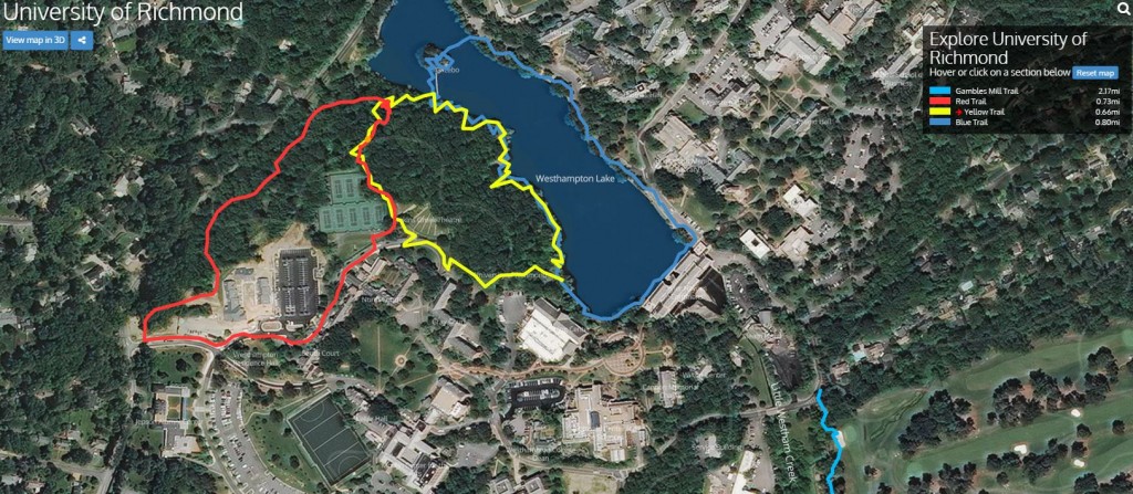
Most of us have used Google Street View–maybe Google Earth–at one point or another to get a sense or the route they need to take, what’s the area like around their vacation destination or for general information. Prior to finding out about Terrain360, there were times where I wished I would be able to virtually walk a trail before physically walking it to get a sense of what was to come or to plan a trip.
Well, “terrain360.com is your interactive guide to the natural world, providing 360‐degree, panoramic image maps of some of the most beautiful trails, waterways and cherished landscapes in the World” (Terrain360).
Recently, the software was used at the University of Richmond to provide an interactive view of the trail around the Westhampton Lake, the Gambles Mill Trail, a running trail around campus, and the route to Huguenot Flat Water. All of the trails are accessible by mobile device (with an internet connection) as well as by computer.
Take a look for yourself, just follow the link and click which trail you would like to explore:
University of Richmond Terrain360 Website


This is an interesting tool for the University of Richmond campus. I wonder how accessible and easy it is for users, though. For example, I wonder if it runs as smoothly on smartphones as it does on my laptop. I love that you can click on a point on the trail and be given an “on the ground” perspective of what it looks like at that point. I can definitely think of important ways a tool like this could be used on a larger scale, such as for tourism in national or state parks.
This is a really cool site, Shaquille! I spent a long time virtually navigating campus while exploring the site. I like that it really shows a “walking tour” of Richmond and sticks to bike/pedestrian paths instead of just following roads with big vehicles. It also has a pleasant user interface, which is nice for people trying to learn to navigate new places. It even seems to use lesser known routes, like old Gambles Mill Road, so I would probably trust other trails by terrain360 to also be well mapped.
Great post!
I wonder how they actually map this out, I know with google street view they have actual google cars that drive around with 360 degree cameras, but trails would be much harder to map.
This website is so cool! My family in Japan constantly want to know what my university looks like, and I sent them photos of UR all the time, but with this I can show them so much more; as if they are literally visiting UR. Thanks!