In case you don’t know, there’s a total eclipse coming to North America next year, on August 21 to be precise. You can find lots of information about it by Googling, naturally.
You’ll only be able to see a total eclipse along a certain path through the US. I wanted to know where on the path I should go. In particular, where is the weather most likely to be clear on that day?
I asked my brother, who’s a climate scientist, where to go to find this out. He pointed me to the cloud fraction data from NASA’s MODIS TERRA/AQUA sensor, which contains whole-earth cloud cover maps. Here’s the answer:
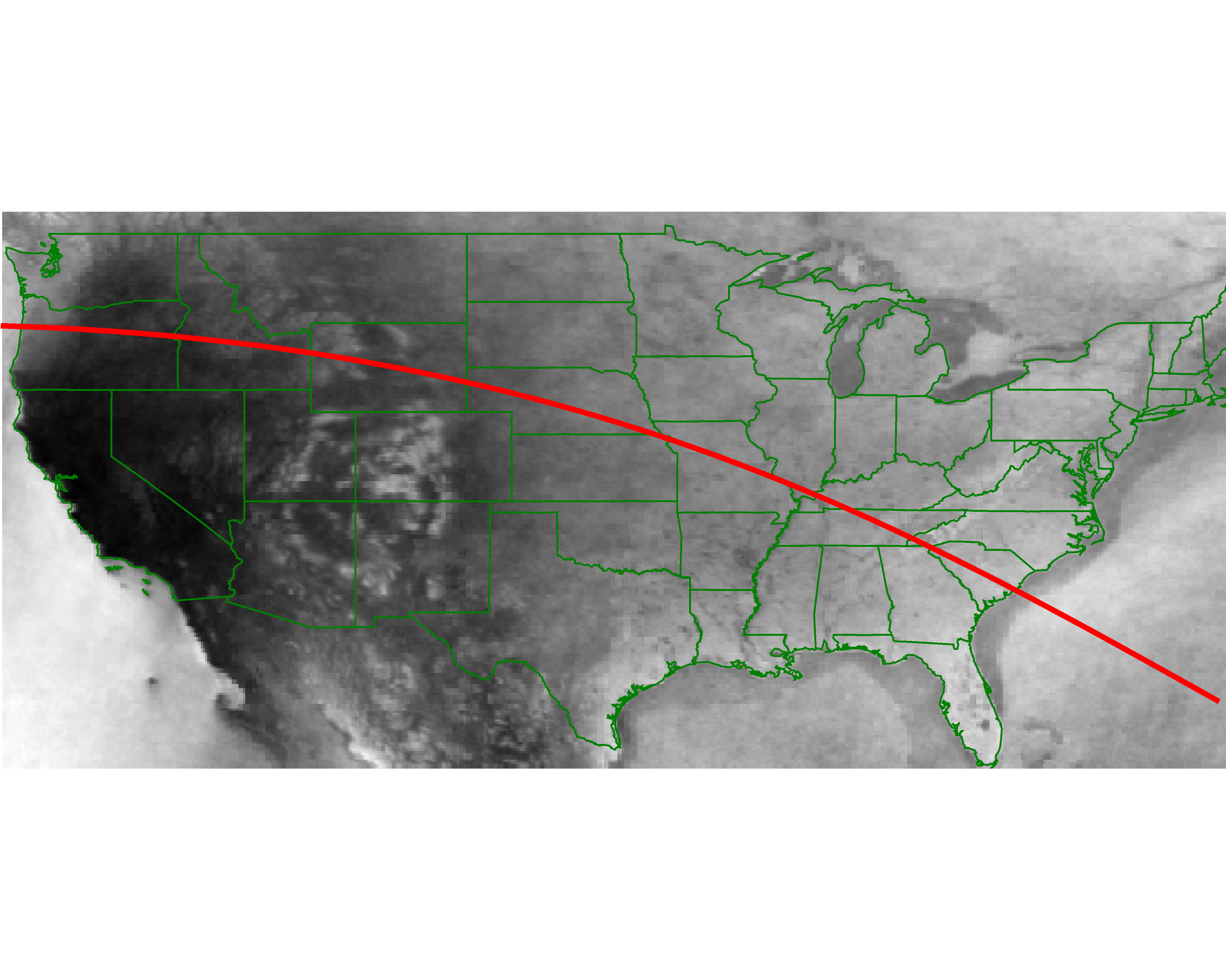
The red curve is the middle of the path of totality of the eclipse. The eclipse will be total over a band of maybe 30-50 miles on either side. The colors show average cloud cover. Black is good and white is bad.
(In case you’re dying to know the details, here they are. I grabbed the data for the past 10 years for the time around August 21. The most sensible data product to use seems to be the 8-day averages. August 21 is right on the edge of one of those 8-day windows, so I took the two eight-day windows on either side, and averaged together those 20 maps.)
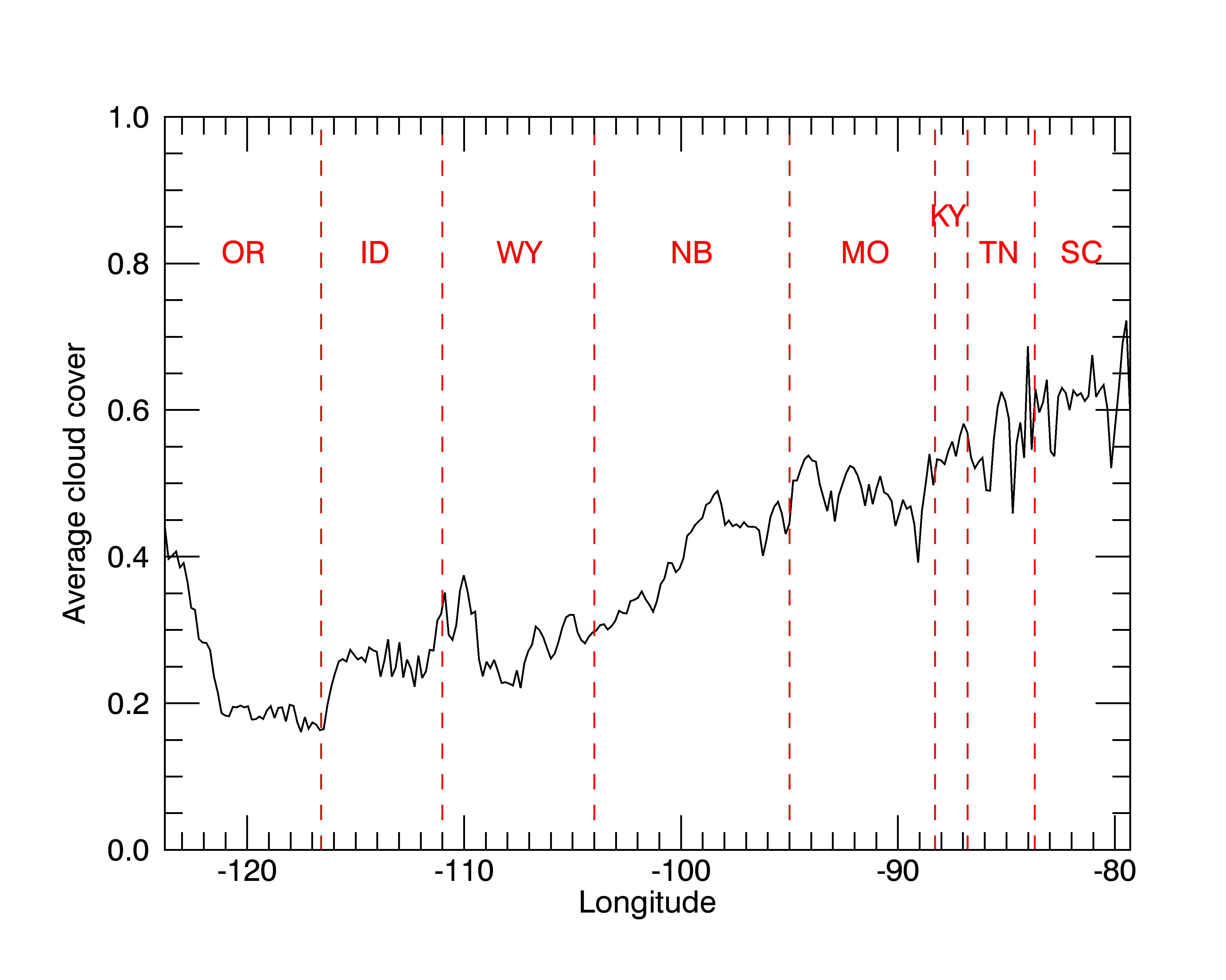
Here’s another way to look at it: a graph of average cloud cover along the path of totality, across the US. The red dashed lines show state boundaries. The path clips little corners of Kansas, Illinois, and North Carolina, which I didn’t bother to mark.
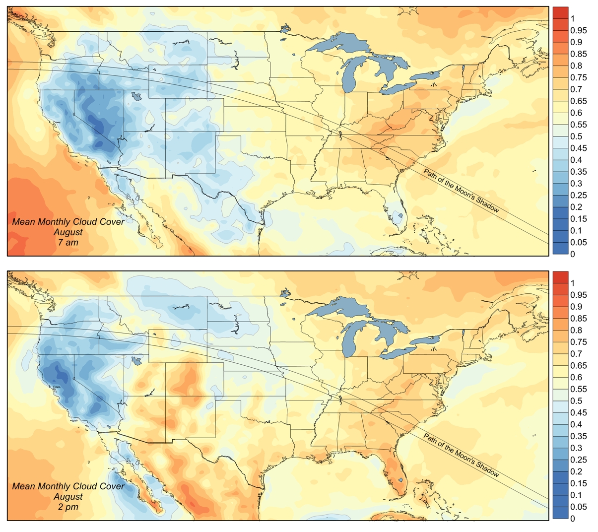
After making my map, I found this one, which reaches similar conclusions.
Hotel rooms along the path of totality are already hard to find. Make your plans right away!