
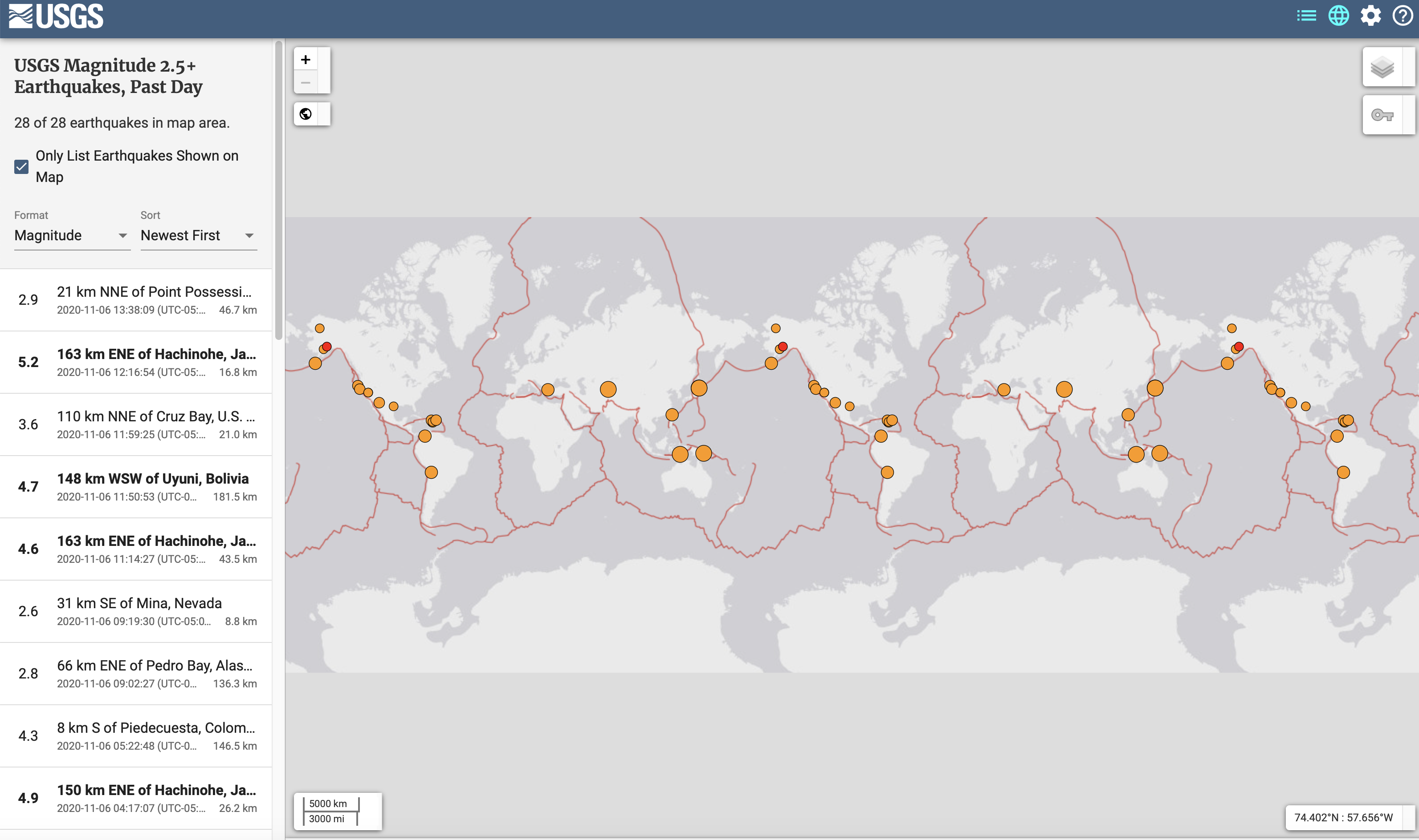
The resource that I found is a website that tracks earthquakes above a 2.5 magnitude on a map and provides information on them. The website updates as these earthquakes happen, so it is an important resource as it is always being updated. The website tells you the time, depth, magnitude, and exact coordinates (along with city) of where the earthquake hit. The map is of the whole continent and shows the plate boundary lines in red and the earthquakes as orange circles. The website is a great tool for scientists or any person to study more about where these earthquakes are occurring.
In class, we spent a lot of time talking about earthquakes and read in our textbook about the catastrophic ones. This website is a great tool that allows any person with a computer instant access to know the most important information about an earthquake. I do believe that while this is an amazing resource, it is not one that is predicting the coming earthquakes. As we learned in class, earthquakes are extremely hard to predict so that does not seem feasible. However, hopefully this website could eventually provide more information on the past earthquakes and provide warnings for one that are coming(if that is ever possible).
https://earthquake.usgs.gov/earthquakes/map/?extent=-89.58486,-653.90625&extent=89.57973,245.39063&listOnlyShown=true