
EDDMaps collects crowdsourced sightings of plants, insects, diseases, and animals to track distribution and presence across the US. It enables users to report a sighting accompanied by a photo, creates interactive maps of all sightings of a particular species, provides information on each species’ taxonomy and native territory, and provides downloadable datasets including all sightings of a particular species. Users can easily access maps that show all states or counties with reported sightings or look more generally at the entire country, and grouped point symbology makes it easy to identify areas of the country where the species is most common. Additionally, this website offers user support in accessing and using the available data as well as training in reporting species sightings. The images below feature the information available if I am interested in coyotes (Canis latrans).
The crowdsourced nature of this website is incredibly important to the thoroughness of its data collection. Rather than being limited to a specific team of people, data is being collected on a much wider scale by including the sightings of anyone with access to technology. Such maps of species distribution are valuable in tracking the movement of invasive species and the growth or decline of specific populations. By making this data downloadable and available to others, the site promises to expand access to the data and allow for further study.

This interactive distribution map reporting all recorded coyote sightings in the US
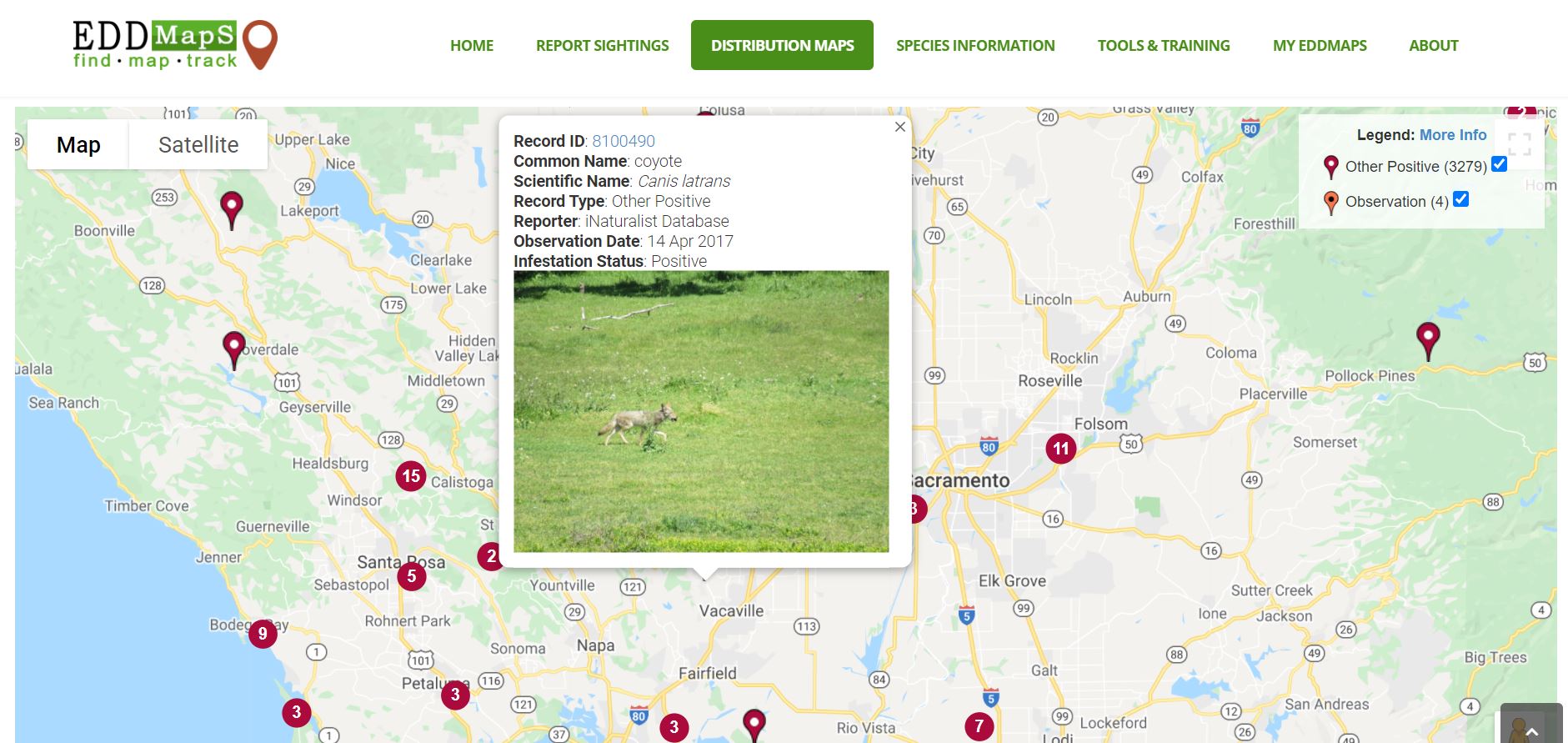
A specific record on the map
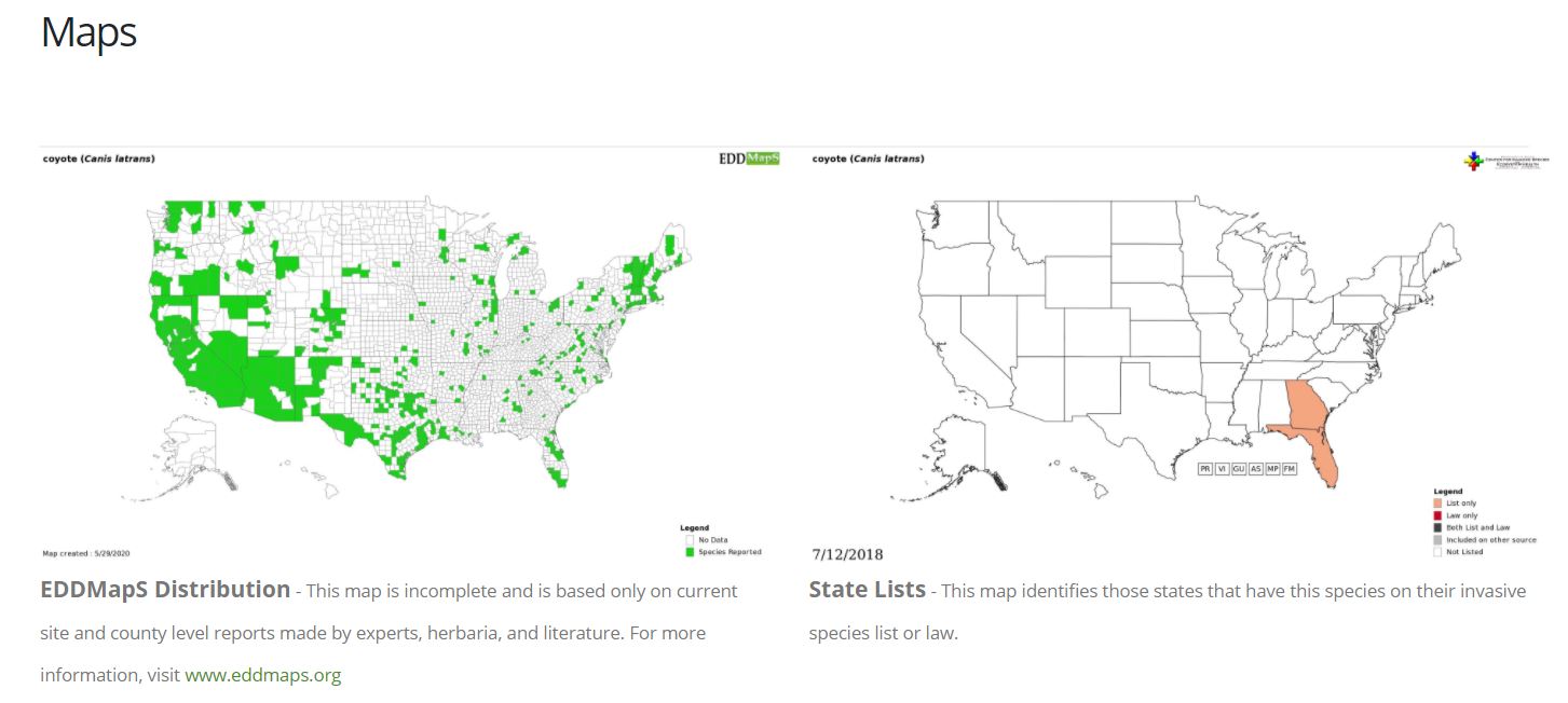
Counties with reports (left); States classifying species as “invasive” (right)
https://www.eddmaps.org/