THE ART OF GLOBAL WARMING coal + ice photography exhibition open at three shadows

by Avery Shackelford
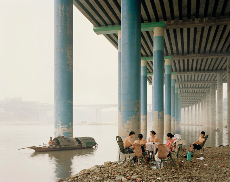
Nadav Kander, Chongqing IV (Sunday Picnic)
 Series: Yangtze, The Long River,
 Chromogenic Colour Print

 2006
 Chongqing, China picture taken from: http://sites.asiasociety.org/coalandice/photographers/ , picture credit information taken from: http://www.prixpictet.com/2009/view/605/5211

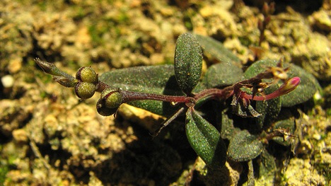
An art exhibition open Sept. 24 – Nov. 28 at the renowned Three Shadows Photography Art Centre in Beijing features the works of 30 photographers hailing from across the globe including the United States, the United Kingdom, China, Norway, Russia, Italy, Canada, Malaysia and Germany.

These artists’ photographs tell a story from the base of the coalmine to the peaks of the Himalayas.

Photographs, including those taken by American photographer and filmmaker David Breashears, who co-directed the first IMAX film shot on Mount Everest, demonstrate how the use of coal emits greenhouse gases that are warming high-altitude climates like the Himalayas, where rapidly melting glaciers are affecting river currents, which in turn play havoc with the lives of downstream residents.

The photographs span an “arc” of phases showing how greenhouse gases resulting from coal use go up into the atmosphere causing the glaciers to melt, thus affecting the hydrologic cycle. The exhibition also includes time-lapse photos that show the changing landscape.

The goal of the exhibition is to promote environmental awareness as well as tell a beautiful, yet haunting visual story.

For more information, and to watch a behind the scenes video with commentary from the curators see the gallery’s Web site: http://sites.asiasociety.org/coalandice/


Coral Reefs in Decline

Coral reefs are of the utmost ecological importance in that they are estimated to harbor 25-45% of Earth’s marine species yet they only occupy .1-.2% of the oceans. They are of additional relevance due to the fact that they have a global economic value of $375 billion dollars annually, predominantly derived from the fisheries and ecotourism industries.

The success of coral reefs is highly dependent on the symbiotic bacteria they harbor known as zooxanthellae. These bacteria are vital to the survival of coral because they release up to 90% of the material they fix through photosynthesis to their coral hosts.  They play an integral role in coral calcification (growth) because they fix CO2, raise the dissolved oxygen level, and provide components of the coral’s organic matrix.

Over the past several decades, coral reefs have been in a state of decline due to increased sea surface temperatures related to global climate warming and El Niño events.  When coral reefs are exposed to these increased temperatures, they expel their zooxanthellae which they rely so heavily upon for their growth in an effect known as coral bleaching.  In 1998, following one of the most dramatic coral bleaching events on record, certain locations on the Great Barrier Reef exhibited estimated mortality rates of 80-90% of corals. In addition to rising sea surface temperatures, invasive human activity such as agricultural and sewage runoff leading to eutrophication, sedimentation from deforestation, and harmful fishing practices have also increased coral mortality rates.

This article provides a great overview as to the biological and human factors which come into play in the decline of coral reefs while simultaneously outlining the economic and ecological importance of coral reef ecosystems.

http://www.stumbleupon.com/su/9P7bBl/blogs.ei.columbia.edu/2011/06/13/losing-our-coral-reefs/

Plants That Don’t Need a Green Thumb

What would you do if your annual plant just went ahead and planted itself for the next season? This new flowering plant species found in Brazil does just that. Once it fruits, it leans over slowly and deposits its seed on or even sometimes in the ground, effectively planting itself. It was found on the property of an amateur botanist, Alex Popovkin, by a handyman working there. The flower is small and pink and white. This new find is one more piece of evidence that we still have so much to discover in the realm of flora and fauna. What’s next: crop fields that plow themselves?

http://www.treehugger.com/files/2011/09/newly-discovered-flower-plants-its-own-seeds.php

Sky-Map.org

Sky-Map.org (or Wikisky.org) in an interactive website that allows you to view the universe through one of the most powerful telescopes in the world. From the main page, you can click on one of the 500,000,000 cataloged objects, or choose one from the list on the right side of the page, and you are immediately transported to another world. The up-close view of celesial objects such as the Carina Nebula is accompanied by detailed scientific information. The site also contains thousands of stunning photographs, adding an artful component to the educational and scientific potential that this site holds. My personal favorite: the Butterfly Nebula (NGC 6302): http://server5.sky-map.org/starview?object_type=3&object_id=286

http://www.sky-map.org

National Geographic Surname Map

http://ngm.nationalgeographic.com/2011/02/geography/usa-surnames-interactive

This site is an exciting interactive map of surnames across the United States.  This helpful map displays the most common surnames in each area, with the larger bolder ones being the most common and the smaller ones being less so. Using this map it is easy to track many interesting pieces of information besides just checking the popular names around your home. One of the most interesting opportunities this site provides is the ability to see where different ethnic groups have settled around the United States. The prevalence of english and irish names in the mid atlantic, scandinavian names in the midwest, and latino names in the southwest states all point to very specific and fascinating settlement patterns. This is also shown in the identification of small subpopulations such as the cuban community in southern florida. This map also shows an interesting pattern of population density. As you might expect, names are much larger and more densely packed in the northeast, while the western states have fewer names, most of which are much smaller.  In making this map, National Geographic has used geography and cartography to portray information on surname distribution in a creative, accessible way.

Flash Earth and Flash Planetarium

Check out this amazing tool for exploring the planet’s surface and the night sky! It’s a totally comprehensive flash player tool that allows you to view the entire surface or sky at once. Of particular interest is that you can position yourself anywhere on the planet for a personalized astrological map of the stars. It’s super intuitive and engaging. Check it out.

Hurricane Tracker

http://www.surfline.com/hurricanetrak/

Hurricanetrak is a great tool that can be found on surfline.com. It allows anyone to follow or track the path of a tropical system or hurricane anywhere in the world. You also can keep an eye on weather conditions. The primary objective of this tool is to help surfers know where the best surf is. By using other tools, such as LOLA and Google maps, you can zoom in and out of storms, display various layers of forecast data, and also use interactive shadows and rulers to see exactly where a storm is going. LOLA is a global surf forecast. During hurricane season you can click on  individual storm names to see the current storms path. You can also access historical data to research previous storm activity. Specific details, such as wind speed, pressure, wind and swell direction, and wave height can be examined as well.

Aurora Forecasting

If you have been curious about the Northern Lights or Aurora Borealis there is no time better than now to check out more about this awesome natural phenomenon.  The aurora borealis is essentially the result of protons and electrons from the sun colliding and mixing with the Earth’s atmosphere and magnetic fields.  When this happens there is an awesome display of color that occurs at both the North and South Poles, though the north is better known for it in my experiences.  The Northern Lights are absolutely remarkable and this website predicts how good they will be.  The Geophysical Institute is sponsored by the University of Alaska Fairbanks and their website puts up predictions for how well and when the Lights will be able to be seen.  The website also talks about interpreting the forecast and tips for how to plan to see the Aurora Borealis when it is at its best.  I suggest checking this website out if you would like to know more about the Northern Lights.

http://www.gi.alaska.edu/AuroraForecast/2011/04/27

WATERLIFE: Promoting Awareness of the Great Lakes

WATERLIFE is a highly interactive website that focuses on a documentary that tells the “story of the last great supply of fresh drinking water on Earth,” which happens to be the Great Lakes.  Upon entering the site, you can choose from a number of images that transport the viewer to subjects related to the Great Lakes, such as invasive species, bottled water, power, recreation and healing.  It is possible to click on any of the subject, which then takes the viewer to a page that explains that subject more in depth and involves imagery from the film.  WATERLIFE essentially is promoting the conservation of the Great Lakes due to its importance locally, regionally, and internationally.  It relays facts like only half of the Great Lakes wetlands remain intact.  Also, 100 billion gallons of water evaporate from the lakes each day.  The Great Lakes have been greatly impacted by invasive species, which harms not only the ecosystems but also the local economies.  These species include Asian Carp, Zebra Mussels, and the Lamprey.  A great aspect of the website is that although it speaks of many issues and negative impacts associated with the Great Lakes, it also focuses on positive action that can be taken.  Education is a major component of this positive action.  WATERLIFE is a part of that education tool, as it uses storytelling and beautiful imagery in order to promote awareness and the conservation of the vast supply of fresh drinking water in North America.

Bible Geocoding

Satellite map of the places in the Bible

http://www.openbible.info/geo/

This websitie took on the major task of locating every geographically identifiable place mentioned in the Bible.  The Goggle Earth map breaks down geographic locations not only by every Biblical book, but also chapter.  It is pretty remarkable project considering how many locations had to be identified.  There is also an Atlas that lists all the places alphabetically, complete with thumbnails, verses, and photos.