Discovery News – What Can You Discover?

After browsing through several not-so-interesting geography websites, I stumbled upon the Discovery News site.  Associated with The Discovery Channel, this site immediately caught my eye with its incredible pictures and interesting headlines.  The site is conveniently divided into seven categories ranging between physical geography topics (Earth, Space, and Animals), more cultural geography (Human and History), and just random super cool stories (Tech & Gadgets, Adventure, and Autos).  The website is truly engaging because of its numerous videos, photo galleries, and vast array of exciting science articles.  Below are some of my favorite stories so far:  

1)      This incredible series of photographs explores the phenomenon of visual color warnings in plants and animals.  The story explains that certain colors, patterns, and visual characteristics can communicate danger. 

 2)      This video talks about a recent eruption of an underwater volcano.  It relates to the discussions we had about the lithosphere in class and the difficulty of predicting when volcanoes will erupt.  Scientists were however, successfully able to give an 8-year time frame in which the volcano would erupt.  Scientists said this site was easier to predict because the crust was thinner and there was a huge supply of magma.  The video also gives a cool look at the underwater site.

3)      In relation to Matthew Sturm’s article about the changes in tree distribution as a result of climate change, this article discusses the movement of seaweed as a result of global warming.  Scientists believe that a profound amount of Australian seaweed is actually moving south in order to find cooler environments. 

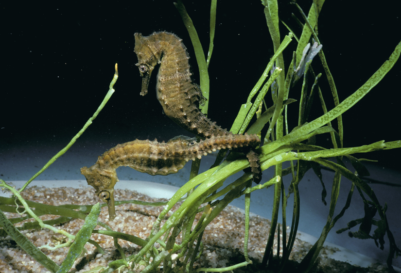
Seaweed provides an important habitat and food source for many underwater animals. Image by © Jeffrey L. Rotman/CORBIS

 4)      Last but not least, you can even take a look at the “Be as Manly as Bear Grylles Guide” because let’s be honest, who doesn’t love Bear Grylles?

Share which stories catch your eye!

Hobbit-holes, not just for hobbits anymore

Geoff Weathersby

http://www.simondale.net/house/

If you’re like me then a small part of you wants to live in the Shire. There’s something very settling about how hobbits live. Tolkien made them very communal beings that didn’t waste much. Everything they took they gave back, and then some. Last year, I was fumbling around on the internet and happened to find a group of people who made real-life habitable hobbit holes. Needless to say, I was instantly intrigued.

They guy behind it all is a man named Simon Dale and he calls his creations “low-impact woodland homes.” For Simon, it’s all about environmental sustainability. He says that we need to start taking real action to cut off our dependence on fossil fuels and he says we can do it by relying on land as we did before the industrial revolution. This, he says, is the answer to the climate change problem. We need to establish self-reliant local networks that operate both mentally and physically closer to the land. He writes, “Climate change is a clear imperative to curtail our fossil fuel use.” He suggests we do this by planting edible perennial food, eating less meat, using wood for fuel by setting up lots for rotational wood harvesting, and learning basic handiwork skills. By doing so, we will create communities sustainable within themselves that take a whole lot less from nature and replace a whole lot more.

 To the left is a view from inside one of Simon’s low impact homes. It was made with a hammer, chainsaw and a chisle, cost 3,000 pounds, and took about 1500 man hours. It is 50 square meters in size, which is just under 550 square feet from our point of view. It is heated by a wood burning stove, gets water that flows down the hillside, is naturally lit by a skylight seen in the picture, and has solar panels that provide electricity. You can’t get much more sustainable than that.

I believe this has special relevancy for our class given our focus on the interplay between human life and our planet’s many systems. These low-impact homes, in a way, embody what I believe the take home message from our class to be. Earth is a closed system and we must plug into it. Burning fossil fuels, as well all know, is not a sustainable practice. As it is speculated that we have reached our oil peak, we all have to take a little responsibility in the quest for alternative energy. In the meantime, we need to look at how we’re currently living and examine how much we take that we don’t give back.  This is what drove Simon’s work and it needs to drive ours as well.

BBC Science and Environment

For years BBC news was the easiest and fastest source of world news for me. I usually use the Russian version of the website thought, which is slightly different. Recently, I discovered the Science and environment section on the BBC website.

EU climate commissioner Connie Hedegaard

This website is informative as a well as interactive. It has in the news story of the day. For example today  the main article on the page was Climate summit faces big emitters’ stalling tactics, it discussed the efforts of cutting GHG emissions by the nations. It showed that the debate about which countries should do what still continues even after the Kyoto protocol. According to the article developing countries will certainly target rich governments such as Japan, Canada and Russia over their refusal to commit to new emission cuts under the Kyoto Protocol, whose current targets expire at the end of next year. However, the article states that another main topic of the summit will be financial aid to the developing countries through Green Climate Fund, although it is not clear yet who exactly will provide the estimated funding of $10 billion dollars for the developing countries to reduce their GHG emissions. Developing countries say the public coffers of industrialized nations should be the main source, whereas industrialized world believes that private sector must be the primary source. At the end of the article the website provides links to previous articles related to the topic such as why did Copenhagen fail? I find that very useful, especially while starting doing research.

The main webpage of BBC science and environment has other unrelated stories below the main article, concerning different aspects of biosphere, hydrosphere, atmosphere and lithosphere. It also provides links to articles/ blogs by BBC experts on different topics. For example, I found one on marine reserves in Australia called Australia plans huge marine reserve in Coral Sea. The plan is to have fishing commercial and recreational allowed being only in some areas of the reserve, which at its closest point would start 60km (37 miles) from the coast and it extends out to 1,100km to protect the coral reefs.

The website also has great video and audio resources to keep the reader interested and save time. Videos and audios have related articles or text version below in case anyone was interested in keeping written record. Here is a video of an unusual formation beneath the ocean called Icicle of death.

Science Daily

Hey everyone! It took me a while to decide on a geography related website to post in the blog. Ironically, the site I finally chose, sciencedaily.com, has been a favorite repository of random scientific facts and knowledge for a while now for both myself and my father (it is my dad’s homepage, so every time I use dad’s computer I am greeted with the latest interesting scientific news. My dad does not qualify as a scientist (he sells beer for a living), but every time he finds something cool on Science Daily he emails it to me. Like literally every time haha). Anyway, when you log on to Science Daily you immediately see the days top headlines in the scientific world. For example, today’s top stories include titles such as Ancient Stars Shed Light On the Milky Way, Whiskers: Milestone in Evolution of Mammals,  The Strange Rubbing Boulders of the Atacama, and Bats Can Rapidly Change Ear Shapes. Everytime that I log on I tend to unconsciously dedicate 15 to 20 minutes of my time sifting through novel discoveries.

Today’s most interesting topic was about the unique boulders of the Atacama Desert, which ties in nicely with out recent study of the lithosphere and weathering processes. The large , smooth boulders found in the driest desert on earth were dislodged from hills surrounding the various basins located in the desert. Due to frequent seismic activity and earthquakes, the boulders, which have been in the basin for nearly 2 million years, rub against each other many times over the course of geologic time which creates their characteristic smooth sides. This process of weathering is extremely rare, and can only be found in areas of extremely low rainfall and high seismic activity, two conditions characteristic of the Atacama Desert. A picture of the boulders taken from the article is shown below.

The website contains a lot of other cool features that allow you to find articles regarding specific topics. These topics vary temendously and include a myriad of topics associated with the atmosphere, hydrosphere, lithosphere and biosphere. For instance, one of today’s articles, titled Evidence of Ancient Lake in California’s Eel River Emerges, credits a past catastrophic landslide with the creation of a lake that affected, and still today affects, the gene’s of the region’s steelhead trout. It is a fascinating study that connects changes in the lithosphere and hydrosphere dictating changes in the biosphere. This article could be found under 3 different tabs (Plants & Animals, Earth & Climate, Fossils & Ruins), further proving the interconnectedness of the science of physical geography. Geography itself is a topic tagged in many of the posts, including an article about the spatial distribution of long-term carbon storage in the Ganges Basin. This website is really interesting, and like I said, if you spend a couple of minutes searching through the varying articles you are bound to learn something really interesting!


THE MOST INTERESTING BLOG EVER-PLEASE COMMENT!

About Project Noah: http://www.projectnoah.org/about

I came across the website through an advertisement on the National Geographic Website. Clicking on the link soon lead me to an interesting project that four NYU graduates have created. Entitled “Project Noah”, the experiment attempts to build a fun, location-based database mapping out wild-life intercations all around the world. The way Project Noah works is that anywhere at anytime, if you come across an organism, you take a picture of it, post it on the website, and attribute a location to where you spotted it. Oftentimes, members do not know the “official” names of the organisms that they take pictures of- but that is where the social networking aspect of Project Noah comes in. On the website, you can post and comment on the pictures by writing the name of the organism or general feelings toward the picture.

Another aspect of Project Noah is that it conveys the vast biodiversity around the world. With over 120,000 participants, and over millions of pictures uploaded, Project Noah serves as a catalog for speicies diversity and dispersion. Members can also participate in “missions”, which link all the classified organism pictures into a central location such as the National Saguaro Park. This helps scientists count and identify the certain species in the Park.

Project noah’s most notable feature is that it can be downloaded as an app, so pictures and categroizations can be uploaded easily and at any time. I see this whole project as a way to encourage people to reconnect with nature, documenting local wildlife, and creating “citizen-scientists”.

What’s Your Pollution Scorecard?

Coal-fired power plantDespite the success of national legislation like the Clean Air Act, the Clean Water Act, and the Federal Insecticide, Fungicide, and Rodenticide Act, pollutants still enter the environment at alarming rates. We can easily identify obvious sources of pollution—sulfur dioxide is bound to be coming out of a coal-fired power plant’s smokestacks—yet often less-obvious sources go unnoticed.

When pollution from any of these sources enters the environment, the substance likely enters either the air, local ground or surface water, or the soil; some of these substances may remain in these locations for many years. These chemicals have obvious effects: human and environmental health suffer in a variety of ways.

Nevertheless, the landscape of the region and the physical distance from a polluter means that some locations will experience only minimal levels of a pollutant. Wind and other weather patterns could transport a pollutant away from region and toward another; a city-dweller living next door to a factory will inhale many more toxic chemicals than will a rural farmer living kilometers away.

Luckily (or not, depending on your perspective) there is an online tool to determine which polluters exist in your locality. By visiting Scorecard, you can input your home or current zip code and get a list of polluters in your locality, the location of those polluters, how much pollutant they emit, and which pollutants are most prevalent where you live. For instance, I learned a company was emitting lead-based compounds from what I thought was an office building adjacent to the suburban neighborhood where I grew up! You can also see if any Superfund sites exist near you, determine the cleanliness of your local water, and learn what percentage of homes in your area have risk for hazardous levels of lead.

How many polluters are in your locality? Are you surprised at what you find out? Let us know in the comments!

National Parks Infinite Photo

Follow this link to see some of the most stunning images of national parks. Keep zooming in to see amazing geographic features, bizarre animals, and fascinating rock formations. The fun goes on for hundreds of pictures. The pictures were submitted by normal people who shared their photography with national geographic. I have literally been playing with this for the last two hours.

http://travel.nationalgeographic.com/travel/national-parks/infinite-photo/

Just an example of one of the amazing images from this website.

Everything about Geology

Geology.com offers everything there is to know about geology and Earth sciences. Just take a look al the Categories list on the left side of the page and you will get a feeling of the enormity of this website. The website also offers state specific geological information and maps. The middle of the home page answers a bunch of important geographic questions, many that we covered in class. There is a current In the News section on the right hand side of the page. This website is a perfect way to study for the final! Take a look, but be careful not to get lost in Geology.com.

Visit at http://geology.com

Volcano Explorer

Want to make a volcanic eruption at home but don’t have baking soda, vinegar, or paper mache?

Then check out

http://dsc.discovery.com/convergence/pompeii/interactive/interactive.html

The Discovery Channel online has created an interactive website where visitors can not only use as a tool to broaden their geographic knowledge about the inner workings and facts of various types of volcanoes but, more excitingly, users can create and their own volcanoes!

The fascinating and fun aspect of this site is that when you first enter the page you are directed to 4 links. The first three links include the Overview, covering Global Perspective, Volcano Types, and Inside a Volcano. The fourth link is, in my opinion, the most fun and insightful. This link will direct you to a Virtual Volcano where you, as a volcano explorer, can build your own volcano and then watch its impacts as it erupts. To build your volcano, you decide the viscosity of the magma and the extent of gas/pressure you want to launch it. Once you’ve set your conditions, watch your virtual volcano erupt!

The video first presents what kind of volcano you’ve created and then goes through all the effects that emerge as the volcano erupts. Furthermore, it labels the key aspects of the eruption and the user can also click on the aspects’ respective links to learn more about them and their effects.

For student geographers, this is a great site to discover more details about volcanoes from its creation, eruption, and after effects. Even better, it’s a lot of fun!

Seismic Monitor

topmap_eveday.gif

The website for the Incorporated Research Institutions for Seismology offers many fascinating and interactive visuals.  My favorite by far is the Seismic Monitor.  This map displays up to date information on the size and location of the world’s earthquakes.  The earthquakes are represented on the map by various-sized circles, to show the quakes’ magnitudes, and colors, to represent the dates of the earthquakes.  The map displays information from the past five years, which helps to illustrate the important role that plate boundaries play in the location of earthquakes (especially around the ring of fire).  If you zoom into a region on the map you can click on a specific earthquake to learn more about its date, time, latitude, longitude, magnitude, and depth. Enjoy!