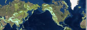
The geography website I choose was created by the United States Geological Survey in 2017 and is called “The Global Mountain Explorer”. This relatively new tool shows a map of mountains on top of a satellite image background giving users the most detailed view of Earth’s mountains. This resource was developed in partnership with Esri, the Center for Development and Environment of the University of Bern (CDE), the Global Mountain Biodiversity Assessment (GMBA), and the Mountain Research Initiative (MRI). The work is part of a Group on Earth Observations (GEO) initiative called GEO GNOME, GEO’s Global Network for Observations and Information in Mountain Environments. This work specifically addresses the goal to accurately delineate mountain regions using best available data. It is intended to provide information on the global distribution of mountain ranges and a variety of mountain data with a resolution 16 times more detailed than previous mapping efforts. What makes this tool useful for physical geography is that it allows anyone with connection to the Internet to observe where mountains are, what their relative altitude is, whether they are scattered or continuous, covered in snow or snow-free, etc.
https://rmgsc.cr.usgs.gov/gme/gme.shtml

