
https://www.volcanodiscovery.com/home.html
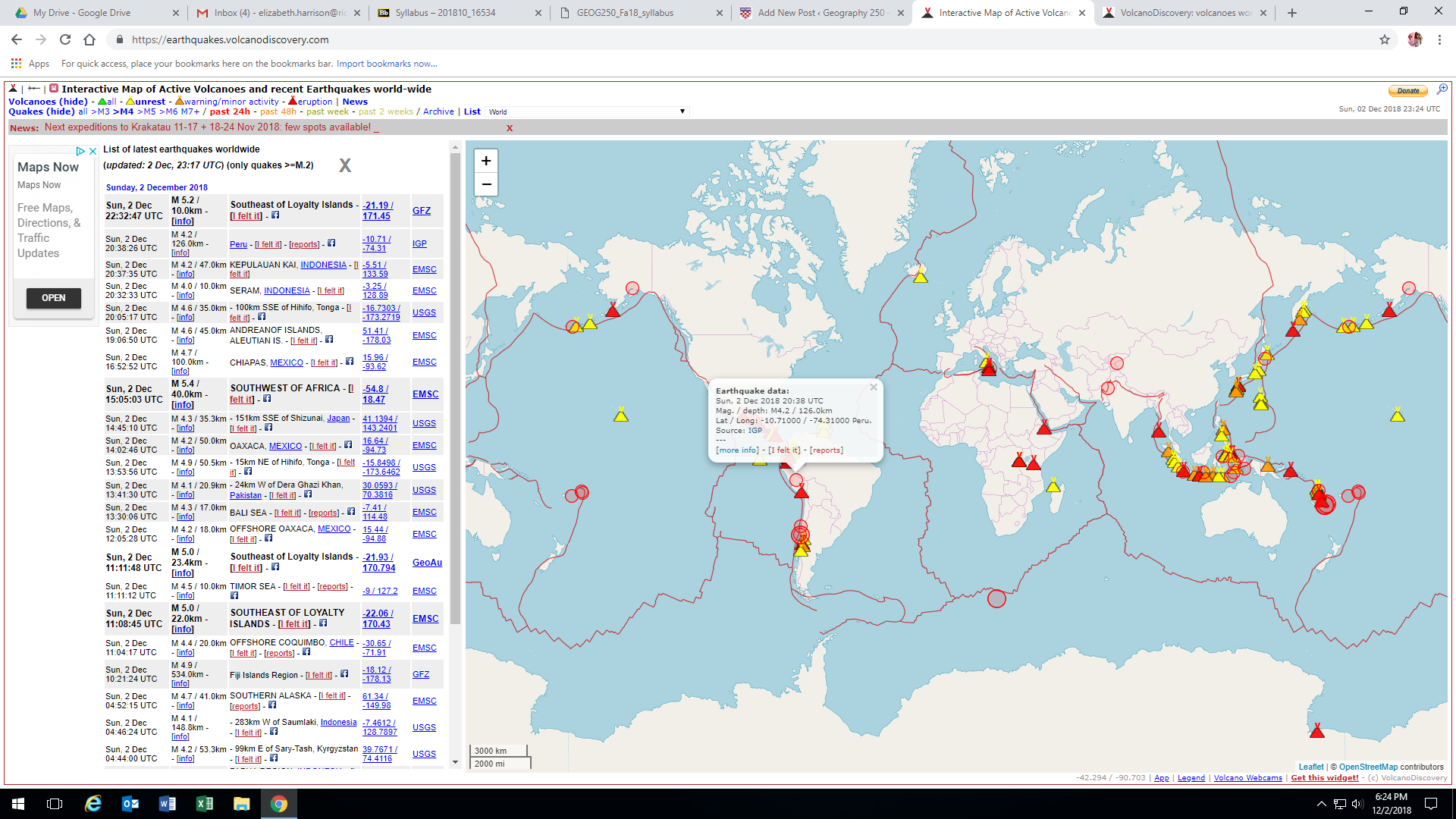
Volcano Discovery represents a tour company that offers expeditions to observe and study active volcanoes all around the world. However, the site has also come to be a hotbed of information, data, photos, videos, and first-person accounts of recent volcanic eruptions. The page I found most to be the most interesting was the continuously updated and interactive map that tracks all of Earth’s volcanic eruptions, no matter how small. Until I accessed this page I had no idea about the high frequency at which volcanic eruptions occurred around the world.
There is also a page that provides access to webcams depicting live footage of over 200 active volcanoes. Some volcanoes have as many as 37 different feeds (like Mt. Etna, Europe’s largest and most active volcano), while others only have 1, but they all offer a unique look into different kinds of volcanoes, fissures, hydrothermal fields, lava domes, and a variety of other lithosphere phenomena.
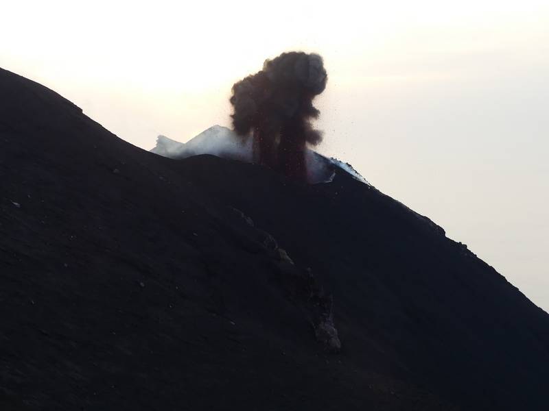
Volcano Discovery’s “Photo of the Day,” on 2 Dec 2018. Photographer Ingrid Smet.
Elizabeth, this is awesome! I am excited to look into it. I think the fact that they offer these expeditions is so cool and so important to our understanding of the lithosphere. There is no better way to learn than to experience something firsthand! Thanks for showing this to us.
Wow this website is so cool! I especially enjoyed scrolling through the website and looking at photos from different types of volcano eruptions. I really like that they offer so many cool tours and that the tours are very hands on and allow guests to be fully immersed in the environment. Going on tours and being able to see a volcano up close and firsthand is such a great way for people to learn about volcanos and gain a better understanding of how the earth works.
Elizabeth – Thanks for sharing this site! I showed it to my boys tonight, and they were geeking out. I love that they have an interactive map. This site is a great example of the cool info products that get produced when the internet, GIS, and scientists come together. Thanks for this neat and focused insight into the processes of the lithosphere and plate tectonics.
Elizabeth, this is such a fascinating website! It helped me contextualize, and learn more about, the seismic activity I reported on for my own post (the Mayotte volcano). The webcams were also super fascinating, and it was helpful to see volcanic activity a little more vividly instead of looking at a picture or a map. I really liked how the website pulls together a massive cross section of information, data, and multimedia products, and aggregates data around topic areas. Thanks for calling our attention to this resource!