
Lunar Wall Mosaic
Since its birth, our society has been captivated by the celestial beings which stood far beyond our reach of understanding and technology until the 1600s. With Galileo’s invention of the telescope, the science of astronomy took a major leap forward – and with it lunar mapping. Over the next century, the field of selenography expanded as techniques for mapping the moon become more advanced and astronomists created maps that included the moon’s detailed surface, its longitude and latitude, and, by the 1700s, a full coordinated system. Photography of the moon, although low quality, was first introduced by J.W. Draper in 1840 (Wilford. 427). The 20th century saw the greatest progress in lunar mapping, especially during the Space Race between the United States and the Soviet Union during the Cold War era.
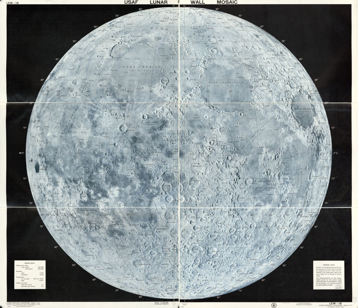
In class, we looked at a rather abstract map of the moon titled “USAF lunar wall mosaic.” We discussed how this map, though it may seem simple and straightforward, carries political and military connotations that contextualize this 1962 documentation of the moon. The moon, though over 200,000 miles from Earth, became a major focus of the United States and the Soviet Union during the Cold War era. The Space Race, which involved lots of funding being directed towards NASA and defense agencies, was simply another area in which each superpower sought to establish its political supremacy through technological and scientific superiority. The map was created by US Air Force Aeronautical Chart Information Center, direct evidence that this project was driven by the government’s political interests, which were more militarily than scientifically focused in 1962. We also noticed that the map’s interests were related to its physical attributes, particularly how it is a mosaic of photos rather than one full picture or, like most maps, drawing of the moon. This map is an actual mosaic as it takes tiny pieces of the moon and brings it into one full photo. Although it may appear that only having pieces of pictures makes the U.S. seem less knowledgeable about the moon, this actually is able to emphasize all the specific details because they are able to have the most detailed understanding on the moon’s surface. Looking closely you can see that every feature of the moon is clearly labeled. The United States was able to gain a sense of ownership, putting them ahead in the Space Race, by creating the first fully label map of the moon.
-Ellen Silka and Josie Garcia
“USAF Lunar Wall Mosaic : LEM-1B. | Library of Congress.” USAF Lunar Wall Mosaic : LEM-1B. | Library of Congress. Accessed November 04, 2014. http://www.loc.gov/item/00561368/
Wilford, John Noble. “Extraterrestrial Mapping: The Moon.” In The Mapmakers, 426-45. New York: Knopf, 1981.