
North Korea Prison Camp Maps
Our presentation delved into the intricate system of prison camps in North Korea consisting of Kwan-li-so camps (political prisoners), labor reeducation camps, and regional and labor training camps. Since 2004, an estimated 400,000 inmates housed in these camps suffered from malnourishment, sickness, execution, and torture. We focused on the massive Camp 22, which is described as the most oppressive and deadly of North Korea’s prison camps. Camp 22 holds 50,000 prisoners, who are each in captivity until death with no possibility of release. Despite the fact that Camp 22 is believed to have been dissolved in 2012 for unknown reasons, at least fifteen more large camps are still in operation, committing similar human rights violations.
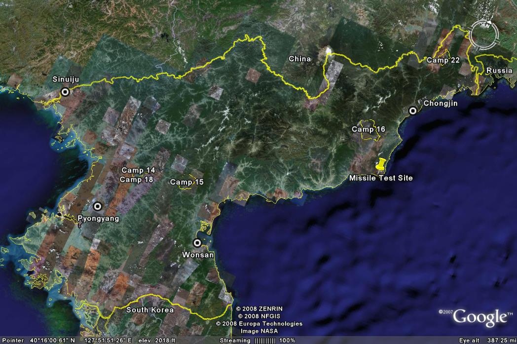
Historically, the truth about the horrific nature of these camps has been a mystery apart from interviews with former guards. With the introduction of highly detailed satellite imagery of North Korea, first-hand stories could now be supported publicly via these satellite photos. Images, for instance, display the mass graves as well as the perimeter traps and landmines that encircle the camps that the interviews claimed. Satellite technology also enabled the US State Department to corroborate North Korea’s claims of Camp 22’s closure as imagery supported the decommissioning of the prison camp. If we had just the word of the North Korean government to go by, it would be hard to believe that the camp had truly been shut down. Organizations like 38North.org and other platforms currently take advantage of the accessibility of satellite imagery to monitor North Korea’s nuclear and military installations.
The North Korean prison maps are an example of how satellite imagery inherently ties into political issues as well as supports the Western dominance of information. Additionally, despite the fact that services such as Google Earth are widely accessible sources of information, Google can actively influence the public to adhere to its own agenda. Google can alter and label borders in the way they wish and distort and restrict certain areas on their map. The public often overlooks the potential of bias in satellite imagery, which only gives private providers such as Google even more power in the decisions they make. Although satellite imagery can still have limits and distortions, overall, it has brought to light restricted regions in North Korea and active violations of human rights, helping raise concerns for the international community.