
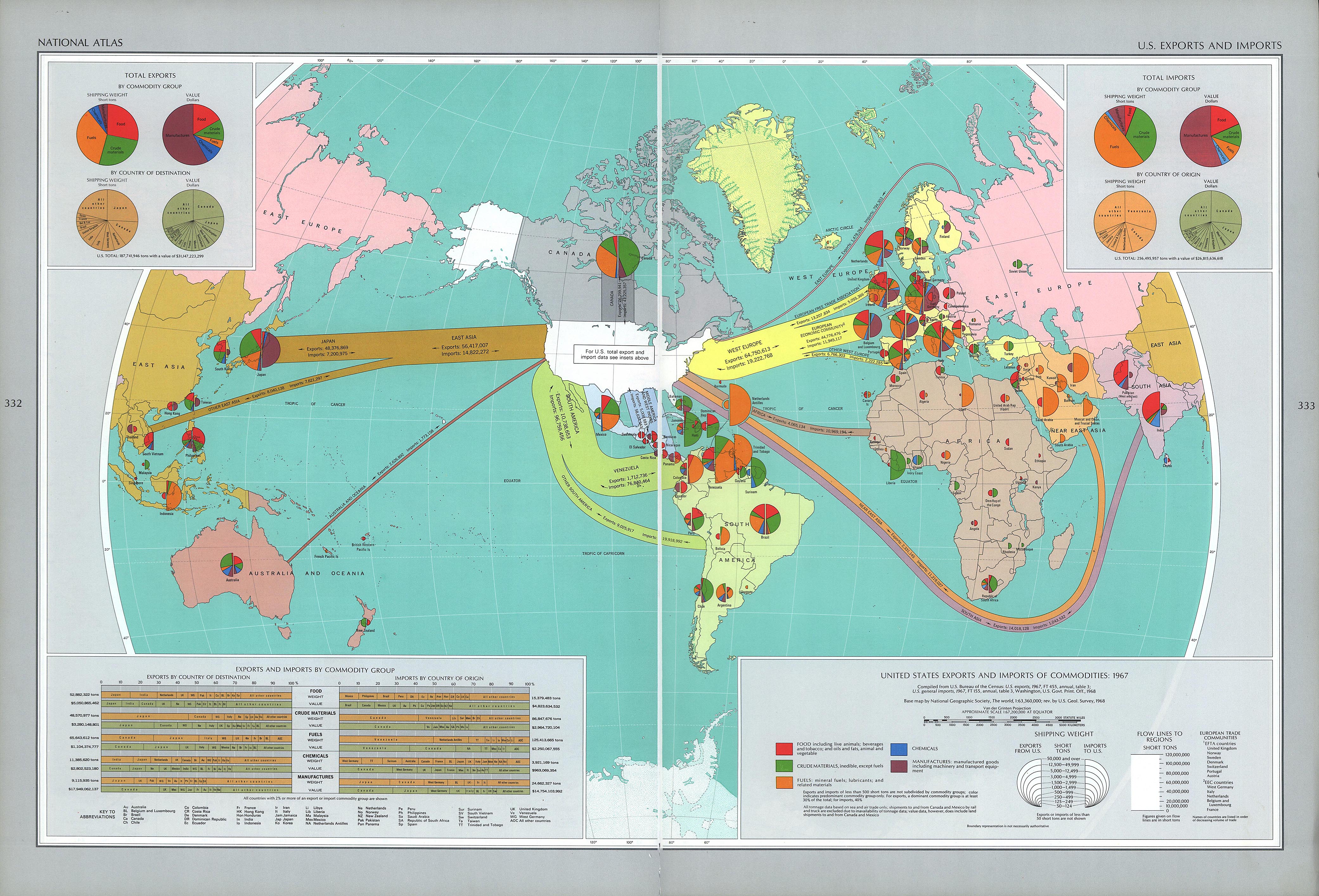
“National Atlas of the United States of America: Exports and Imports” map of 1970 comes from the National Atlas of the United States of America, which was developed by The U.S. Geological Survey. The National Atlas of the United States of America was developed for many different people with many different interest including: agriculture, worldly affairs, economics, socio-cultural, climate and history to name a few.
Although at first glance the map appears to be purely informational it contains multiple political interests, which portray Cold War era propaganda. First it is worth noting that the United States is attempting to portray itself as the center of international trade in order to show its importance in the market economy. Furthermore, the maps use of arrows and tables show that the United States traded with nearly every single country, even those bordering the USSR, but they did not trade with the USSR. This is reflective of Cold War tensions particularly the containment policy utilized by the United States in response to Eisenhower’s Domino Theory. It is also worth noting that: “A symbiotic relationship formed between post war [WWII] U.S. global strategy and oil”. The mass amount of oil trade the United States had with a plethora of countries in the middle east as well as Venezuela shows how the United States believed that: “Controlling oil helped the United States contain the Soviet Union”.
The United States captures the attention of the audience. It is dead center of the map and is the only nation on the map that is white. In contrast, the USSR is completely neglected. Not only is it cut off on both sides of the map, but there are also charts that cover up even more of the USSR. the cartographer clearly wanted to direct attention away from the USSR and toward the US. Amongst all that neglected space is just one small pie chart. The USSR is portrayed as completely insignificant, as opposed to the US and every other nation the US does business with. The map serves as a weapon of United States imperialism in that it empowers the US economically. This map exemplifies the United States’ use of soft power in order to grow as an empire. The map shows only the US’s relations with other nations and not the relations among other nations with each other. The United States’ influence through worldwide economic relations empowers them as a nation, more fittingly, as an empire.
By Luke Perda and David Link.