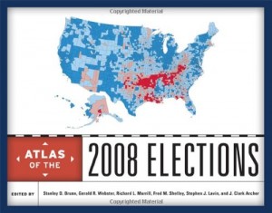
The Atlas of the 2008 Election, edited by Stanley D. Brunn, Gerald R. Webster, Richard L. Morrill, Fred M. Shelly, Stephen J. Laven and J. Clark Archer, is a breakdown of the voting patterns of the 2008 Democratic and Republican Primaries, the general election, major state-wide ballot measures, other “Key 2008 Elections,” and major congressional votes of the 111 congress¹. The most interesting feature of this atlas is its ability to breakdown one of the most momentous elections in a life-time into easy to understand and rather fascinating maps that most people would not otherwise think of. There are maps about travel schedules of the candidates in the week before the election, one of the number of Google searches about each candidate, Twitter reports of wait time at the polls, newspaper endorsements, median center of each party, “Donor sheds,” and other important breakdowns of national statistics and the way certain groups voted². The use of this atlas allows the reader of it to gain a much better and more in-depth understanding of the 2008 election and American politics as a whole.
-
Recent Posts
- Map Duo Presentation – William Guy and Michael Zhang
- Map of the Week: Unraveling the Borders of Israel and Palestine Through Time
- Map Duo Presentation – Carter House and Ryan Soulis
- Map Duo presentation by Peter and Yaozhuo
- Yaozhuo Sun — Map of the Week: City Maps That Orient You Better Than Google Can
Recent Comments
- Luke Hedlund on Map of the Week: Voici les Bases Américaines dans le Monde: Que est l’agresseur? Qui Menace?
- Luke Hedlund on Map of the Week: Unraveling the Borders of Israel and Palestine Through Time
- Owen Goss on Mexico’s Crippling Water Crisis
- Owen Goss on Map of the Week: German and Polish Borders Across Time
- Lucy Duggan on Map of the Week: A Serio-Comic Map of Europe
Archives
- December 2023
- November 2023
- October 2023
- September 2023
- May 2022
- April 2022
- March 2022
- February 2022
- November 2021
- October 2021
- September 2021
- May 2021
- April 2021
- March 2021
- February 2021
- May 2018
- April 2018
- March 2018
- February 2018
- December 2017
- November 2017
- October 2017
- September 2017
- May 2017
- April 2017
- March 2017
- February 2017
- December 2014
- November 2014
- October 2014
- April 2014
- March 2014
- February 2014
- December 2013
- November 2013
- October 2013
- September 2013
Categories
Meta

