
In the late 1950s and 1960s, America and the Soviet Union were at the height of the Cold War. Both countries were attempting to prevent the spread of the ideology of the other, and both were actively participating in espionage. Proxy wars raged around the globe as both global superpowers attempted to gain an edge over the other. Tensions often came to a head at UN General Assembly meetings, where ambassadors debated in front of a global audience to try to fault the other nation.
In July of 1960, the USSR accused the United States of “new aggressive acts” and “creating a threat to universal peace.” In response, US Senator Henry Cabot Lodge used three maps to debunk the Soviets’ claims and turn the accusations on the Soviets in front of the UN Security Council and the rest of the world.
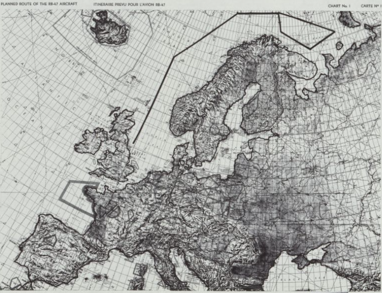
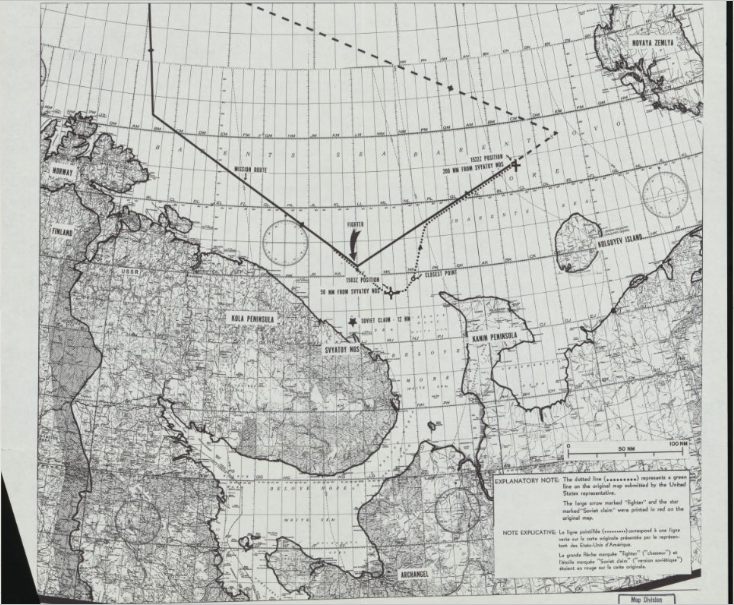
The first and second maps that Lodge produced involved the RB-47 incident, where an American reconnaissance plane was shot down over international waters in the Barents Sea. Lodge used the second map to show how a Soviet fighter tried to force the American jet into Soviet airspace so that it could be shot down, while the first map was used as an overview of the RB-47’s planned flight path, showing that it stayed in international waters for the duration of the mission. Despite soviet claims, American instrumentals showed that the plane did in fact stay in international waters, and was shot down illegally. These maps effectively prove that the USSR violated international law in this case, which Cabot Lodge used to turn the Soviets’ claims on themselves. The cherry on the cake was that the Soviets rejected an investigation into the incident, which was almost concrete proof that the Soviet claims were false.
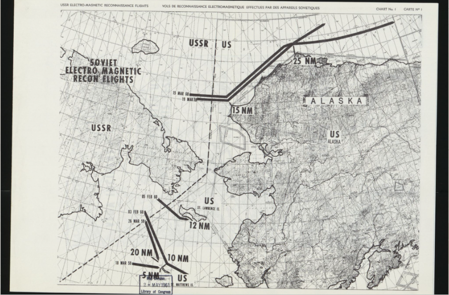
The third map showcased Soviet reconnaissance flights that came close to US territory. In the northern Pacific Ocean, soviet spy planes came closer than 20 nautical miles from American territory six times in just two years. The worst case was a soviet flight that came just five nautical miles off the coast of St. Matthews Island, which was inside US airspace. The cartographer of this map used thick black lines so that the flights appeared closer to American territory than they seemed. Even so, this map effectively puts more blame on the USSR, since the US would have been justified in taking military action against the Soviet planes, unlike the RB-47 incident.
This confrontation in the UN Security Council was just one of many instances of Cold War escalation in the second half of the twentieth century. Maps were used in many cases to throw the blame on the other nation. These maps are inherently political because the makers choose which situations they want to portray on the map and which they would rather omit to help their case.
This map and your analysis was very interesting because it presents the emerging topic of international airspace through the lens of the Cold War and mapping. Since this incident, I often hear in the news of planes “buzzing” other plans along the boarders of international airspace and domestic airspace. I believe that since the Cold War there has been a lack of strides made to discourage hostile violations of international airspace and thus such encounters have become commonplace and often mark an era of escalating tensions between nations. I would be interested in seeing a contemporary map of Taiwan and Chinese airspace incidents conducted in with the same rhetorical mapping and presentation style as the RB-47 incident.