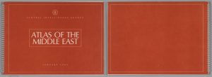
 The CIA’s 1993 Atlas of the Middle East presents a wealth of information on probably the single most geopolitically important and complex region in the world at the moment. There are maps that show the region’s topography, oil reserves, freshwater sources, history, and much more that combined provide a comprehensive picture of the Middle East as it stood in 1993. The changes in the region between then and now become very apparent as you look through the atlas, and a lot of the information is just interesting to look at visually thanks to how it is presented.
-
Recent Posts
- Map Duo Presentation – William Guy and Michael Zhang
- Map of the Week: Unraveling the Borders of Israel and Palestine Through Time
- Map Duo Presentation – Carter House and Ryan Soulis
- Map Duo presentation by Peter and Yaozhuo
- Yaozhuo Sun — Map of the Week: City Maps That Orient You Better Than Google Can
Recent Comments
- Luke Hedlund on Map of the Week: Voici les Bases Américaines dans le Monde: Que est l’agresseur? Qui Menace?
- Luke Hedlund on Map of the Week: Unraveling the Borders of Israel and Palestine Through Time
- Owen Goss on Mexico’s Crippling Water Crisis
- Owen Goss on Map of the Week: German and Polish Borders Across Time
- Lucy Duggan on Map of the Week: A Serio-Comic Map of Europe
Archives
- December 2023
- November 2023
- October 2023
- September 2023
- May 2022
- April 2022
- March 2022
- February 2022
- November 2021
- October 2021
- September 2021
- May 2021
- April 2021
- March 2021
- February 2021
- May 2018
- April 2018
- March 2018
- February 2018
- December 2017
- November 2017
- October 2017
- September 2017
- May 2017
- April 2017
- March 2017
- February 2017
- December 2014
- November 2014
- October 2014
- April 2014
- March 2014
- February 2014
- December 2013
- November 2013
- October 2013
- September 2013
Categories
Meta
