Atlas of the Week:
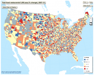
The Food Environment Atlas is produced by the United States Department of Agriculture’s Economic Research Service. The purpose of this atlas is to evaluate determinants of food choices and diet quality as well as examine communities’ abilities to obtain healthy food. The atlas includes a variety of maps that together create a full picture of the food environment in different communities, which is made up of factors such as restaurant availability, food assistance, and health and physical activity. This atlas can also shed light on the Food Insecurity Map chosen for the Map of the Week; maps in this atlas showing access/proximity to grocery stores and food prices/taxes might be useful in explaining why some areas experience greater amounts of food insecurity than others.
https://www.ers.usda.gov/data-products/food-environment-atlas/go-to-the-atlas/
Blog Link of the Week:
This blog showcases a variety of maps on topics including business, politics, arts and entertainment, and health. Some maps in this collection are scientific and educational, while most are purely for entertainment. Regardless, all provide the audience with new and unconventional ways of looking at the world. On this blog one can see which countries have the most expensive slice of pizza, what the shortest route between all the pubs in the UK is, and what the world looks like according to Donald Trump.
http://bigthink.com/articles?blog=strange-maps

