
 The first highway act was envisioned by Roosevelt. The project could not begin due to WW2 and all resources were focused towards the war. The Federal Aid Highway Act actually passed in 1938 but only 6500 out of 40,000 miles were completed by 1953. After the war had ended, during Eisenhower’s time in office, funding issues still remained. Not until 1956 the Federal Aid Highway Act of 1956 was finally passed. This act stated that 41,000 miles of highways were to be completed with $25 billion authorized for the construction. The project began rolling in 1957 and continued up until 1969.
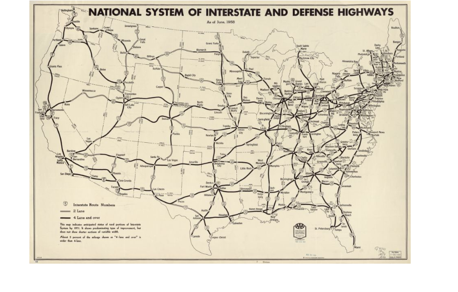
In class we talked about the many unique qualities the map has. The Cold War was occurring while these highways were being built (also, the second Red Scare occurred a few years before the act was finally passed). Not only does the map literally depict the predictions of interstate highways by 1971, it has many underlying meanings. The United states is worried that it may or may not be attacked by Russia or some other communist country at the time (notice how the map is titled “national interstate and defense highways”). The highways could be used for escape routes in case a city or town is attacked (probably by an atomic or nuclear bomb) or transporting goods to a city or town that is in need. Another interesting fact is that the highways physically connect the United States, making the citizens “closer” not only in a physical sense but join the country closer together, somewhat as a family. The map itself looks as if the highways are “veins” and the country is a body.
“National Interstate and Defense Highways Act (1956).” Our Documents -. N.p., n.d. Web. 24 Oct. 2014.