
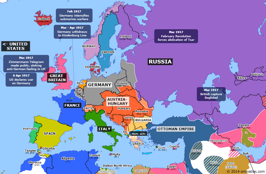
The Omniatlas map of Europe from April 6, 1917, when the United States entered World War I.
Omniatlas maps regions of the world overdecades and centuries, showing how each region changed over the years. Simply click a button to advance to the next event in that region’s history and see how the geography of that region changed. A historical analysis of each event is also given. One can both read and see how international relationships changed the layout of countries over time in a level of detail which is not possible with traditional atlases.