
The National Geologic Map Database (NGMDB) is managed by the US Geological Survey (USGS) and Association of American State Geologists (AASG). They recently released MapView beta, which combines over 25,000 regional, state, and local geologic maps into one data viewer. Although there are other interactive geologic maps, this one is among the most detailed. As the user zooms in and out, a number in the upper left corner displays how many maps are in view, with citations. This tool is probably best used at state scales. Geologic features cross state lines, but different states are symbolized with different color scales.
Knowing the local geology is important because it has informed patterns of human development and socioeconomics more than people realize. The placement of America’s largest cities is largely due to local geology. Geology affects resource availability and ease of access or development, both of which have tremendous effects on human history. Geology provides a more detailed view of the landscape than meets the eye. And rocks are just plain cool!
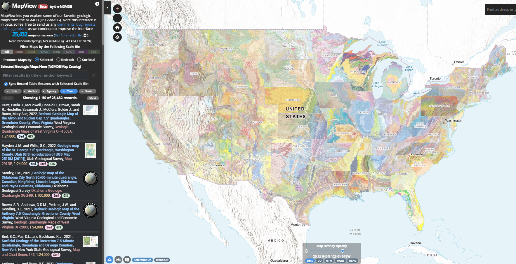
I enjoyed looking at this tool on my own, clicking around through different years and states. It is very cool to see the development of the land of each of these states. The first thing that it took me back to was 1825, North Carolina, and the most recent data was information about West Virginia from 2022. This map definitely has a ton of information that takes a while to comb through. I decided to just look at the development of New York, where I am from, to see how human development impacted the land. I viewed a map from 1914 and identified locations of Long Island that weren’t even quite developed yet. Thank you for sharing this website!