
http://mapmaker.education.nationalgeographic.com
National Geographic has created a simple way for novice mapmakers to make interactive maps online. With a variety of subjects to choose from, users can combine different layers to make inferences about the physical geography across the globe.
Layer categories include food, climate and weather, U.S. History, water, earth systems, human populations, environment, energy, animal ranges, culture, economy, and political boundaries. Within these categories contains layers that pertain to the hydrosphere, lithosphere, atmosphere, and biosphere.
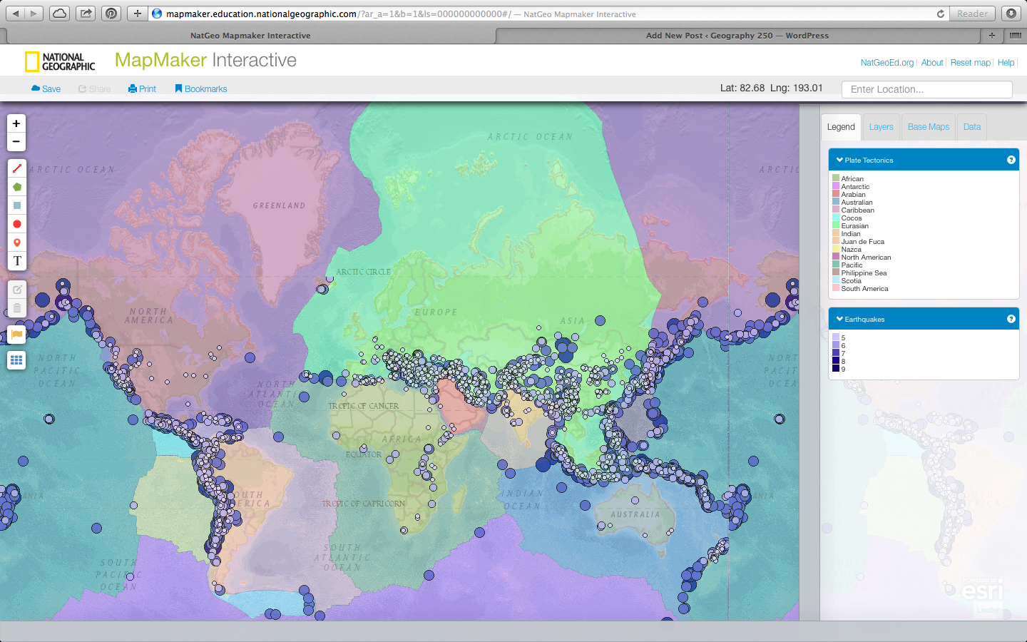
With this interactive map, it’s possible to compare variables, such as global CO2 emissions with global energy usage, to see if there is any connection between them. Another example is to look at the location of significant earthquakes with the location of plate tectonics (as shown in photo).
In addition to the provided layers, users can create lines, polygons, rectangles, circles, markers and text to their map. Maps can also be saved for later, or printed to share.
Although this map is fairly limited in it’s capabilities, for someone who wishes to create a map, but does not know how to use GIS, this website is very useful.
You guys should all try it. It’s fun!
-Katie
I found this website and thought it was so cool…and then I saw that you already posted it! I love how you can place so many layers on this map and see how the systems might interact, or what forces might be effecting a certain region. It’s so easy to use compared to most tools like this. I’m a huge fan!
This website is awesome. I really liked how they included seemingly random items such as “language diversity” and “women in parliament” even though most of the layers you could add to the map related to the environment and Earth systems. it’s interesting to see the interaction between various systems. I do wish that I could find more about its sourcing for the information–I don’t know if I was missing something, but it would have been nice to know where the data was coming from.