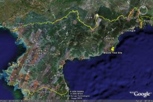
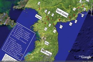
The maps of North Korean PrIson Camps were made to introduce North Korean Prison camps through google earth. The map contains two parts, which are the North Korean Prison camps and the google earth. Therefore, we divided our presentation into these two part. In the presentation, before we moved on to the main topics of our map, we first briefly introduce the evolution of digital mapping. In the 1950s, due to the inconvenience of computer tools, cartographers simply used that computer software to change the shades of areas on maps in order to show population density or other thematic data. Then in the 1970s, cartographers were able to add time into the map. After 1996, the new era of cartography started, which brou ght “democratization” into maps-everyone were able to access into map creation.
Then we moved on to our first topic-North Korean Prison Camps. There are three types of prison camps in North Korea-Political Prison Camps, Labor Reeducation Camps and Collection Center and Labor training centers. Political Prison Camps were normally very large, punishing political criminals. However, under North Korean policies. The family members of the criminal would also be sent to other camps simultaneously, which creates a domestic terror of North Korean regime’s systems. Labor Reeducation Camps were mostly for people who were caught trying to flee the country, and Collection Center and Labor Training Centers were for economic criminal. Due to the insufficiency of food, many people died in the camps within one year.
Google Earth is a computer software that was created by a company that was funded by the CIA in 2004. It was bought by Google in 2005, and released for public use. It is a virtual 3D perspective of the world that is made by placing images taken from satellite images, aerial photography, and geographic information systems onto a globe. Many people use Google Earth to look at various places in the world that would be hard to see otherwise, and make their own points. Google Earth also allows people to upload their own images. There are some potential downfalls of having an application that allows people to make their own data points on maps and upload their own images. For example, these maps are not necessarily correct — since they are being looked at from a bird’s eye’s view, some of the makers of these maps could have misinterpreted what they were looking at and published false information. Also, people may upload images of a place that is not where a picture is taken. When using an application that can zoom closely into the entire world, you would like the images taken there to actually be taken there. However, there is no way that Google Maps edits the images for accuracy.
There are also some societal issues that come about with an application like this relating to private and national security, and information. People are not warned when the images are being taken, so Google Earth can show aspects of their lives to anyone that people may not want photographed. Another issue relating to individual security is that this application can actually show all of the possible entrances to a house, which can lead to robberies and people feeling unsafe. Some of the issues with national security is that we can see clearly images of other nations, such as their army bases and prison camps, and these are things that they may not want anyone with a computer to have access to. Another aspect of this is it could be potentially dangerous to have this information available to anyone, and terrorist attacks could occur. One of the societal question relating to information is: If the technology is available and owned by a company that wants to share it with the public, then should it be allowed to have restrictions by various nations? By having this information available, it can also show countries their weak points and allow them to protect themselves more.
Through discussion we discussed how even Google Earth is biased, even though it is actual images of the earth. We also discussed how like the airplane, satellite imaging can bring the world closer and closer together.
–Emily Ferkler and Violet Zeng


