
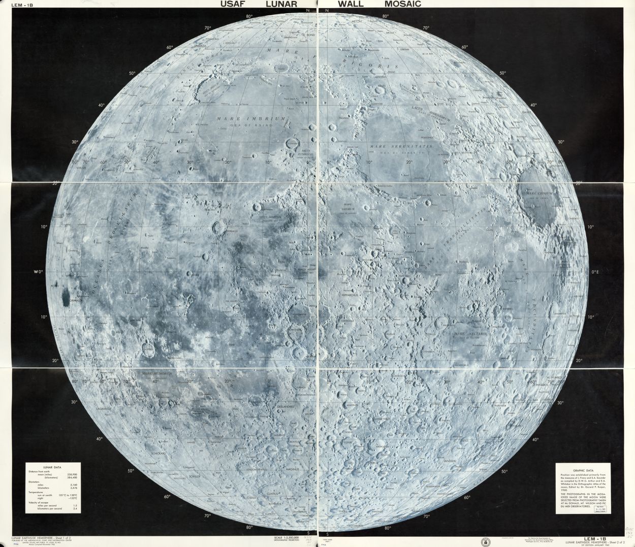
This map was created in 1962 by the Air Force Aeronautical Chart and Information Center to aid with NASA projects like Apollo 11. At first glance, this map may seem devoid of useful information, however, the highlight of this map is the accuracy to which the topography is mapped. The location of craters, latitude and longitude, and other points of interest all serve a very specific purpose. Mapping the moon proved to be quite difficult for these cartographers however, because it had never been mapped in its entirety before, and because so much new information had to be gathered, such as calculating the equator and finding “sea level”. Unmanned spacecraft called Lunar Orbiters were sent into orbit around the moon to collect information and to take photographs, which served as the basis for this map. Such a detailed and accurate map of the moon was needed in order for NASA projects like Apollo 11 to succeed. Astronauts needed to know the exact topography of the moon in order to ensure a successful landing.
This map was created during the heart of the Space Race, a competition between the United States and the Soviet Union to be the first country into space and subsequently to the moon. American cartographers were in a race to collect data as well, since this information was needed in order to put a man on the moon. This map is a representation of the competition between the two super powers to collect information necessary for the success of space projects.