
By Steven Gu
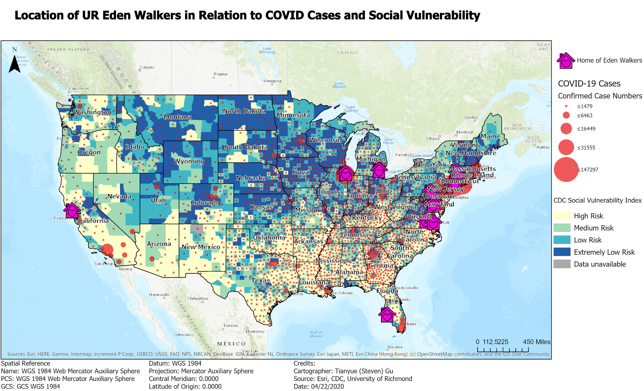
On the maps above and below, the hometowns of ten 2020 UR Edenwalkers appear on a base map of coronavirus cases maintained by the Centers for Disease Control, showing areas of relative social vulnerability and risk. Underlying each home icon is a snapshot of county-level data at the time of publication.
A number of my classmates live in the northeast US (detail, below), where the concentration of COVID-19 cases is heaviest. These maps were compiled using data from Esri, CDC, and the University of Richmond.
