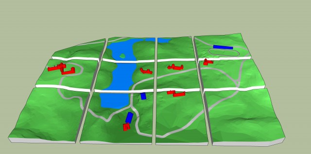
As part of the century celebration on campus, the Center for Teaching, Learning, and Technology; Digital Scholarship Lab; and Boatwright Library collaborated on the printing of a 2 foot by 3 foot terrain map of campus as it looked in 1914 with 7 major buildings on campus and the roads and terrain as they existed at the time. The image below shows the 12 pieces that were designed for individual printing on the new 3D printer
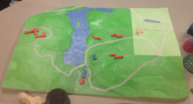
The photo below shows the final and printed version (the two blocks in the upper, right-hand corner had not yet been finished so they have a pastel look to them).


