Portland

Portland 1

IMG_5320

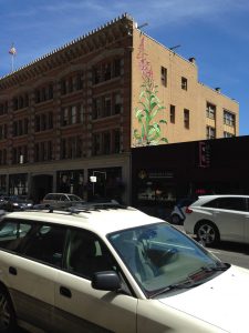
A classic symbol of Portland

Both books emphasize the study of place. Define the geographic concept of “place”. Illustrate the concept by describing the place where you are this summer.

A place can be defined by countless characteristics including mountains, rivers, buildings, and transportation systems. I am spending my summer in Glen Allen, Virginia which can be described as a suburban area not far from the James River and Short Pump Town Center. I live on the outer edge of Glen Allen which has many farms nearby, but I am also a five-minute drive from Staples Mill Road and the Crossridge shops, so there is an essence of both country and suburban living.

Before reading this book, think about your preconceived idea of the City of Portland. From this introductory material, describe two things that matched your preconceived notion of Portland. Describe two things that you had not previously associated with Portland.

Before reading both of these books, I knew about Portland’s food culture since Richmond is extremely similar. I also was familiar with the unique hipster style of Portlanders, especially their love of organic food. However, I did not realize the extent of the environmentalist views in the city and the book clearly shows that there are many people who advocate and vote for environment-related issues. Additionally, I learned that there are countless outdoor activities in the area. I knew that there were similar activities to do, but I was unaware of the large number of them.

Why did the authors choose to introduce Portland as a Cascadian City? What does it mean to be a Cascadian City?

The authors describe Portland as a Cascadian City because the meaning of Cascadian can be interpreted in many ways. The purpose of the book is to provide various maps that each portray a different aspect of the city. In the introduction, there are multiple maps that each explain Cascadia in a different light. Some focus on the geography while others emphasize trading. Since Cascadia can be defined by different characteristics, the Cascadian City is the best way to describe Portland and its unique culture and geography.

What is the essence of Portlandness? Why are maps a useful way of presenting this idea?

Portlandness conveys that Portland is more than just a food lover’s and environmentalist’s city. There are so many layers to the culture of Portland and each individual can feel different emotions and senses when visiting. The maps are a useful tool to express this point because cartographers choose how to describe a place through their maps and each map can show a unique trait of Portland.

Portland 2

IMG_5326

A fountain in Portland

What is the main concept illustrated in this section (e.g., what is an Urban Landscape)?

The concept of Views of the City relates to how people experience a place through sight, taste, smell, and feelings. For instance, I think of the James River, the variety of food, and the smell of smoke when I think of downtown Richmond. There are specific emotions and senses that are evoked when recalling a given place. The maps in this section of the book explain the feeling of being in Portland.

What perspective did you choose to read for this section (e.g., Bridgetown, Under the Bridges, Where the Sidewalk Ends… or Naked City)? Why? How would you describe Portland according to this perspective in a few sentences?

I chose to read Imagined Population Densities because I was surprised that Portland is not a dense city since it is very well-known. I thought it would be interesting to look into how Richmond compares to Portland and other cities around the world. According to the maps in this section, Portland is considered much less dense than the largest city in the world, Dhaka, Pakistan. If the residents of Portland were to live according to the population of Dhaka, they could live in just a fraction of the area of the city. Portland is also not much denser than one of the United States’ least dense cities, Salt Lake City, Utah.

What map would you produce for Richmond to represent this concept? Why? What would be the title of the map? What might the map look like?

I would produce very similar map of Richmond compared to the maps displayed for Portland. I would compare different cities’ population densities to that of Richmond, which is smaller than Portland. I would title the map “Richmond: The Populated, But Expansive City.”

Portland 3

What is the main concept illustrated in this section (e.g., what is an Urban Landscape)?

The Social Relations section describes the interactions between residents of Portland through maps of homelessness, art, and environmentalism. Portland is a unique city and the ideas communicated between one another are important to understanding the relationships within the city. These relationships are critical in developing an identity for Portlanders.

What perspective did you choose to read for this section (e.g., Bridgetown, Under the Bridges, Where the Sidewalk Ends… or Naked City)? Why? How would you describe Portland according to this perspective in a few sentences?

I chose to discuss The Invisibility of Homelessness due to the large homeless population of my hometown, Richmond. I was interested in learning more about this issue in Portland to compare my experience of seeing homelessness in my own city to the city I will visit in just a few weeks. According to the map, there are between 306 and 474 homeless individuals in the center of the city along the Willamette River. Although there are a great number of homeless people in city for its low population density, there are several organizations such as R2DToo that are working to provide shelters.

What map would you produce for Richmond to represent this concept? Why? What would be the title of the map? What might the map look like?

I would create a population density map for homeless people in certain areas of Richmond. For example, I would compare the Fan, Downtown, and Glen Allen. Each of these areas have vastly different homeless populations which would be expressed in the map. I would title the map “Homelessness at Home.”

Portland 4 

IMG_5015

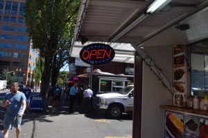
The food carts in Portland

What is the main concept illustrated in this section (e.g., what is an Urban Landscape)?

Portland is known for its food variety and organic food production. This section on Food and Drink explains the different aspects of food that make Portland unique such as restaurants, food carts, and breweries. Portland is surely made for food lovers.

What perspective did you choose to read for this section (e.g., Bridgetown, Under the Bridges, Where the Sidewalk Ends… or Naked City)? Why? How would you describe Portland according to this perspective in a few sentences?

Over the past decade, restaurants, especially fast food, have popped up all over the world. Food is an important part of Richmond’s identity as well and I read this section to see the similarities between Richmond and Portland. Portland has the highest density of restaurants in the metropolitan area which is strange for a city, but not surprising for Portland. This city is known for its food and its 5,287 restaurants in the metro area proves that fact.

What map would you produce for Richmond to represent this concept? Why? What would be the title of the map? What might the map look like?

diningmap

The map above demonstrates the key concepts I would address in a map about Richmond restaurants. It expresses the large number of dining areas in the downtown area; however, I would have expanded the map to show a decrease in restaurants further from the city’s center. I might title the map “Richmond is for Food Lovers.”

Tagged | Comments Off on Portland

Forest Under Story

Section I

 What do you expect to observe when we visit the H.J Andrews?

I anticipate to see the Lookout Creek Watershed within the Willamette National Forest, the long-lived conifers, associated wildlife and stream ecosystems, first-hand data collection and analysis, and the four Reflection plots.

What are some of the different ways of telling the story of these forests? How do these methods of creative reflection support scientific inquiry and vice-versa?

There are several ways of telling the story of forests. They include both scientific and artistic methods such as through poetry, observation and experiment, and through myths and math. Creative use of language, concepts and metaphors shape what scientists can see and imagine thus enabling them ask novel questions, propose innovative solutions thus better communicating their ideas that can become part of peoples’ lives. Creative writers on the other hand, draw on the rich vocabulary and conceptual insights of science to help people understand the value of the world and feel a visceral connection to an issue to act upon it.

 Why is the long-view critical to understanding the role of humans in the natural world?

Comprehending the long-view is significant due to the dynamic nature of both societal and environmental contexts regarding the role of humans in the natural world. Because of this, there is need for humans to imagine and enact strategies that will help ensure the continuity of environmental systems, by cultivating a community of interest in people, and committing to have faith in the future of these systems.

Section II

Why was this theme chosen (e.g., Research and Revelation for Part One) to tell the story of the H.J. Andrews Experimental Forest?

Research and Revelation

The writer chose this title as part one probes an inquiry into the nature of the old growth forest from the out view, decomposition and human-ecological interactions. This section also reveals a lot about the nature of the landscape and the need for humans to adopt the long-view so as to understand their role in ecological systems.

Change and Continuity

The writer chose this title to illuminate the changing relationship between the forest and human culture. This has resulted in the change in the nature of forests from species’ evolution and co-evolution, vegetation succession and extinction of certain species. The continuity describes nature’s response after disturbances from vegetation succession to restorative land forms.

Borrowing Others’ Eyes

The writer chose this title to emphasize the need for us to learn from other people’s experiences. This is because humans have the tendency to perceive acute changes relatively quickly, while overlooking small gradual changes that may have a significant effect on ecosystems.


What do you expect the landscape to look like from the passages in this section?

Research and Revelation

The landscape has a high elevation ranging between 1300 to 5300 feet. The lower rocks are volcanic composed of lava flows and mud flows. Conifers dominate the old growth though other species such as Douglas fir, wet and dry meadows, herbs, shrubs and deciduous trees exist. There are also several streams crisscrossing the landscape.

oldgrowth 1

Change and Continuity

The landscape has suffered the effects of disturbances such as floods, landslides and wildfires. There are new stream channels formed from the rearrangement of previous stream channels. There are also clear-cuts and sections containing post disturbance vegetation such as shrubs and herbs. Present also are dead decaying logs.

oldgrowth2

Borrowing Others’ Eyes

The landscape is characterized by dense growth. There is plenty of water resulting in pervasive dampness and excessive humidity. There are soggy mats of moss draping tree limbs, and fungi and algae on the forest floor. There are also geophonics of small and large streams.

oldgrowth3


Provide an example or two of how the scientific context presented in the Ground        work essay is reflected in creative storytelling for the section.

Research and Revelation

Log trucks full of ancient trees were barreling down the valley at a rate of one per minute. This depicts the excessive deforestation of the old growth.

Change and Continuity

Big wads of logs cruised down Lookout Creek. This shows the extent of flooding as an ecological disturbance in the forest.

Borrowing Others’ Eyes

If you walk hard wearing rain gear, you’re drenched with sweat from the inside, and a trickle bisects your shoulder blade. This shows intense humidity that characterizes the outgrowth.


 What’s a question you have about the forest from reading these passages?     How can we use science and art to enlighten the community on the need to preserve forests?


References:

https://www.google.com/search?q=hj+andrews+experimental+forest&espv=2&biw=1366&bih=667&source=lnms&tbm=isch&sa=X&ved=0ahUKEwiZx9eLxtXOAhWmJMAKHd9RC78Q_AUIBygC#imgrc=_

https://www.google.com/search?q=hj+andrews+experimental+forest&espv=2&biw=1366&bih=667&source=lnms&tbm=isch&sa=X&ved=0ahUKEwiZx9eLxtXOAhWmJMAKHd9RC78Q_AUIBygC#tbm=isch&q=tree+stumps+at+hj+andrews&imgdii=t-BQ56SGo2Ph4M%3A%3Bt-BQ56SGo2Ph4M%3A%3Btk3ELmfIt9ajfM%3A&imgrc=t-BQ56SGo2Ph4M%3A


Posted in Uncategorized | Comments Off on Forest Under Story

Portlandness

Section 1

  • Geographic concept of ‘place’

A place is an area that has unique characteristics that define it. These attributes could be as a result of natural and/or human influence.

This summer I was in Richmond.

richmond

Richmond has unique attributes such as forests, the James River, Appomattox River, rolling hills, all which were naturally formed. There is also infrastructure and settlements which are as a result of human influence.

  • Matched preconceived notion of Portland
  1. I always envisioned Portland as a green city that was very conscious of the environment. I was therefore not surprised to learn about Portland’s energy conservation strategies.
  2. I always imagined Portland as an agriculturally viable region. I was therefore not surprised to learn of the farm markets in Portland.

Did not previously associate with Portland

  1. I have always thought of Oregon as a conservative state. I was therefore surprised to learn of the liberal freedom in Portland such that there is a vibrant LGBTQ community, and people are relatively free and safe to express their sexuality.
  2. I had never associated Portland with the high number of breweries that characterize it.


  • Why Cascadian City?

The authors wanted to avoid the conventional and often stereotypical attributes which people associate with a place due to its location in a particular region. As a result, the authors wanted to use a better way to portray Portland’s uniqueness.

Cascadian City?

A Cascadian City means being part of a bioregion, which is a region not defined by existing political state or provincial boundaries but rather by proposed boundaries due to common characteristics such as watersheds, soil and terrain.

cascadia


  • Essence of Portlandness

To show people’s perspectives about the city of Portland. This includes attributes either stereotypical or factual that people associate with Portland.

Maps have great power that help structure how people see places. In Portlandness especially, maps have a visual appeal that powerfully displays a particular notion and show how ubiquitous the notion is.

Section 2

Urban Landscapes

This section aims to redefine our skewed interpretation of the word landscape by examining the setting of Portland and its neighborhoods from many unconventional perspectives. For a long time, people only associated landscape with natural settings, and as a result failed to recognize the intriguing stories that pastoral and urban landscapes reveal.

Perspective chosen: Where the sidewalks end

Why? Given the information I gained from the introductory material on Portland’s robust carless commuting and energy conservation, I was interested in finding out how the people conveniently get their way around the city.

Describe Portland according to this perspective: A significant number of roads lack sidewalks. Pearl District in particular either has dead-end walking paths, sidewalks reclaimed by vegetative growth or no sidewalks at all. Some of the neighborhoods lack sidewalks too.

sidewalk

What map of Richmond to represent this concept? I would design a map to show availability of sidewalks in the city of Richmond. Unlike the city of Portland that has a robust public transport system, Richmond has a menial public transit system since most of the people commute using their own vehicles.

Title of the map: An all driving city?

The map would probably not look any significantly different from that of the city of Portland. Most roads in the central district and downtown Richmond would probably be lacking sidewalks due to the huge number of people who use their own vehicles to commute.


The once and future city

This section aims to explain how the city of Portland has progressed from its ancient times and how such change has contributed to the present outlook of the city. The authors examine the elements of the city that are no longer present or never came to be. For the missing elements of the city, the authors invite us to imagine and engage with the past in trying to discover what role such elements played in defining the present Portland.

Perspective chosen: Ethnic Imprints

Why? This perspective seeks to explore the effect of the different ethnic groups of early settlers on the present outlook of the city. These immigrants caused major ethnic segregation in Portland in the early 18th century.

Describe Portland according to this perspective: Despite the huge levels of ethnic segregation that were caused by the early European settlers, Portland has progressed to be an all-inclusive city. Much of the early immigrant groups are absent from the contemporary landscape and very little remains of Portland’s European immigrant neighborhoods compared to the cities on the East coast.

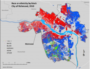
What map of Richmond to represent this concept? I would create a map that shows the effect of race relations on the settlement patterns in the city and the neighboring areas. Much of the city is still racially segregated.

race

Title of the map: Racial Divide

How the map would look like: The map would portray a huge disparity in settlement patterns which are largely influenced by racial affiliations. Eastern sections of the city would show an immense number of African-American residents which is largely due to the historic red lining practices, while the west side would be predominantly white.


Social Relations

This section aims to explore the relationship between people and people, people and authorities, and people and ideas. Some of these relationships both historical and contemporary are sometimes very noticeable to people and invisible to others too. The authors hold the view that by examining the relationships that are often hidden, provide particularly useful glimpse at perspectives of a place different from our own.

Perspective chosen: Mission Invisible- The path of least surveillance

Why? I was particularly interested in finding out how the city of Portland was able to maintain very low incidences of crime. It was interesting to note the huge reliance on surveillance cameras in the city.

Describe Portland according to this perspective: There are many surveillance cameras in the city of Portland such that the authors coin the title ‘the path of least surveillance’ implying that whichever route one takes in the city, there is a likelihood that one is being monitored. A huge concentration of the security cameras are in the central district area with 400 of them also discernible focused on streets in downtown Portland. There are also more surveillance cameras at ATMs and others which are hidden.

What map of Richmond to represent this concept? I would design a map that shows the distribution of security cameras in the city of Richmond and its environs. With Richmond ranking as one of the cities in the US with moderate to low incidences of crime, it would be interesting to find out if the low incidences are as a result of the presence of many surveillance cameras.

Title of the map: A watchful city?

How the map would look like: The map would probably show fewer surveillance cameras compared to those in Portland. With the modest levels of crime in Richmond, there would be no need to have numerous surveillance cameras. The map would therefore show Richmond having a more robust police department for supplementary surveillance.

References:

https://www.google.com/search?q=sidewalks+portland+oregon&biw=1093&bih=458&source=lnms&tbm=isch&sa=X&ved=0ahUKEwiqoMLj8tPOAhUIbR4KHfKKDUEQ_AUICSgE#tbm=isch&q=racially+segregated+housing+in+richmond+VA&imgrc=MwAwIDdxpYGQ0M%3A

https://www.google.com/search?q=sidewalks+portland+oregon&biw=1093&bih=458&source=lnms&tbm=isch&sa=X&ved=0ahUKEwiqoMLj8tPOAhUIbR4KHfKKDUEQ_AUICSgE#tbm=isch&q=cascadia&imgrc=Xl_iLJ9ADrQshM%3A

https://www.google.com/search?q=sidewalks+portland+oregon&biw=1093&bih=458&source=lnms&tbm=isch&sa=X&ved=0ahUKEwiqoMLj8tPOAhUIbR4KHfKKDUEQ_AUICSgE#tbm=isch&q=richmond&imgrc=Xp3w862FrKuuQM%3A


Posted in Uncategorized | 1 Comment

Benedict Roemer Forest Under Story Reflection

image

View of Wolf Rock and Western Cascades from peak of Carpenter Mountain (Photo by Benedict Roemer)

  • HJA 1: In the introductory material (pages 1-14) the author asks the fundamental question, “What’s the story here?” After you have read the first chapter, answer the following questions (no more than a short paragraph per answer):

* What do you expect to observe when we visit the forests of the H.J. Andrews?

I hope to observe both sides of the forest that the book describes: the clear-cut, majestic cathedral side and the wild, thick shrubs and vines side. Seeing both personalities will give me the full story of the forest. I also hope to see a wide variety a wildlife while exploring the cathedrals and thickly shrubbed hillsides. While the trees are of course very important to telling the story of the forest, I believe that the wildlife which inhabits a forest is also instrumental to filling out the story.

* What are some different ways of telling the story of these forests? How do methods of creative  reflection support scientific inquiry and vice versa?

The story can be told creatively and imaginatively through essays or poems, paintings or photographs. It can also be told analytically and scientifically through  instrument reading and graphs and data. Both approaches to telling the story are very important, and actually support each other because one approach alone could not tell the full story. Pure scientific analytics and data cannot describe the ancient beauty of the forest or the feelings that it invokes in visitors. However, the scientific data is also essential to understanding the history of the forest as well as the many life forms that call thee forest home. Together, the science and creativity narrate the full story of the ancient forest.

* Why is the long-view critical to understanding the role of humans in the natural world?

Only by studying a forest like St. Andrews for many, many years can one begin to study the role of humans in the evolution of that forest. As the book points out, it takes about two hundred years for a fallen log to decompose and transform back into soil. Therefore, the forest should be studied for at least that long in order for scientists to document the full cycle of change. This includes the long term effects that humans have on the forest. In two hundred years scientists can see the long term effect of logging projects and forest fires. Naturally, as society evolves, so will the ways in which we interact with the forest and therefore we will never know exactly the effect that we are having on the natural world in any given moment, but we can certainly get closer to understanding our role in the natural world around us.

image

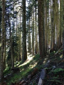
Forest along trail up Carpenter Mountain (Photo by Benedict Roemer)

image

View of Three Sisters from McKenzie Pass (Photo by Benedict Roemer)


  • HJA 2-4: For each of the main sections of the book (Part One, Two, and Three), read the Ground Work essays and at least three other entries for the section. Then answer the following questions (no more than a short paragraph per answer):


* Why was this theme chosen (e.g., Research and Revelation for Part One) to tell the story of the H.J. Andrews Experimental Forest?

2. The name of this section is a perfect introduction to the forest because research leads to revelation. By learning about the research conducted in the forest, the nature of the forest is slowly revealed to us. Once we become more familiarized with the forest, we can move forward in the book and our knowledge of the forest.

3. As we all know, change is the only constant. The same is especially true for the Andrews Forest where the ecosystem is in a state of constant change. Sometimes this change moves slowly, like the rotting of a log, and sometimes it comes suddenly and quickly with a massive storm or wildfire. However, along with the change is a certain amount of continuity, although even part of what is continuous is change.

4. This book has already focused on the importance of approaching research of a place from many unique directions. Therefore, it makes sense that the final section of the book would be titled “Borrowing Others’ Eyes”. This section of the book shows how different areas of research, such as hydrology and soundscape ecology, can contribute to the story of the Andrews Forest. All of these many methods are brought together in one place in this book and the most complete version of the story is told through the eyes and ears of many scientists from different fields and poets and writers simply exploring and observing the wild beauty all around them.

* What do you expect the landscape to look like from the passages in this section?

2. From the descriptions in this section of the book, I developed an image of a dark forest full of grand, tall trees, both conifers and deciduous. Rushing down the steep slopes are small creeks full of stones and interruptions from small waterfalls.  Lying around are fallen logs in various stages of decay and covered in small mushrooms. Scattered across the hills are areas  wiped almost bare by wildfires and logging, but even here saplings are starting to reach towards the often cloudy skies.

3. This section of the book paints a much more ragged and scared image of the forest. Now I imagine a landscape hillsides ravaged from mud slides or avalanches, and massive areas burned out by fires. I also picture acres of new growth forest full of barren, rocky fields and messy shrubs.

4. The first Ground Work essay in this section paints quite a vivid picture of a damp, moss and fog filled forest eternally dripping. However, this is during the rainy season in the winter, so I will not see that side of the forest. Many of the creative writings also speak about bright green beds of moss or clearings filled with green ferns, so I do still expect a landscape filled with a million shades of green. The landscape will be filled with the dark green of the needles in the treetops, to the bright, light green of new moss covering stones and fallen logs, and everything in between.

* Provide an example or two of how the scientific context presented in the Ground Work essay is reflected in creative storytelling for the section.

2. The storytelling in this section tells the story of the forest as well or even better than the Ground Work sections. They communicate what is taught in the Ground Work sections but then expand on that creatively and paint an even more complete picture of the forest. For example, the poem Cosymbionts by Vicki Graham talks about how the forest can be dissected into many minute parts, and how poetry can do that as well, describing each little detail. The first Ground Work in this section describes the landscape of the forest in many separate parts as the poem does, describing each part separately, but then as a whole as well. Another poem by Vicki Graham reflects on how an old growth forest is never still and how research plays a role in the constant activity of the forest. at the end of the poem, Graham concludes by saying that all the signs of research found in the forest show that the forest must be loved.

3. In Bill Yake’s essay Forest and People, he speaks extensively about the word change. He gives a dictionary definition and then he speaks about what it means in the context of the forest. He reflects that in the forest change can mean slow evolutionary change rapid, cataclysmic change. He also reflects that people’s opinions about the forest can also change, which relates to the third Ground Work piece which speaks about public opinion and the conservation of the forest. The poem Ten-Foot Gnarly Stick by James Bertolino muses on the passage of time. He finds that the characteristics of a stick that he finds reflect the path of his life. However, those knobs and dark spots can also show the story of the forest through time.

4. Jane Hirshfield begins her essay titled Wild Ginger by saying “The journey from ignorance to seeing is made by borrowing others’ eyes.” It is very possible that the editors decided to name the section off that fantastic quote because it so perfectly encapsulates what the section is all about. If I am not a hydrologists, I cannot teach myself what is described in the Ground Work essay on water, and I therefore must rely on the hydrologist’s eyes and understanding to end my ignorance of the subject. The same is of course true for soundscape ecology. However, Jane provides a much simpler, but just as important example of how this is true, by saying how  friend might point something out to you that you missed, and now you can not only see that thing, but also see it when it appears elsewhere. All the other creative essays and poems in this sections, and really in the whole book, are tributes to the value of borrowing others’ eyes because without them our own vision would be far too limited to see all the beauty and intricacies of the world around us.

* What’s a question you have about the forest from reading these passages?

2. The first Ground Work section says that their are not many sounds of wildlife in the forest. Is this because there simply aren’t many vocal birds and other creatures in the forest, or does something about the forest muffle any animal sounds that may be made?

3. Even though this forest forms a world of its own, it is not immune to the changing environment of our planet. Therefore, I am wondering how the warming temperatures and new and extreme weather patterns of climate change will shape and change the forest in the future.

4. This section about viewing the forest through other perspectives leaves me wondering if non natural scientist scientists have ever studies the forest. For example, has a psychologist ever studied the effect of forest on our mind? Or have economists ever studies or written about the monetary value of the forest? Not only the lumber contained in the forest, but also the value of medicines that can be found in the plants, such as the bark of the pacific yew than is a treatment for breast cancer.

Tagged | Comments Off on Benedict Roemer Forest Under Story Reflection

Benedict Roemer Portlandness Reflections

IMG_5320

Iconic sign in downtown Portland

  •  * Both books emphasize the study of place. Define the geographic concept of “place”. Illustrate the concept by describing the place where you are this summer:

A place is an area defined by the the context in which it is placed or the way in which is is described. For example, the authors of “Portlandness”, David Banis and Hunter Shobe, begin their introduction by speaking about the many contexts in which they could begin to describe Portland, and how that would give the reader a certain perception of that place. I could describe the place where I am working this summer as a birthplace of American Industrialism, the less beautiful and less prosperous side of Bethlehem, a beautiful example of revitalization, or the home of the nations largest free music festival. These are all ways to describe the same place: the Southside of Bethlehem PA. However it is best to view a place in many ways as possible because “it is through our understanding of places that we make sense f the world.” (Banis and Shobe)

* Before reading this book, think about your preconceived idea of the City of Portland. From this introductory material, describe two things that matched your preconceived notion of Portland. Describe two things that you had not previously associated with Portland:

Before reading Portlandess I shared in a view of Portland that I’m sure many people would agree with. I imagines Portland as a cold and rainy city full of environmentalist liberals. This book confirmed that Portland does receive a fair amount of rain every year, and it does have a very liberal population who do a lot do protect the environment through using public transportation and green energy and eating local food. Two things that I did not know about Portland are the popularity of food carts and the prevalence of micro breweries in the city.

* Why did the authors choose to introduce Portland as a Cascadian City? What does it mean to be a Cascadian City?

Portland is best introduced as a Cascadian city because placing it within any other context would only hold it within stereotypes already associated with Portland. The Authors want to introduce us to Portland in a new way that is also free of stereotypes so that we can view Portland with an open mind. Ultimately, a Cascadian City is city of diversity. Just as Cascadia can be described in so may different ways, Portland can also be seen through a diverse set of windows, as this book illustrates.

* What is the essence of Portlandness? Why are maps a useful way of presenting this idea?

Though the word “Portlandess” sounds like it might come from the Portland based comedy Portlandia, it really means much more than the Portland depicted in that show. The true essence of Portlandness is the amazing diversity of Portland. Portland has seen a fair amount of hipster gentrification, but there are also many areas of poverty an low development remaining. Portland boasts of its environmentalism,  but the Willamette River is still contaminated by an era of industrialism. Only many, many maps can depict the numerous sides and personalities of Portland.

  • Portland 2-4: For three of the main sections of the book (I-VII), choose one of the perspectives presented (e.g., for I. Urban Landscapes, you could choose Bridgetown, Under the Bridges, Where the Sidewalk Ends… or Naked City), and answer the following questions (no more than a short paragraph per answer):

* What is the main concept illustrated in this section (e.g., what is an Urban Landscape)?

1. Urban Landscape: As more and more people live in an urban setting, it is important to expand our understanding of the word “landscape”. Just as wild, nature landscapes can tell the stories of shifting earths, moving glaciers, and wildfires, urban landscapes can tell the story of industrialization and revitalization, urban decay and gentrification, and new cultures coming and going. In this section, the authors describe the landscapes of Portland that contribute to Portlandness.                                                                                                         2. Views of the City: This section utilizes our less often used senses to better understand Portland. In “Views of the City”, the authors show us how the city feels and smells and sounds and is imagined by college students and elementary school students. By viewing, or rather not only viewing, the city in these ways, the authors strive to show how different Portland is from place to place, and how wrong it is to assume that the entire city is one way because your experience of one part of the city was that way.                                                3. Social Relations: A city can’t exist without the people who live in the city and make it what it is. New York would be nothing without the hard core Yankee fans and investment bankers. Boston wouldn’t be what it is without the Irish immigrants  and young and old scholars. Portland would not have Portlandness if it didn’t have the coffee addicted hipsters and all the other people who have made their way to Portland for one reason or another. The true character of the city can be seen in how its inhabitants get along or disagree. Portland is home to many different people, and over the years there

Map of the density of coffee shops in Portland (from "Portlandness", by David Banis and Hunter Shobe)

Map of the density of coffee shops in Portland (from Portlandness by David Banis and Hunter Shobe)

have been some disagreements between them, but I think that many would agree that almost everyone can unite under the flag of the People’s Republic of Portland. While Portlanders still have their disagreements with each other and the authorities, they can still unite behind their soccer teams or the thing that makes them all so special: Portlandness.


*What perspective did you choose to read for this section (e.g., Bridgetown, Under the Bridges, Where the Sidewalk ends… or Naked City)?  Why? How would you describe Portland according to this perspective in a few sentences?

Map of edited stop signs around Portland

Map of edited stop signs around Portland (From Portlandness by David Banis and Hunter Shobe)

  1. Stop! Writing On Stop Signs: The writings on stickers found on stop signs across Portland are a great way to see how Portlanders choose to express themselves, and what they have to say. While some of the additions would be expected in Portland, such as “STOP eating animals” or “Peace STOPs War”, others are more surprising. I found the sign “STOP Make Portland Normal” especially surprising. Apparently not all citizens of Portland appreciate its hipster reputation. Regardless of the content of the signs, the number of vandalized signs describes a Portland in which people feel comfortable expressing themselves. This matches well with the wildly held perception of hipster Portland.
  2.  Sounds of the City: As a musician, I am drawn to how a place sounds, and often even prefer to experience something through sound rather than sight. In a city, the constant humming of traffic and emergency vehicle sirens can become overwhelming if you can’t escape to a nice, quiet park. Portland definitely has the sounds of a big city in the Burnside neighborhood, but, as an environmentally conscious city should, it also has many parks. The parks should be an escape from city sounds, but as the soundscape shows with the note of an airplane cutting through the quiet, Portland is truly a large city.
  3. The Invisibility of Homelessness: I found this section quite surprising, even though in hindsight I can see that it was very naive of me to not expect that Portland would have a homeless population. What I found significantly less surprising, and extremely interesting about Portland was how they approach the problem.  Two of the homeless shelter locations highlighted by the authors were developed through peaceful protest by the homeless and negotiation with authorities. Maybe I’m just not giving other cities enough credit, but I can’t imagine that authorities, and the public, in other cities would be so tolerant as to even negotiate with the homeless population. Also, many cities try to make the homeless as invisible as possible, and Portland is also guilty of this. However, the Right to Dream Too community right in the middle of downtown Portland is a wonderful gesture against that desire to hide the problem of homeless. I think that the prominence of the the community shows how many Portlanders are willing to confront the issued that face society

* What map would you produce for Richmond to represent this concept? Why? What would be the title of the map? What might the map look like? (go ahead and sketch it, if you feel you can. Don’t worry about the technology, if you can’t post the drawing.)

  1. I’m not sure how many stop signs have been written upon in Richmond, but a similar map could show statements written by Richmonders in graffiti. Such a map would also depict what a similar part of Richmond is thinking about the city and the world. The map would be titled “The Writing’s on the Wall”. The map would have to cover almost all of Richmond to include the Church Hill neighborhood and the South side of Richmond, which is where I imagine the highest concentration of graffiti would be found. However, I think it would also be important to find graffiti in areas where it might not be expected in case that graffiti was created by a different demographic and might therefore show a different perspective.
  2. I think a sounds of the city map is a great way of experiencing and understanding any city, so I would try to replicate the map for Richmond. Richmond also has a diverse soundscape with a busy downtown, a heavily trafficked Broad Street, and many quite residential and park areas. It would also be interesting to see what kind of sounds are noticed in areas like Cary Street and Grove Avenue.  I think I would start the map in the West End, near the University of Richmond Campus, then move up to Broad Street and the Willow Grove Area, then through Downtown near the State Capital, then through Shockoe Bottom, then back to the lake area and Maymount Park, then back towards the West End through Cary Street and then finally to the River by Pony Pastures. As I write all of this I realize just how many areas I want to explore through sound because I believe that would really give me a different perspective of the city.
  3. I know that a large homeless population exists in Richmond, so I would map that population as well. However, rather than mapping the density of the homeless population, I think it might be interesting to map the race of each homeless person because of the difficult history that Richmond has with race relations. A title for this map could be “They Have No Home in Richmond”, reflecting that maybe Richmond still needs to do more to be welcoming to all people, and make up for the injuries done to African Americans for hundreds of years.
Tagged | Comments Off on Benedict Roemer Portlandness Reflections

working hard, or hardly working?

Hellooo digital world of the Geography of the James blog!

Natalie here; it is high time this little blog was brought back to some life, almost two years later. It’s gonna be great – we’ve got some good things in the works, what with summer goings-on and then another year of Earth Lodge coming up. Huzzah for more people learning about the James River watershed and geography and all and learning to love it and care for it more!

IMG_0185

IMG_0195

This summer, I am working with the James River Park System as an intern! My role or job description is vast and varied, including things such as: environmental educator, adventure leader, river rat, protector of nature… you name it, I’ll probably cover it. I’ve been at work a couple weeks now, and the broad range of tasks we’ve done thus far is an indicator of the well-rounded nature this internship will be. I’m real keen.

As the James River is one of my favorite places in the world and I feel most at peace when on or around or beside the river, it seems too good to be true to be working there all summer. We have done so many random and fun activities and adventures thus far; half (or more of) the time it doesn’t feel like we’re working! For example, yesterday I helped out with a Summer Solstice Float event at Huguenot Flatwater… but it was exactly the kind of thing I would want to do on a Sunday anyways: canoe to an island, have a cookout, swim around in the water. Can you get more ideal of a summer opportunity?? (Probably yes, and depending on what your preferences are, for sure… But for me, this is amazing.)

IMG_0216

IMG_0204

Basically, much of the time at my internship so far, I’ve asked myself the question: am I working hard, or hardly working? It’s such enjoyable work (at least for the most part; trash collection, not so much – but also necessary and educational in ways) that it often doesn’t feel like a job. (I suppose maybe jobs have too much of a negative connotation as being something that you have to do, you’re stuck in, that no one likes, etc etc.) I know I’m going to enjoy this summer quite a bit though.

IMG_0233

IMG_0242

Stay tuned for some updates/reflections on my internship this summer! Also, happy summer solstice. Cheers, mates. (And hopefully for the next post I figure out how to upload photos at a better quality…)

Posted in Uncategorized | Comments Off on working hard, or hardly working?

Jewel on a Chain

Home is a rather small place. Wherever we settle, we tend to carve out our own small plot that we become familiar with above all else and somehow manage to forget the rest. Even at Folly, my family’s 50 acre property in Madison County, VA, I have my comfortable space, and the farther reaches are left largely terra incognita for all intents and purposes. Such has proven to be the case in my recent thoughts on the James and my interactions with other rivers. With a few small snapshots of the most picturesque memories, I’ve cut my images of my favorite rivers into a perfect collage. It acts as a wonderful hideaway in my mind, a de-stressor and reminder of what is truly important. But when I remember to peek behind the curtain, I am suddenly confronted by the facts of the entirety of the rivers. The James is not just Westhampton Lake at sunset, nor is the Rapidan just a canoe ride on a hazy summer day. They stretch for miles beyond where I have seen them, and they are affected by more than I can fully comprehend. Although the James is the jewel of Richmond, it is far bigger and stranger than that.

In “Urban Myths”, Jonah Lehrer makes the case that bigger cities have faster “metabolisms” than smaller cities. If one draws the same conclusion with rivers, then the James has one of the best metabolisms in the state. Meanwhile, most efforts to protect it are focused securely on the abs (aka Richmond). Through the years this area of the James’s body has gone through many punishing diets of pollution, quite a few canal tummy tucks, and, most recently, a regime of healthy awareness and activism crunches that are doing a good job, but haven’t quite reached the goal. Meanwhile, the rest of the body lacks the focus and dedication of Richmond. The ‘head’ of the river is hidden on a private farm in the Blue Ridge and the overall James report card still comes in at a mere C. According to the report card, important species such as the striped bass are declining, and sediment pollution continues to drag in excess nitrogen and phosphorus. Richmond may be highly aware of the river due to its overwhelming pride in it, but the rest of the region seems stubbornly unaware. Without so much culture and pride tied up in the James, the rest of the watershed leaves it by the wayside.

I recently looked at a Virginia map and came to the horrifying realization that, without labels, I was unable to identify my Rapidan. If you handed me a picture of the Spicer’s Mill, where we put in our canoes for a longer cruise, I would recognize it in an instant. But find it on a map? Recognize even the basic shape of the whole river? I was lost. My perspective of the Rapidan was limited to a few miles. And I soon realized that it was the same for the James. Richmond encompasses all of my experiences in connection to the watershed, so I have no real idea of the river beyond the city limits. And this, I think is where the quickly growing awareness of the James in Richmond both hurts and helps. One of the (very) few things that has stuck with me from microeconomics, and was echoed in our “Urban Myths” reading, is the idea of economies of scale. Basically, a large business will do better than a small business because its very bigness gives it an efficiency advantage. The James River Association is based in Richmond, as are most of the parks, and so most efforts are logically located in that area. This means that the people of Richmond are consistently made aware of the problems and wonders of the James, and that this doesn’t extend much past the Greater Richmond area. However, as more and more people are exposed to the beauty and activities on the James, awareness of its problems will also spread, giving the JRA and other activist groups a greater economy of scale to spread up and down river from the city. People are constantly moving through Richmond, and one can hardly move in Richmond without getting a dose of the James and its affect on the city. This means that, hopefully, the number of people who care about the river will grow exponentially, especially as the JRA opens new parks and initiates new projects.

As I continue on with the James and the Rapidan and the many rivers to come, I hope that I can remember this lesson. Scale of perspective has a huge impact on what we know (or think we know) about a place. To me, the James will always be first and foremost the beautiful oasis in a bustling city, but I still have to remember that there are many problems and adventures lurking just beyond where my collection of memories ends. But I can take my new-found awareness with me, and spread it to the people I will meet. And if ideas work like cities or businesses, it will grow stronger and faster the more I talk. And maybe one day I won’t have to shush a passing cellphone user as I watch a blue heron hunt on Westhampton Lake. Maybe soon they’ll simply join me, and we’ll add a new snapshot to our collages; a new jewel on our personal chain of the river.

Posted in Synthesis | Comments Off on Jewel on a Chain

Can you feel it? Can you feel the Earth Lodge Love? ♫

Before I begin describing any of the amazing experiences I have had or the abundance of knowledge I have gained from being part of the Earth Lodge, I must say it has both exceeded my expectations and turned out to be very different from my expectations.


About this time last year, Garrett, Sam, and I began talking about how much we wanted to be in Earth Lodge after reading about it online, going to an information fair, and hearing stories from past lodgers. We hoped we would all be accepted and talked about who else we thought would be part of the program. A large part of the adventure of Earth Lodge has been getting to know people I never would have spoken more than a few words to and even a few people who I may never have even seen on campus. These people have become some of my closest comrades these past few months because we share a special bond in having some sort of passion for the environment.


What a bunch of goons

I am not sure what my expectations for class were for this semester, but I can definitely say I have learned a LOT. While I thought I knew a lot about environmental science before the class, I should have known that there is always something new to learn. And there is definitely always a new watershed to study. I had no idea the James River watershed encompassed so much nor did I expect there to be so much history and modern cultural ties to the river. There are books written about just the river! Books – that’s plural! And we have read at least one of these books along with many articles, magazines, news stories, case studies, and reports. Throughout all of these readings, I have gained more insight into the health, history, and culture of the James River. I never expected there to be a “culture” of the James River where people spend so much time on the river, work with the government to protect, and pass on stories of the river.


One of the coolest field trips we took was meeting Ralph White, a key player in preserving this river culture. Ralph is a local legend and has worked for over thirty years to shape the river’s park system into what it is. He is an example of the fact that it is undoubtedly the passion of the locals that drives the protection of an area like the James River because they are the ones who use it the most and use it all year round. I feel like all the Earth Lodge members have become part of this group of dedicated river lovers who work to maintain the river, and I am definitely included in that.


Earth Lodge getting weird during Fall Break

Another one of my favorite topics we have covered in the Geography of the James River Watershed class, trailing right behind tree identification, is how much potential the river has to create more connectedness and improve the water quality. There are many plans in place to improve trails, access points, and awareness of the river that could push the James to a whole new level in terms of being a part of the Fall Line city. It is exciting to read about how much we can do as local citizens and how much the city has planned for the James’ future. As a Richmond citizen, I cannot wait to see Richmond and the interaction with the James grow.


By far my favorite part of being part of the Earth Lodge community is that it is just that: a community. I have gotten to know my classmates more through late night studying in the lounge, bonding during the Fall Break trip, and singing together during Tuesday Tea times than at any other point in the class. It is true that those who struggle together, stay together. While we have “struggled” together in terms of studying together and being supportive during rough moments in the semester, we have all grown very close and formed a bond that will last at least for the rest of college, even if we do not all live together again. That bond itself has made the entire experience worthwhile.


Reflecting on the semester as it comes to a close, I could not have asked for better classmates or a better professor. While some Living-Learning Communities or SSIRs have great trips or dorms, we have by far had the best experiences (which makes up for the not-so-great dorm location). Our professor is definitely one of the most dedicated in terms of striving to help his students and being like another member in the community. And I am not just saying that for a better grade. All of my classmates and both my professor and TAs have contributed to this amazing experience. It is definitely a testament to the power of learning in an intimate, hands-on setting with a group of supportive, equally passionate individuals. And I am so glad that I still have another semester to spend with these people, even without a weekly class.

Can you feel the Earth Lodge Love?

Posted in Synthesis | Comments Off on Can you feel it? Can you feel the Earth Lodge Love? ♫

You Can’t Help.. Yet

Disturbed is the closest word I can use to describe how I felt as I more deeply analyzed the implications of an Environmental Leadership article the Earth Lodgers were assigned a few weeks ago. It identifies the three characteristics an Environmental Leader should exhibit: power, knowledge, and passion. I feel like this entire semester, we have been the privileged, unique individuals who were able to get the immersion experience required to kick-start environmental leadership. However when I looked at one specific diagram from the article (below) it shows politicians as high in power and scientists high in knowledge. Why are politicians and scientists the only ones with power and knowledge? Why are politicians themselves not high in both categories according to the diagram? Also, the diagram shows that passionate politicians and scientists lead to an informed and empowered public. Can we not have an informed and empowered public without scientists and politicians? How can we improve the ways things work so that the public can find independence and become environmental leaders? How can we free individuals from dependence on the few people in privileged positions of knowledge and power? Upon first glance, the environmental leader reading was inspiring to me. However, upon further examination, I’m not so sure.

Power is for politicians. Knowledge is for nerds.

The first issue the article raised was separating scientists from power and politicians from knowledge. This is a problem I have seen in society for my entire life. At one science lecture I asked how much the President is advised by the head of the Environmental Protection Agency (EPA). Under George W. Bush, allegedly 0 minutes of his entire term were spent discussing things with this knowledgeable, “powerful” environmental leader. However, Barack Obama at least nominated someone (from my hometown no less) to be the assistant administrator for the scientific research arm for the EPA, a position that left vacant for 9 months. The fact that we barely know the names of scientists and environmental scientists at that provides evidence that the most knowledgeable people in terms of the science behind environmental issues have limited power without politicians and/or the President himself. This issue with science/knowledge lacking power and influence has plagued me to the point that I have considered running for office someday. I think there needs to be a revolution in politics where people from various backgrounds have political power. If some scientists could be involved in the conversation, politicians would have immediate access to new knowledge rather than having to consult scientists later. Setting up a system of direct, diversified collaboration would be a huge improvement over the current system.

Besides the issue of scientific experts and politicians establishing a more effective system for change, there is the issue of developing citizens into informed and empowered beings with or without the political system and/or full expertise. I believe online tools such as the runoff calculator help people manage their personal environment at home. It gives suggestions such as rain gardens and barrels in addition to reducing impervious surface area to reduce the runoff a certain property generates. Another online tool that develops individuals into environmental leaders themselves is the Chesapeake Conservancy Prioritization Tool. It allows people to rate areas based on historical and cultural resources, habitat, and ecology and how important these categories are to them. This teaches people which parts of an ecosystem most provide what they are interested and also shows that each individual’s opinion can make an impact. However it requires an intimate knowledge of the landscape from the outset. Also, these tools are not things the average citizen would search for on their Internet escapades.

Getting outside consistently throughout a lifetime is the first step in maintaining environmental autonomy. Experiencing the outdoors allows people to view and interact with the environment in several meaningful ways. Over this semester alone I have viewed watersheds from planes and from a bird’s eye window view on my way to Boston, from my reflection spot, and most importantly from volunteering. Environmental leaders can help facilitate these community interactions with the environment. For example, Ralph White mobilizes volunteers, which my classmate, Garrett, mentions in his blog “Building an Empire.” Garrett mentions White’s quote that, “Volunteers made this park,” in reference to the James River Park System. Not only do these activities and experiences increase knowledge of the environment, but they cultivate passion as well. In this way, the existing environmental leaders do have some small power by others to become educated and passionate about their environments, thereby cultivating future environmental leaders.

Education on the environment throughout a person’s life must follow or the knowledge is not cultivated in a way that can be seriously applied to make change and become a leadership on one’s own terms. As I mentioned in my article “Trip to Maymont”  education about the environment is stopped too early. Developing knowledge in not only the science behind environmental issues, but also explaining the politics involved will allow for people to find out how to make changes themselves. I was lucky enough to have a father in County Recycling as a child, so I was able to ask him for the right contacts to enact a change in my community. I talked to local politicians and the local Chamber of Commerce in order to get one street in the center of my community lined with recycling bins (bottom of the hyperlinked page).http://www.towsonchamber.com/documents/JulyNewsletter.pdf If every student were required to speak to local politicians and organizations from an early age, they would learn to understand the processes currently involved in making changes on a local level to their environment. However, they would still have to go through the typical political system to legally get these changes made. Hopefully with knowledge/experience and passion developed on their own, the public can learn to navigate the power system of our government.

Overall, the Environmental Leadership article led me to question the ways we can develop and envision future environmental leadership. In my opinion, science and politics should directly overlap to improve policy decisions especially as they relate to the environment. In addition, I believe early and continued education is necessary in order to provide the public with knowledge and passion for the environment. In addition, if people are equipped with the knowledge of how to navigate politics and gain access to politicians, they can direct their knowledge and passion towards environmentally positive outcomes. Earth Lodgers and others who have had access to this amazing, and unfortunately rare training need to step up. We are ready to be and need to lead the next generation!

Posted in Synthesis | Comments Off on You Can’t Help.. Yet

It all Began with a Tour and Some Outdoors Love…

University of Richmond’s accepted students’ day, circa March 2012: I came to visit the university and the city of Richmond for the very first time.  I was insanely nervous, and the more I began to talk to other accepted students, the more I felt completely out of my element.  Most of the students I talked to on that day were high school seniors who had applied here as their first-choice school, early decision, and they could think of no better place to spend their next four years.  I applied to Richmond as a safety school; I had never even visited before accepted students’ day, and I thought it was going to take a lot to prove to me that this school was worth considering.

That was until I decided to take one of the optional tours of the school with my sister.  My mother dragged my unfortunate youngest sister into one financial college planning seminar or another, and my sister Alyssa and I went on a campus tour by ourselves.  I listened to the tour guide’s spiel and waited until the end before asking him what I considered to be one of the most important questions during my college search: what kind of outdoor recreational opportunities were there in the area?  I am sure that there are many tour guides on this campus who may have balked at such a question.  They may have mentioned the possibility of going to Belle Isle or Pony Pasture, but beyond that, they probably would not have known too much about the area.  I just so happened to luck into having an outdoor enthusiast as a tour guide, and so needless to say, I got an earful.  He told me all about the class IV rapids on the James River through the city of Richmond.  He told me about Belle Isle and the number of little parks that I am now able to identify as being part of the James River Park System.  He told me stories about camping trips he and his friends and fellow U of R students had taken over holiday breaks, and he stressed how close all of these options were to the university.

My lovely fellow Earth Lodgers (and TLB) bonding and flashing our sign

I was sold.  It is certainly funny to see how things fall into place, and I can confidently say that tour alone greatly influenced my decision to enroll in the university that same day.  It encouraged me to apply for the Westhampton College Outdoor Adventure living-learning community, and ultimately led to me choosing to apply to Earth Lodge for my sophomore year living-learning experience.  I am obviously biased (as I am sure everyone else in Earth Lodge would also admit), but I think it is very important to be aware of your surrounding environment.  However, this course has taught me the importance of not only being, but also understanding your place in that environment.

The implications of knowing the value of your place go so much further than just knowing off the top of your head how many minutes it takes to get to the nearest James River access point or the nearest public park.  Comprehending place leads to a lot more in-depth, critical thinking and requires the utilization of parts of the brain that I certainly did not expect to be using in a geography class.  I will be honest, I have not taken a geography class since middle school when the hardest thing we had to do was memorize states and countries and be able to fill them in on a map.  However, I realized quickly that geography and place were about a lot more than locations within county, state, or even country boundary lines.  Because the environmental impacts of our actions do not magically stop at these imaginary boundaries that exist only on maps, these places are all connected, and our daily actions many have ripple affects on all of these places that could last several years into the future.

Unfortunately, for most people, these affects only become obvious when the results are newsworthy.  More often than not, this only happens when the results likewise disastrous.  A prime example of this was the unfortunate situation of Kepone being directly discharged into the James River by the company Life Sciences in Hopewell, Virginia.  It was not until deleterious results became prominent in the environment, health of the river’s inhabitants and physical health of the company’s workers that the production of Kepone was questioned and the company was ultimately shut down.  What is more is that while this was a very prominent issue of point-source pollution, a lot of the severe environmental issues we face today are due to non-point source pollution and runoff that is a clear result of our society’s lifestyle choices.

Not many people stop to think beyond the practicality of driving their cars every day to get to work or fertilizing their lawns in the spring so they will be nice and green for the summer months.  Some more environmentally inclined individuals may consider the runoff these activities will contribute to the environment in terms of their own local rivers and creeks, but many do not think much beyond local implications. Before this class, I fell into this category.  I certainly never would have pulled up the run-off calculator on the James River Association’s website, nor would I have known that such a thing actually existed.  I did not have a comprehensive understanding of the difference between my narrow, self-centered view of the environment and the much wider implications my daily actions cause.  This course taught me that, and it has completely changed my way of thinking.  As if the readings were not driving home this point enough, the trips that we took as a class to places like the Wetlands, Pony Pasture, Belle Isle, the Canal Walk, and our fall break trip to the Potomac River could not have opened my eyes any more to the wide breadth of what actually encompasses place.  These trips made the concept of interconnectivity that we have discussed in class countless times, undeniable.

Earth Lodgers identifying a tree on one of our many class trips.

I will certainly never be able to look at the bank of a body of water again and not think about the value or condition of the riparian buffer along the water’s edge.  I will think twice before I fertilize my lawn or decide to pave my driveway and further increase the impervious surfaces in the world.  I will be aware of the watershed I reside in and my affects on that watershed, but I am one person.  Strong environmental leaders possess knowledge, power, and passion, but they are ultimately nothing without the backing of the public.  The environment needs a support group.  It needs more aware individuals such as myself and the other Earth Lodgers, and it all starts with having a conversation.  It starts with informing people about their surrounding environment, getting them excited about their place, and making them feel like they can make a difference.  Whether professors, neighbors, friends, or perhaps a friendly college campus tour guide informs them, the resulting enthusiasm for the environment has the potential to be great.

William Cronon says it beautifully in his article “The Trouble with Wilderness; or, Getting Back to the Wrong Nature,” when discussing the difference between two trees, one in the wilderness and one in a garden. His discussion on the topic goes as follows:

“Both trees in some ultimate sense are wild; both in a practical sense now depend on our management and care. We are responsible for both, even though we can claim credit for neither. Our challenge is to stop thinking of such things according to set of bipolar moral scales in which the human and the nonhuman, the unnatural and the natural, the fallen and the unfallen, serve as our conceptual map for understanding and valuing the world. Instead, we need to embrace the full continuum of a natural landscape that is also cultural, in which the city, the suburb, the pastoral, and the wild each has its proper place, which we permit ourselves to celebrate without needlessly denigrating the others.”

We, as a society, need to have a better understanding of our place, the connectivity between our daily actions in our immediate environment and the affects on all of the surrounding areas, whether we find them particularly “natural” and worth protecting or not, because at the end of the day, it is all connected.


Posted in Synthesis | Comments Off on It all Began with a Tour and Some Outdoors Love…