Portland 1
Both books emphasize the study of place. Define the geographic concept of “place”. Illustrate the concept by describing the place where you are this summer.
A place is a geographic location that is described by physical and human characteristics. Physical characteristics can include earth features such as lakes, mountains, and valleys. Human characteristics can describe attributes linked to a place including things such as culture, political institutions, and religion. The scope of which you describe a place alters the way it is viewed, such as how Portland could be described as a city in Oregon, a city in the Northwest, or an American city. This summer, I am living and working in my hometown of Charlottesville, Virginia. As a place, Charlottesville is known for being surrounded by the beautiful Appalachian Mountains and rolling hills. It is also known for being a very cute, liberal, active, and happy college town.
Before reading this book, think about your preconceived idea of the City of Portland. From this introductory material, describe two things that matched your preconceived notion of Portland. Describe two things that you had not previously associated with Portland.
Two attributes of Portland that matched my preconceived notion of what Portland is like were environmentalism and being bike-friendly. When I thought about Portland previously, I thought about it being one of the most liberal cities in the United States. While the maps show that it is definitely liberal overall, many of the areas and suburban areas surrounding Portland are more conservative, which did not match my previous understanding. I also was unaware of the major brewery presence in Portland. I had thought of Portland as “hipster” and could guess that there were breweries around, but I did not know it was a central part of Portlandness and that the breweries were so prominent in Portland culture. I also was unaware how dog-friendly Portland is!
Why did the authors choose to introduce Portland as a Cascadian City? What does it mean to be a Cascadian City?
The authors argue that setting a place in context has an effect on the perception of the place. For example, thinking about Charlottesville, Virginia, as a city in the “south” brings different characteristics about my hometown to light than if you think about Charlottesville as a city in America. For Portland, where many different characteristics are at play and where many already have preconceived notions addressing the city, the authors chose to introduce Portland as a Cascadian city. Being as Cascadian city means that the city falls within the geographic Cascadian border, drawn through watersheds. The authors’ choice in framing Portland through Cascadia is very important to consider. For one, “[Cascadia] is a bit of a mystery, an unknown” (Banis & Shobe, 16). This allows for more of a clean slate when we picture Portland, as readers aren’t imposing their ideas of a greater place (i.e. the Northwest, Oregon) onto their idea of Portland. Furthermore, Cascadia is an idea for a nation that grounds itself in geographic borders, such as waterways and watersheds. This is important in the concept of “place.” Where does Portland begin and end? Most of our borders are imaginary lines drawn by man. Cascadia reminds us of this point.
What is the essence of Portlandness? Why are maps a useful way of presenting this idea?
The essence of Portlandness describes cultural characteristics Portland is argued to possess. Some of these include a multitude of breweries, being liberal and environmentally conscious, using green energy, and being bike friendly. Maps are extremely useful in presenting the essence of Portlandness because maps can spatially show these characteristics over the city of Portland. From this information, it is easy to see which areas of Portland have the most perceived Portland qualities, and how far these qualities reach. Maps help show the characteristics in an organized and easy to follow manner, which help solidify our idea of Portland as a place.
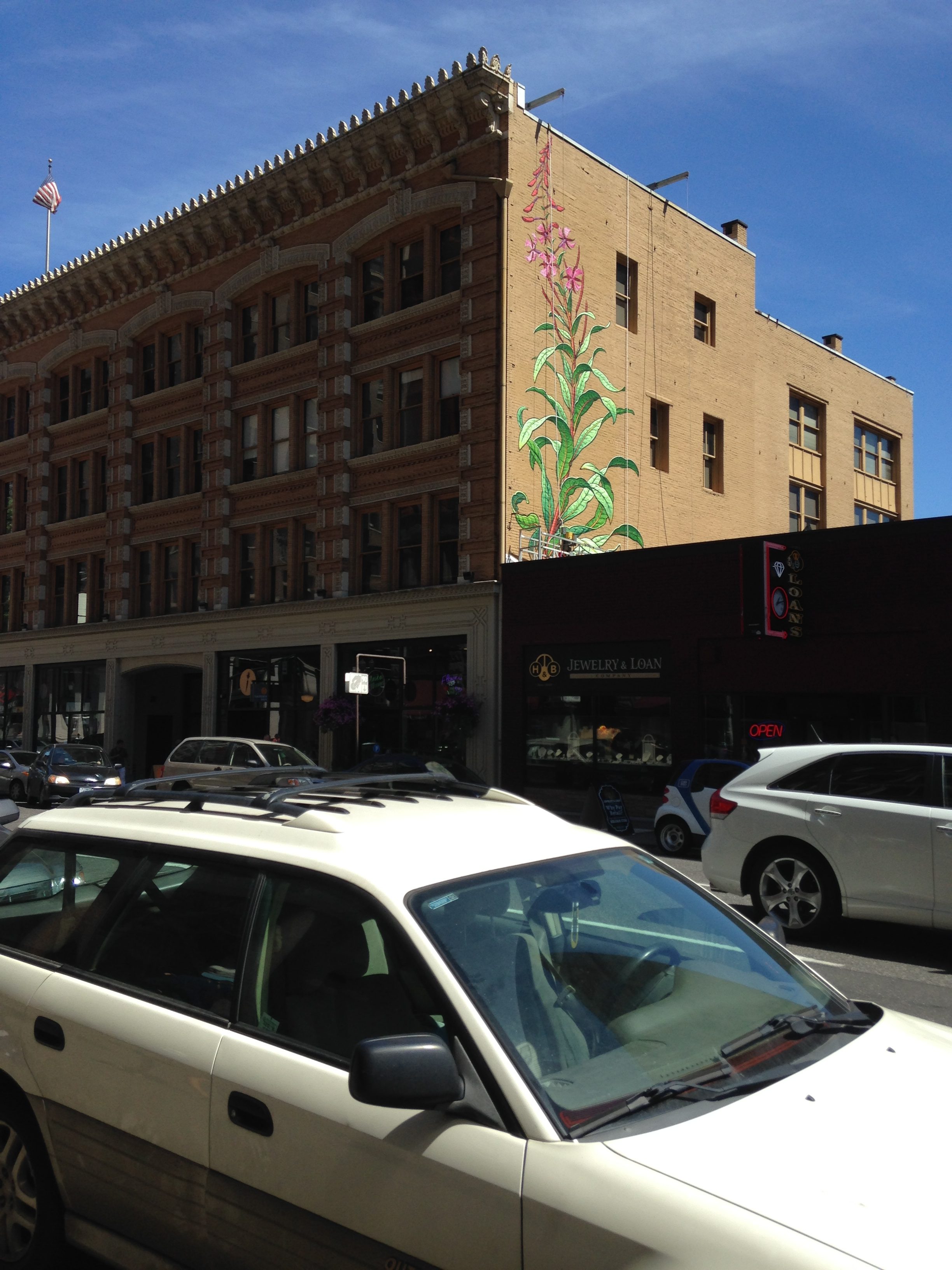
Here’s an interesting example of the graffiti found in Portland. It was all very unique and beautiful!
Portland 2
What is the main concept illustrated in this section (e.g., what is an Urban Landscape)?
An urban landscape describes the urban features (such as buildings, streets, and walkways) that constitute a place. Through analyzing these attributes, a deeper understanding of a geographic place can occur. For example, Portland’s urban landscape shows off its liberal, eco-friendly nature through bike lanes, city parks, and food trucks. However, taking a closer look at the urban landscape, remnants of Portland’s industrial past still linger close to the Willamette river.
What perspective did you choose to read for this section (e.g., Bridgetown, Under the Bridges, Where the Sidewalk Ends… or Naked City)? Why? How would you describe Portland according to this perspective in a few sentences?
For this section, I chose to look at the “Stop! Writing on STOP signs” map. I chose this perspective for several reasons. First, graffiti on stop signs is something I have noticed in my own hometown. It seems to be very popular due to the difficulties associated with removing the graffiti paint without removing the reflective quality of the stop sign. I also chose this map because the graffiti present on Portland’s stop signs exemplifies the passionate people living in Portland, people who want change and progress. The graffiti on the stop signs shows what people in Portland are angry about, such as homophobia, KFC cruelty, war, and global warming. The stop signs also show Portland’s quirky and humorous side, with graffiti urging to “stop hammertime” and “stop Voldemort.”
What map would you produce for Richmond to represent this concept? Why? What would be the title of the map? What might the map look like? (go ahead and sketch it, if you feel you can. Don’t worry about the technology, if you can’t post the drawing.)
One unique thing about Richmond’s urban landscape is the beautiful graffiti surrounding the city. It is something I noticed while first exploring the city last year, and it seems to be present all around the city. Like Portland’s stop sign graffiti, Richmond’s graffiti allows residents to express themselves and, as a part of Richmond’s urban landscape, the graffiti tells a lot about Richmond as a artsy city. The map could be called “Richmond’s Artsy Graffiti” and showcase the different buildings in the city coated with graffiti along with some of the major themes presented by the graffiti. This website shows some examples of the colorful graffiti present in RVA that could be showcased on the map: http://graffitirichmond.tumblr.com/
Portland 3
What is the main concept illustrated in this section (e.g., what is an Urban Landscape)?
The once and future city aims to discover Portland’s character as a city through examining its past and its failed projects. As a city, Portland is constantly changing. This section looks at the parts of Portland that have changed or that were planned but never followed through. By having knowledge of a place’s past, a better understanding of a place’s present and its future can be gained. “Considering what’s missing invites us to imagine not only what’s gone but what could have been” (Banis & Shobe, 55).
What perspective did you choose to read for this section (e.g., Bridgetown, Under the Bridges, Where the Sidewalk Ends… or Naked City)? Why? How would you describe Portland according to this perspective in a few sentences?
For this section, I chose to read the perspective called “The Streets Speak the Languages of the Past.” I chose this section because nomenclature is something that interests me, and you can learn a lot about a place based off of the names chosen for streets. For example, the three streets near my house are called “Raven’s Place,” “Poe Lane,” and “Allen’s Way,” all named in honor of Edgar Allen Poe, who attended UVA (the university in my town). By examining the old street names of Portland, you can easily find the names of the early prominent members of Portland’s society who helped found the city. For example, a street named after Francis Pettygrove reveals that Pettygrove was one of Portland’s founders. Portland is a city that cherishes its past and the important people who helped make it what it is today.
What map would you produce for Richmond to represent this concept? Why? What would be the title of the map? What might the map look like? (go ahead and sketch it, if you feel you can. Don’t worry about the technology, if you can’t post the drawing.)
A map of Richmond to represent the concept of changing over time would have to include Richmond’s rich history. I think it would be interesting to portray Richmond’s importance in different years on a map, particularly the Revolutionary War and the Civil war. The map could include famous battle sites, as well as remnants of the wars that the city still holds. The map would showcase the statues along Monument Avenue that have ties to wars, such as the Robert E. Lee statue, the Jefferson Davis statue, and the Stonewall Jackson statue. The Virginia War museum, located in Richmond, could also be highlighted, though it focuses on later wars. The map could be called “Wartime in Richmond.”
Portland 4
What is the main concept illustrated in this section (e.g., what is an Urban Landscape)?
I chose to examine Food and Drink in Portland. Food and drink can tell a lot about a city. For example, Portland is known for being eccentric and eco-friendly, therefore many of their food options can be described as full of “organic production, locally sourced ingredients… and an explosion of food carts” (Banis & Shobe, 141). The type of food available often connects with the cultural background of the people living in a place. Therefore, examining what a city has to offer as far as food and drink are concerned can reveal quite a lot about the culture and habits of people living in the city.
What perspective did you choose to read for this section (e.g., Bridgetown, Under the Bridges, Where the Sidewalk Ends… or Naked City)? Why? How would you describe Portland according to this perspective in a few sentences?
For this section, I chose the perspective “Farm to Market.” I thought this would be an interesting perspective for this section for me to look into because I love farmer’s markets and I thought it would connect to how people from Portland like to eat local. I was surprised to learn that most of the stands at a typical Portland farmer’s market contain baked goods, prepared food, coffee, and crafts. From looking at the farmer’s markets in Portland, it is clear that they have grown substantially as time has gone passed, seeming to at least double in the twenty years between 1990 and 2010. This shows that people in Portland care about supporting their local economies, preparing food, and eating locally.
What map would you produce for Richmond to represent this concept? Why? What would be the title of the map? What might the map look like? (go ahead and sketch it, if you feel you can. Don’t worry about the technology, if you can’t post the drawing.)
To represent food and drink in Richmond, I think it would be interesting to look at the different kinds of food present at different places around the city. I would be curious to compare a map showing food types, such as Asian cuisine, fast food, Italian, Mexican, etc. to a map portraying concentrations of race and ethnicity in Richmond, such as this one:
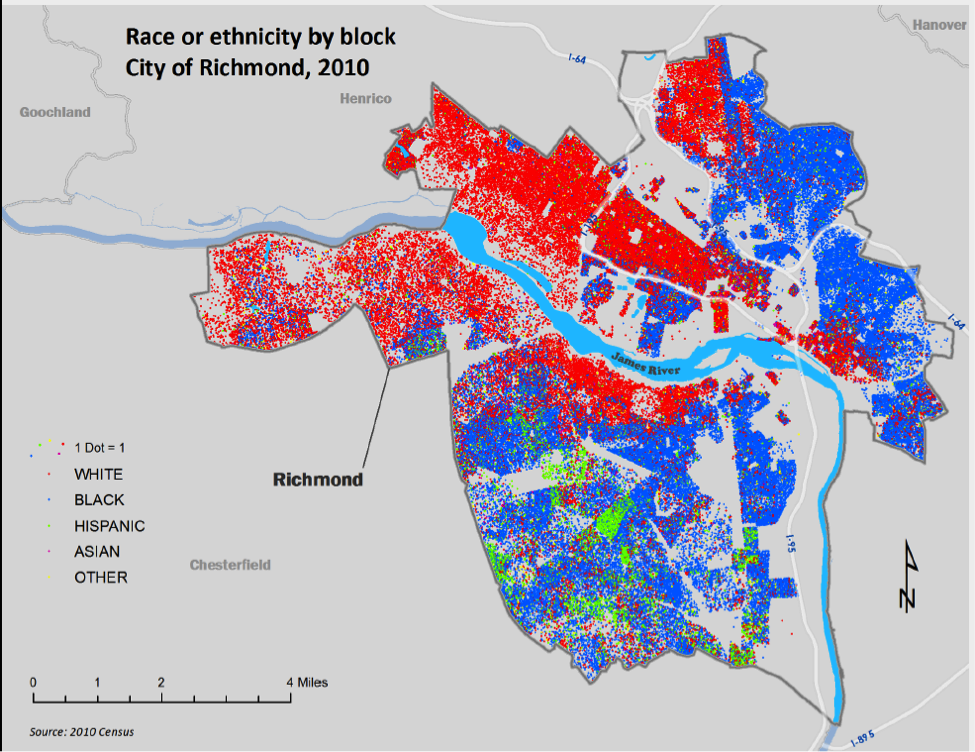
I think this would be an interesting map to analyze in order to discover if there is any correlation between ethnic/racial distribution across the city with what food category is prominent in the area. The map could be titled “Does Richmond’s Cuisine Correspond with Ethnic Distribution?”
Hi Quinn!
I also did not realize how big breweries were, and was pleasantly surprised about the prevalence of dogs as well. I enjoyed reading your section about “The Streets Speak the Languages of the Past” because I am not a history buff and was not as attuned to the street names as you probably were, especially after reading this section. I wish I had paid better attention, but all the more reason to go back to Portland. I did, however, notice a lot of the graffiti and appreciated its quirkiness.
Speaking of graffiti… would be interesting to compare the graffiti and street art (two separate things as written about in Portlandness) between Portland and Richmond. Richmond is aspiring to be internationally recognized for its street art through programs like the RVA Street Art Fest and the Richmond Mural Project.