Spatial Analysis Lab at University of Richmond

300 Weinstein International Center

Skip to content
  • About the SAL
  • SAL Calendar
  • Research and Projects
    • Atlas del Cambio Climático de las Américas
    • James River Rock Pools
    • Research Posters
    • Smallholder Settlement Schemes of Kenya

GIS Day 2016: ANNEXED

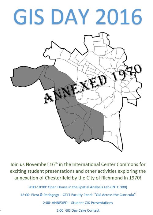
GIS Day 2016: Wednesday November 16

Join us for GIS Day 2016 as students from the Intro to GIS classes explore the Annexation of Chesterfield County by the City of Richmond in 1970, as featured in Dr. John Moeser’s book Politics of Annexation: Oligarchic Power in a Southern City

As always we will have our world famous cake contest and other fun activities!

Capture

This entry was posted in Uncategorized on October 28, 2016 by Taylor Holden.

Post navigation

← Week 4 Update American Association of Geographers (AAG) 2017 Annual Meeting →
Proudly powered by WordPress