Post by Olivia Mobayed ’16
There is no doubt that poverty is a big issue in Richmond. A high proportion of Richmond children grow up in households that live below the poverty level, and a majority of Richmond Public School students receive free or reduced price lunch. Dr. John Moeser has been studying trends relating to poverty in the Richmond region for decades, and I was lucky enough to assist him this past year in his research.
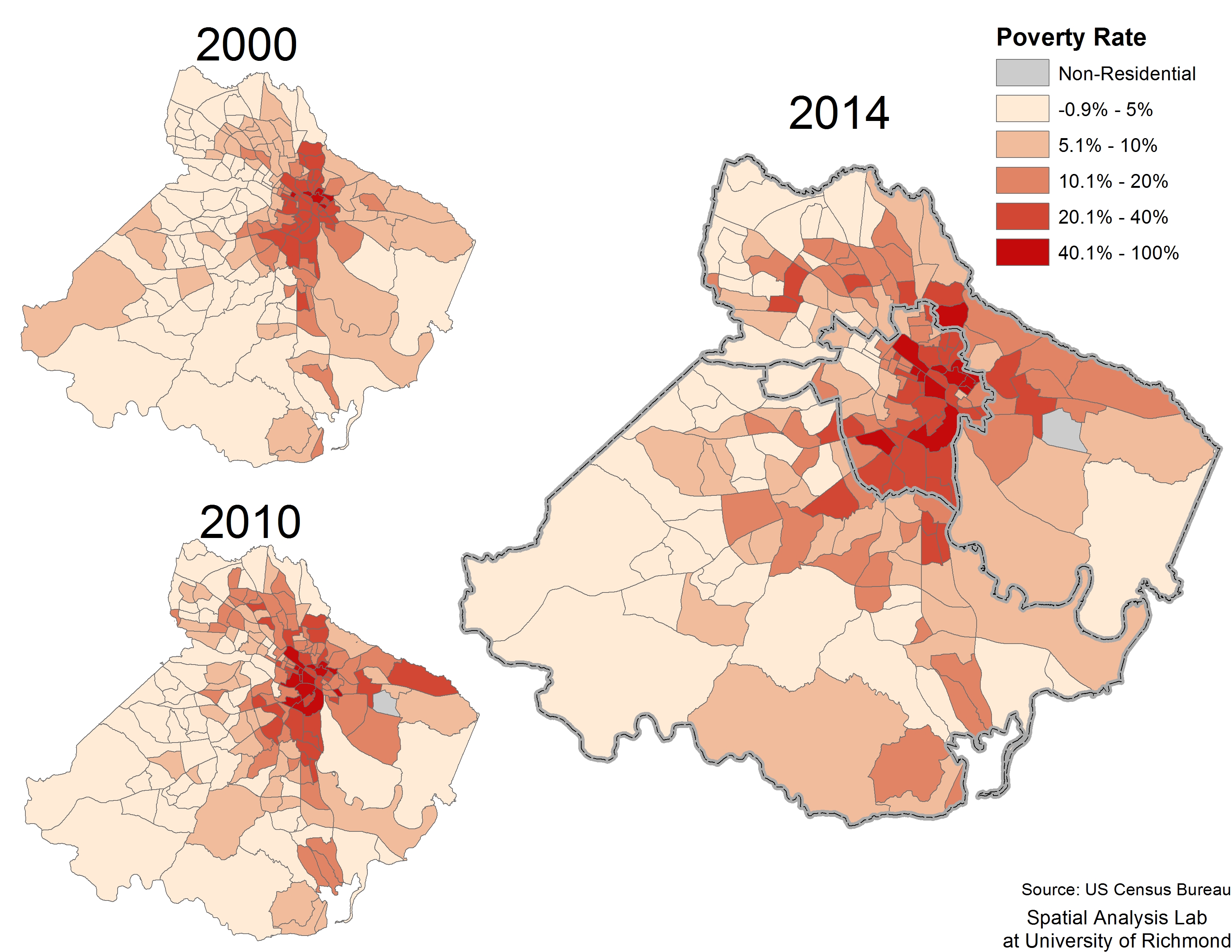
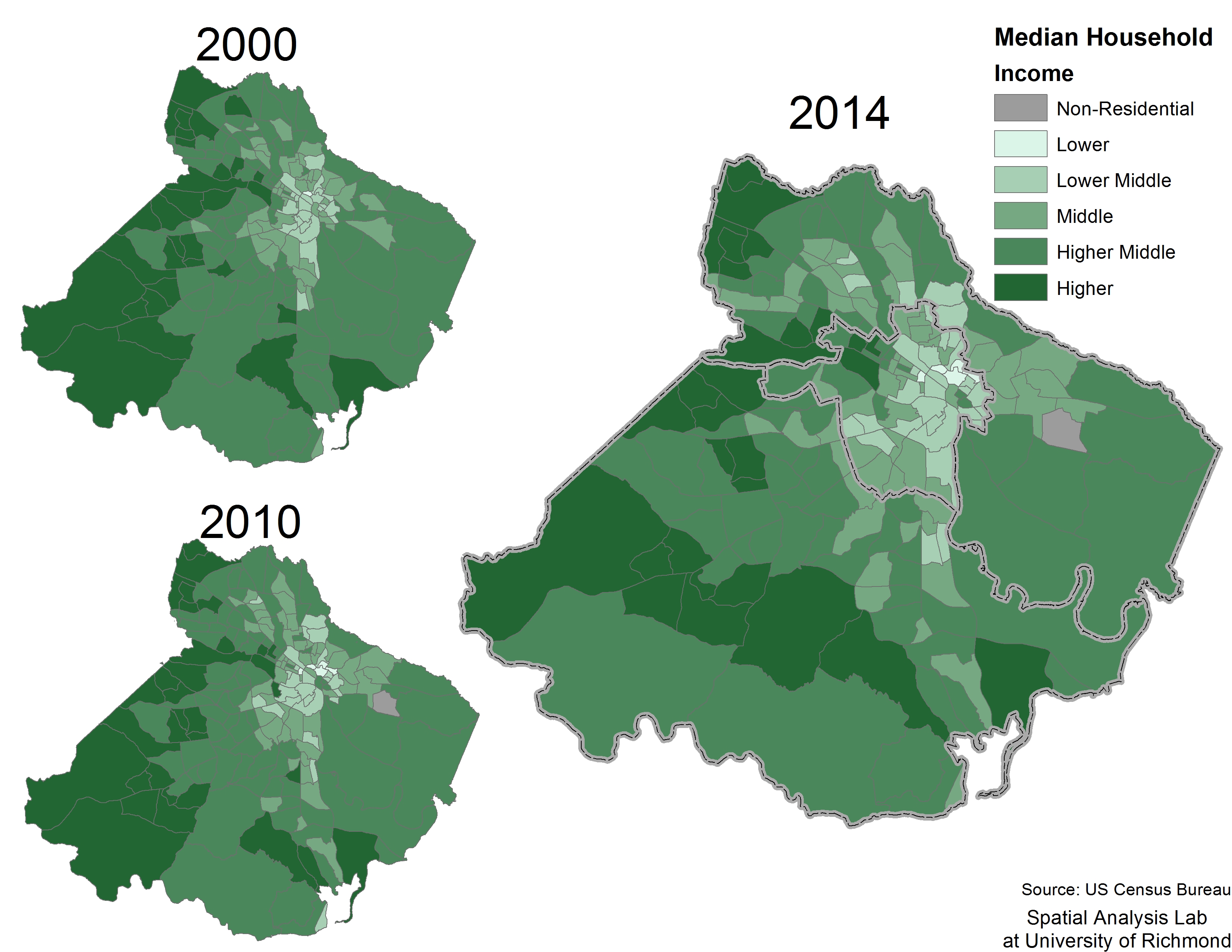
Along with SAL GIS technician, Taylor Holden, I was able to track changes in poverty, unemployment, and household income not just for Richmond, but also for the larger Richmond region. With new data from the American Community Survey, we updated past maps from Dr. Moeser’s research to show 2014 5-year estimates (estimations from the American community spanning from 2009 to 2014). With updated visualizations, we were able to map poverty not just in the city of Richmond, but also how it has changed in the suburbs. We were able to conclude that poverty is spreading outward, and has become a regional issue.
With our findings and maps, we were able to present to various community groups. We presented at church groups, the Richmond City Health District, and at the Richmond Times Dispatch. By utilizing maps, we were able to share our findings with ease, keeping our audiences engaged and informed. Our presentation sparked conversations about policy, history, segregation, transportation, gentrification, and next steps in preparing a regional response.
Lucky for you, the maps and additionally slides from our presentation are available on the University of Richmond library website! Keep updated, because more discoveries are coming in the following months. We hope to study transportation trends within the region – where commute times are longest, and which places use specific transportation types (automobiles, busses, bicycles, and others) more than other places. We are also considering different ways to make these maps online and interactive in order to allow viewers to interact with the data and easily compare various demographic variables (for example, showing poverty rates and unemployment rates side-by-side).
When I first found out about Dr. Moeser’s research, I was so excited to be part of it! I have always been interested in the human side of geography, and mapping demographics from the region I spent the last four years of my life in sounded like a dream come true! Indeed, spending time on this project has made myself even more confident in my plan to continue my study of people and the places they inhabit and interact with.
This summer, I am mapping various measures of health and equity in the Richmond region, thanks to an opportunity I was given following one of our presentations. This fall, I will begin working towards my Masters in City & Regional planning. Although I will not be in Richmond, this research opportunity has been an invaluable experience in understanding demographic trends and the complex system of forces behind them as they relate not just to Richmond, but the whole world. There is no question in my mind that this research opportunity would not have been possible for me without the help of the SAL.
Here is an interactive web map of the data I prepared from 1990-2014 for my Maps and Geovisualizations course. It can be seen larger here
Thank you, Dr. Moeser & the SAL!
Olivia graduated from UR in May 2016 and will begin a Masters of City Planning at the University of Pennsylvania this fall. She will focus on transportation planning and applications of GIS

