Identify is a new, monthly series here on the SAL blog, focusing on students, faculty, and alumni of University of Richmond who have used GIS in exciting ways. Come by each month to learn more about the interdisciplinary nature of GIS here at UR.
Over the last few years, the University of Richmond has greatly increased its GIS presence on campus. Not only has the Spatial Analysis Lab become an even more active place, but various University departments have hired full-time GIS staff. Among these new hires is Justin Madron, the GIS Analyst for the Digital Scholarship Lab (DSL). Madron, who got his Master’s degree this previous spring from Virginia Commonwealth University after receiving his Bachelor’s degree from West Virginia University, has been learning about GIS since his junior year at WVU.
While at VCU, Madron got an internship to work with the University of Richmond and professor Dr. Todd Lookingbill on a project to create a Natural Resource Condition Assessment for Petersburg National Battlefield. During the internship, he continued to hone his GIS skills and simultaneously became familiar with the UR environment and the geospatial resources available here. When he graduated in May, he knew he wanted to continue in GIS; after all, he says, “that’s why I went to graduate school.” Thanks to his connections here at UR, he heard about a new position in the DSL and applied for the job.
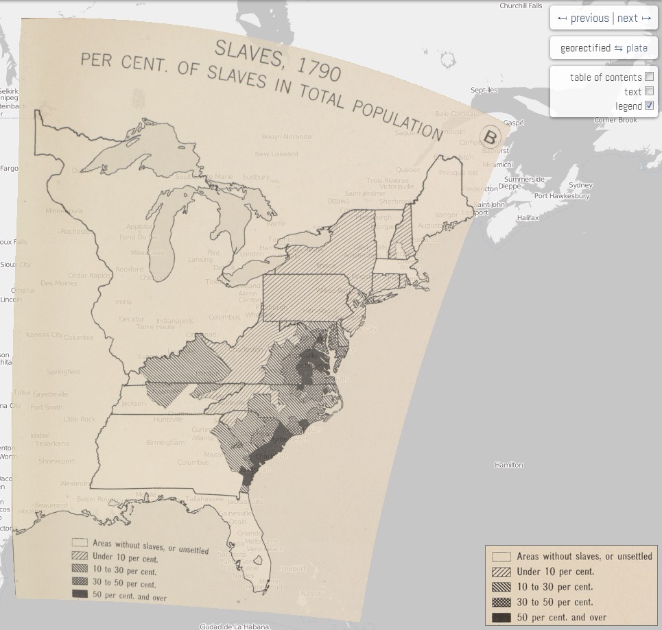
Madron began in July and since then has been hard at work with a few mapping initiatives. First has been a project to digitize Charles O. Paullin’s Atlas of the Historical Geography of the United States. This comprehensive atlas, first published in 1932, contains nearly 700 detailed maps of the early United States, looking at both physical and human geographies. The DSL’s project, which they aim to finish by the end of this autumn, digitizes these maps to view via an online interface, animates them to show changes over time, and makes them interactive, so that users can click on states or counties to see specific data for that area. The Spatial Analysis Lab has already been offering some assistance to Madron and the DSL with this project, beginning to form a knowledge- and data-sharing relationship between these two departments.
But the Paullin Atlas project is a sort of “warm-up” for the DSL’s bigger project. In January, the DSL was awarded a three-year, $750,000 grant from the Andrew W. Mellon Foundation to establish a comprehensive digital atlas of American history. With Madron’s help, the DSL will create two volumes of the atlas out of an eventual planned ten; the first volume will focus on migration, communication, and transportation, while the second will focus on the environment. The Spatial Analysis Lab will be contributing to this project as well, hopefully hosting the DSL’s data on our data servers, in an effort to have even better data sharing across various departments.
Madron is excited to work on these projects and is evidence that experience in GIS can land people unique and cutting-edge jobs. “GIS has opened a lot of doors for sure,” says Madron, “and it is fun.” Look for more updates from the DSL’s mapping projects on their website or here on the SAL blog!
