Simon and Garfunkel wish they were bound for it, John Denver thinks it is down some dirt road, and Lynyrd Skynyrd seems to believe it is only in Alabama. Who is right? Or do they all have it wrong? Home is a complex phenomenon that we have all experienced, yet often have difficulty describing.
Some students work so much, they say they live in the library. But does that make it their home?
Physically, it is where one lives. I was born in Hartford, so that must be my home; however, I grew up in Wilton. Now, I spend my academic months in Richmond, but my most fond memories of summers all link back to upstate New York. Because of this variety in region, surely home cannot be bound by four walls or a city’s limits. Instead, it must be constructed by the humans that play a meaningful role in my life or share a similar culture with me. In this case, my family is home, but so are my friends both here and in Wilton. Perhaps home is a synthesis of both particular physical and specific human characters that influence a region or space. Equally, it could simply be the opposite of traveling far away, which seems to incorporate a level of physicality, leaving home, and emotion, longing for home. But what makes home so special, and why do we often find ourselves returning to it? There must be a deeper connection that draws us back to our roots. Viewing all these many facets of home through a geographic lens can help to focus concepts linked to boundaries, scale, place, region and, most importantly, connectivity. A complete definition of home must accommodate all these aspects of geography and critically analyze the roll that each plays in relation to one another.
Home may be defined as a sense of community, shared culture and mutual values among a similar group of connected humans. In this sense of the idea, home is hierarchical because it could include my immediate family, or it could include all my aunts, uncles, and cousins, or it could include everyone that comes to my house on Thanksgiving. At an even larger scale, home could be all the people, both acquaintances and strangers, that share similar values with me, such as city residents.

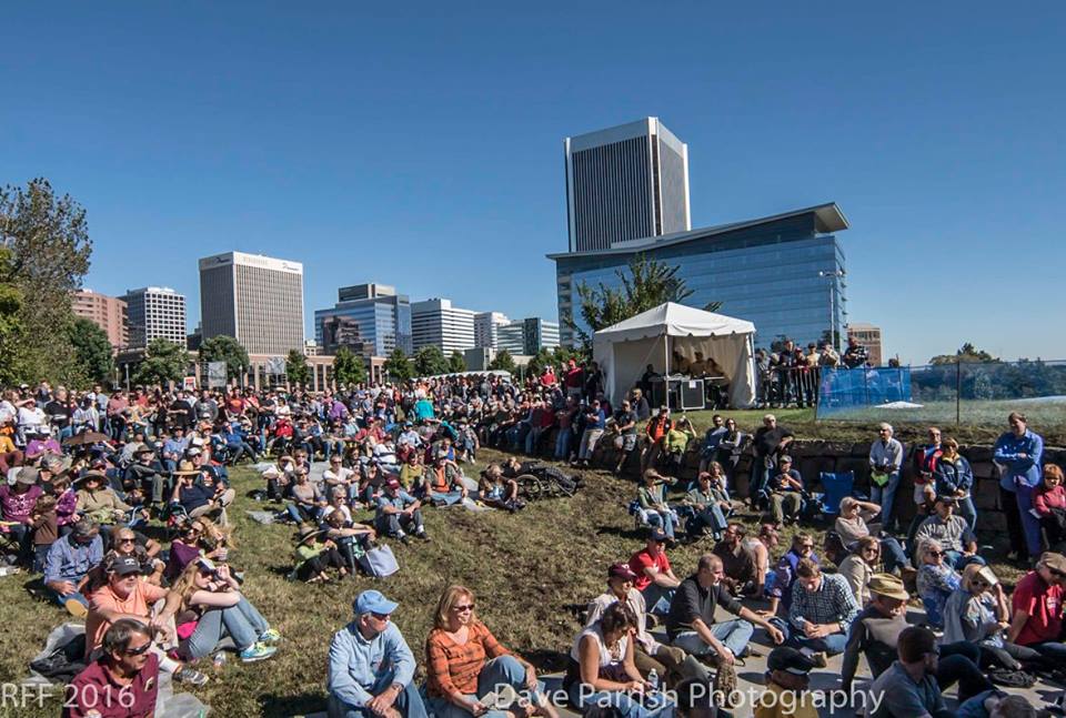
The Richmond Folk Festival unites residents of different cultures, religions and social classes.
In a previous blog post about the Richmond Folk Festival, I illustrate the importance of group mentality and community effort in the accomplishment of any social cause. In regards to the city of Richmond as a home, the blog calls for unification in the task of managing the James River and notes that “without a collective, distinct and conscious passion for the James, there is no hope for its” future. Positive change is dependent upon shared culture.
Parr, too, values the importance of societal unification because he believes “that if we better understand this larger sense of community, then we can push more people to take action to protect watersheds all around the globe.” In his blog post, he explores the notion of connectivity and illustrates how communities are not always bounded by local regions, culture or religion, but are instead united by common causes. Parr looks at humans and their ability to build community in relation to place at a broad level; however, his ideas can be applied on smaller scales, too.

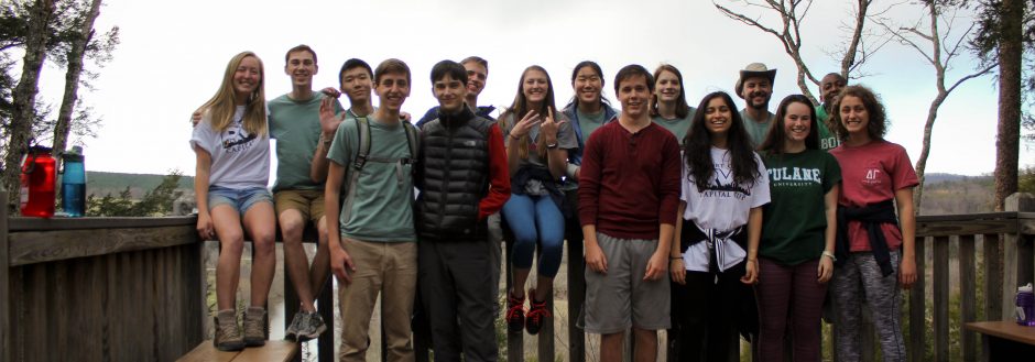
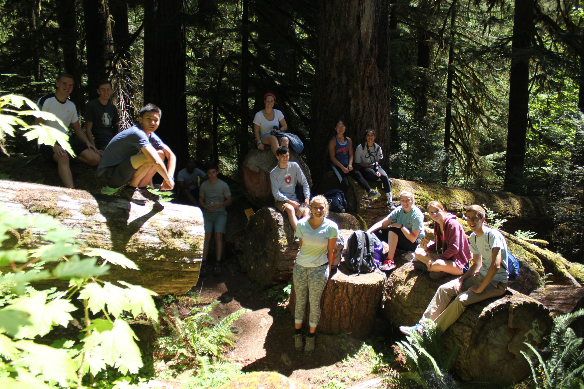
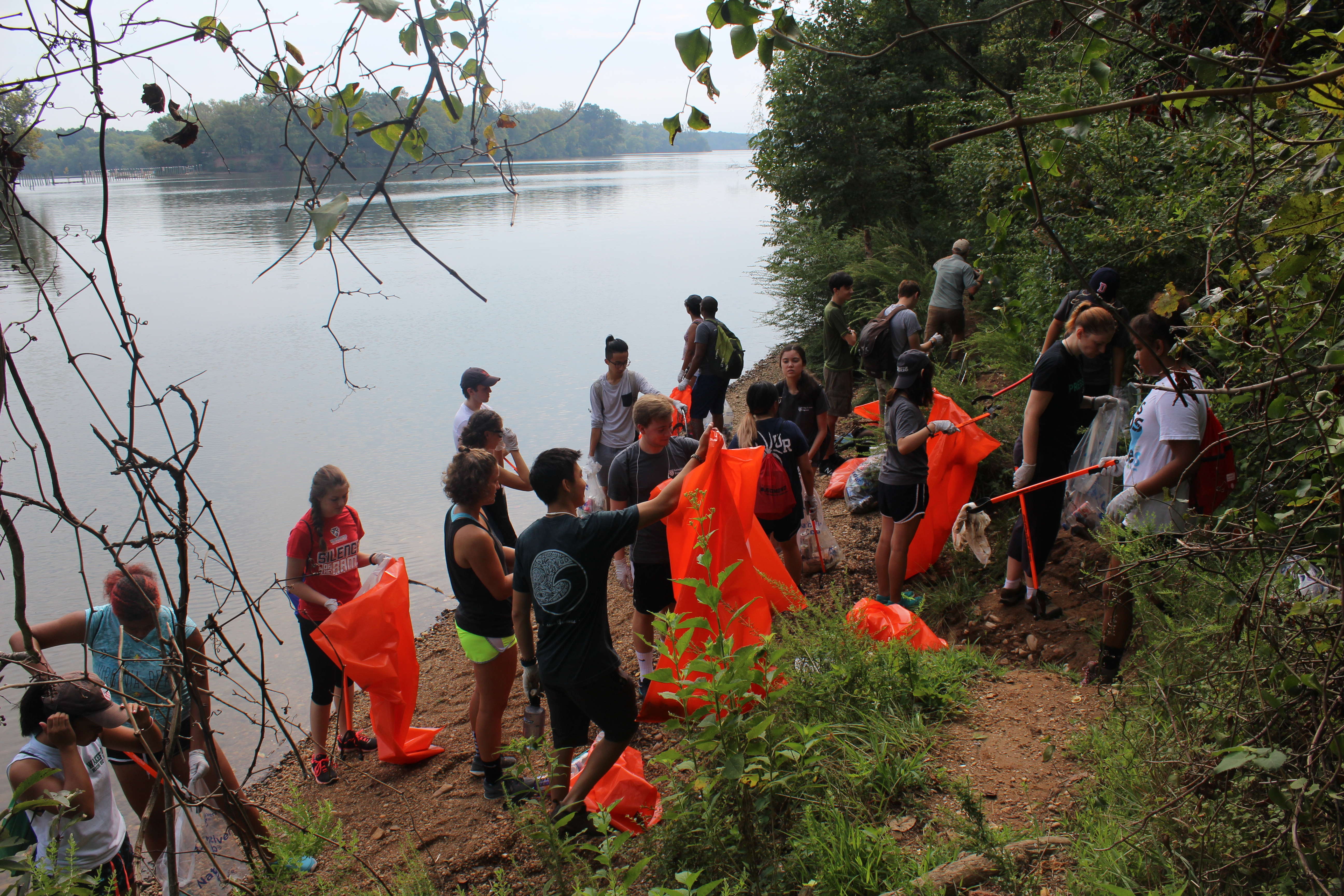
Lodgers bond over wheat thins, cheese and PB&J while exploring old growth forests in Oregon.
Natalie does exactly that in a summer blog post written from the streets of Portland. At that time, she was hoping for the class trip to “promote community bonding” among the individual members of Earth Lodge, which could lead to strong friendships, ultimately improving our quality of life both inside and outside the classroom. She alludes to Earth Lodge acting as a home for students because of the valuable relationships that structure Lodge life.
David Banis and Hunter Shobe devote an entire section in their culture atlas, Portlandness, to exploring the “relationships between people and people, people and authorities, and people and ideas” (Banis and Shobe 119) within a city. In this chapter, the maps and diagrams focus on social relations within a place and illustrate the importance of community when defining any region. Although the human characteristics of a place can come to define the social facets of home as a community, there are other geographic aspects that must be addressed to completely understand the definition of a home, too.
Perhaps the best way to understand the idea of home is to set up a binary: home and away. In Walden, Henry David Thoreau describes the importance of travel, but also notes that people “should come home from far, from adventures, and perils, and discoveries every day, with new experience and character” (take a peek at the full text by visiting your local library or clicking here). Thoreau implies the importance of returning to the safety and comfort of home, but he also seems to call for the importance of constantly altering one’s perception of home.

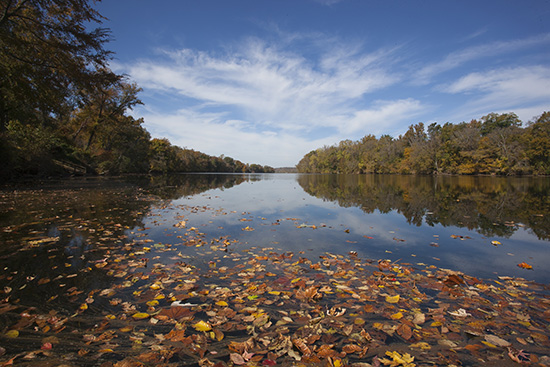
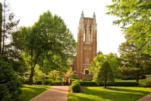
After walking by it every single day, Westhampton Lake is easy to take for granted; however, its beauty helps to define the University.
After traveling to new regions and exploring novel experiences, one may comprehend their regular lives, and thus their home, differently. People are often all too quick to fall into Forsyth’s concept of place blindness and take their surrounding environment for granted. That is why one cherishes home the most when they are away.
After spending a year in the city of Richmond, I had never understood my life’s specific existence as a function within the James River watershed; however, after returning from Portland and Blue River, Oregon in August, I finally began to really perceive the spaces I inhabit and appreciate their characteristics. I needed to travel across the country to be aware of what was right outside my dorm every single day. By viewing different areas of Oregon, and the state itself, as a space, place and region, I learned to be more geographically cognizant. In the introduction of their cultural atlas, David Banis and Hunter Shobe contrast Portland, Oregon with Portland, Maine. By contrasting the two cities, the authors build a basic conceptualization of both. Comparison is key and constructing a duality of home and away can help one more clearly understand the regular environment in which they live.

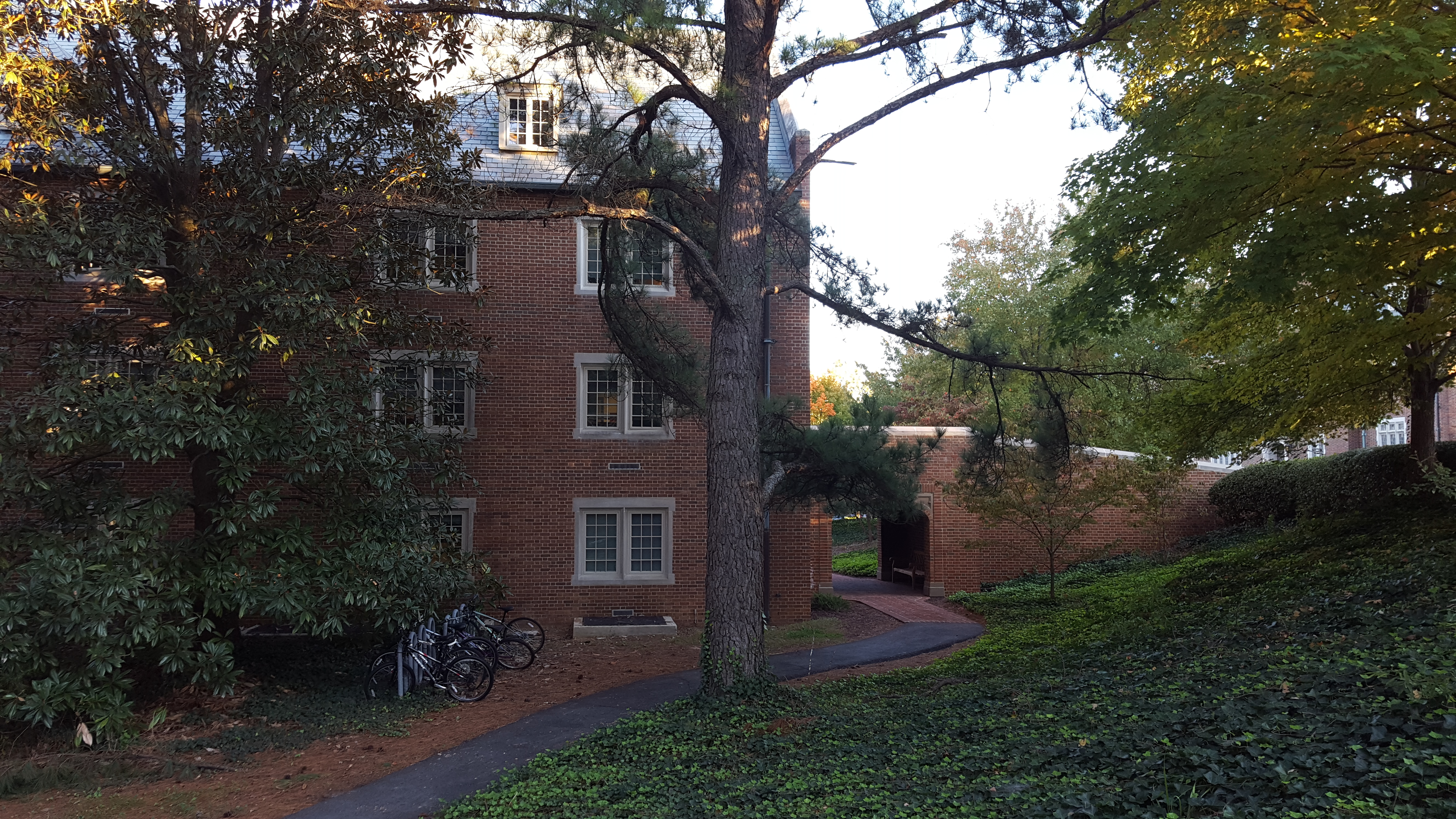
On one level of scale, Grey Court acts as home for Earth Lodgers.
While the concept of home does include the physical description of a place, it encompasses many other geographic aspects, too. These include the human characteristics, which play a vital role in the construction of a sense of unification and community. Additionally, hierarchical boundaries can structure the boarders of a home by scale. I live in my dorm room, but I also live in my residence hall, at the University, in the city of Richmond, in the James River watershed, in Virginia, on the east coast, in the United States, on planet Earth. Home is often most understood and valued after experiencing a different region which can be used as a contrasting environment to reduce place blindness. While these geographic concepts are important, home is foremost a place of connectivity. Individuals are linked to their homes in unique and intimate ways. Sounds, smells, memories and psycho-spatial feelings can be the most powerful and effective methods of describing one’s roots. Practicing dérive can concentrate this elusive aspect of geography that, when converged with the physical and human aspects of a region, can bring the idea of home alive by giving it expressive meaning and personal significance.
Today, my home is the James River watershed. As a resident of its boundaries, I am tied to its physicality and, as a participant and protector of its glory, I am tied to its community. Traveling far from its rolling hills and shining valleys has brought me even closer to its majesty. In the first chapter of her creative novel, In River Time, Ann Woodlief explains how she perceives the surface of the James as a mirror that reflects her own image, but I see more than just myself in that reflection. I see the expansive landscape of my home.
The James River watershed truly is our home.