 “Traditional” maps—those printed on paper and created with GIS software like ArcMap, the software we use in the SAL—are certainly not going away anytime soon. But geographers cannot ignore the fact that Internet-based mapping is quickly exploding in use, allowing virtually everybody to access and to produce their own maps, without requiring any special hardware or expertise.
Esri, the company behind ArcMap, helps facilitate this growth of online mapping through ArcGIS Online, a new product that offers basic map exploration and creation functionality for organizations and for individuals. Users have already created and published thousands of publicly-accessible maps, and more are created each day.
The Spatial Analysis Lab has recently started to explore the potential of ArcGIS Online, especially through the creation of story maps. A story map is one that depicts spatial data but goes further to explain what the data mean and to contextualize its importance; a story map intends to reach a wide audience and to explain the significance of the spatial information.
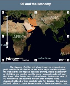
Students in the SAL began publishing maps in ArcGIS Online earlier this year, and recently, other students have taken some of those maps and turned them into story maps. You can see an early result of the story map efforts here. This story map is only a first step, so far, but it already reveals the great potential story maps can have in communicating spatial information. In general, you can review a gallery of Esri-published story maps here.
Moving forward, students in the SAL are learning how to create maps in ArcMap and upload them to ArcGIS Online, in order to have greater control over map design and content. And looking ahead, students will be adding those maps to a server, so that any changes they make to those maps in ArcMap will automatically be pushed to the story maps published in ArcGIS Online.
Online mapping is a nascent art, so the SAL is excited to be on the cutting edge of spatial analysis. Look forward to more story maps soon!