Introduction and Summary
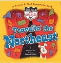
Travels with Charlie: Travelin’ the Northeast written by Miles Backer and illustrated by Chuck Nitzberg, is all about the Northeast United States. It includes the 12 states from Maine to Ohio to Maryland. The book features a different state on each page with seek-and-find questions in a poetic form. Along the tab of each page is information about the state including the capital, flag, and lots of interesting facts. A dog named Charlie goes to each state and hides somewhere in the state. Can you find Charlie?
“Find Manhattan Island, home to Wall Street.
Find the Statue of Liberty. Find hot dogs to eat.
Where’s Charlie?”
Curriculum Connections
This is a great book to introduce upper elementary students to the Northeast states as a region. It can be used in conjunction with the other books in the Travels with Charlie series, Way Out West and Way Down South. With the multitude of maps used, it could also be a great way to explore the use of maps and key landmarks on a map in the younger grades (History SOL K.4a,b., 1.4a) The incorporation of the geographical landmarks and bodies of water such as the Great Lakes and the Statue of Liberty would be beneficial for older elementary as well (USI.1f, USI.2b, c)
- Northeast Geography Lesson: A great lesson plan geared for grades 3-5 that focuses on map skills and resources of the Northeast USA
- Northeast and more: This website is a great tool to allow students to research the regions of the United States with lots of information and pictures about each region
- Northeast Info: this site has great information about the products and resources of the Northeast region as well as the geographic landforms, populations, climates, and tourist locations
Book: Travels with Charlie: Travelin’ the Northeast
Author: Miles Backer
Illustrator: Chuck Nitzberg
Publisher: Blue Apple Books
Publication Date: 2006
Pages: 36 pages
Grade Range: 2nd-5th grade
ISBN: 1593541627

