Introduction and Summary
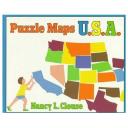
Puzzle Maps U.S.A. written and illustrated by Nancy L. Clouse is a playful book about geography. It concentrates on the different states within the United States. This book is a very basic introduction to maps while Clouse uses puzzle activities to utilize the different shapes of the states to appeal to young children.
“This turtle is going for a swim. Which states are going to get wet? The turtle’s eye is the smallest state in the United States. Look closely at the turtle and you will find eight states in all.”
It begins with a big map of the United States where each name of the states have been omitted. Clouse transforms the United States map into a large puzzle that visually can be taken apart and put back together. The subtle use of basic colors and the efficient designs that are collages made up of the states make this book more visually appealing than many map books.
Curriculum Connections
Puzzle Maps U.S.A. is a super resource to introduce simple maps and help students develop an awareness that a map is a drawing of a place that shows where things are located (SOL K.4a). It also promotes students with identifying the shapes of the United States and Virginia on maps (SOL 1.4c). A students’ scientific reasoning and logic is utilized while reading this book. Observations of the different states are made from multiple positions that allow the students to achieve a variety of perspectives (Science SOL 1.1b). Lastly, math skills, specifically geometry, are used when reading Puzzle Maps U.S.A. because the author manipulates the States into images of familiar objects throughout the book.
Additional Resources
- Puzzled States is an online activity that gives students a chance to sharpen their geography skills by clicking and dragging each state to its proper place onto a map of the U.S.A. The students will collect facts about each state while performing the activity.
- A worksheet that has the outline of the state of Virginia. Students can color the state to get familiar with the shape of Virginia.
- A booklet that students construct made of printables. These printables promote map skills by allowing students to color, cut, and paste different maps of the United States and Virginia.
General Information
Book: Puzzle Maps U.S.A.
Author: Nancy L. Clouse
Illustrator: Nancy L. Clouse
Publisher: Henry Holt & Company, Inc.
Publisher Date: 1994
Pages: 32
Grade Range: 1-4
ISBN: 0805035974

