
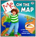
Me On The Map, written by Joan Sweeney and illustrated by Annette Cable, is a colorfully illustrated introduction to the subject of maps and geography. It is a story about a little girl and how she locates her physical place in the world . Her curiosity of her place on the Earth leads her to illustrate maps of her room, her house, her street and step by step she maps out the world complete with all seven continents. After she finishes, the little girl explains her steps to the reader while she backtracks through all of her maps to show how she found her very own “special place on the map”. She ends with an understanding that…”in rooms, in houses, on streets, in towns, in countries all over the world, everybody has their own special place on the map”. It is a great little book and a nice way to introduce the skills of mapping to young students.
Curriculum Connections
The book, Me On The Map, may serve as a great resource when introducing geography to elementary school students in lower grade levels. There are many opportunities to use this book as a reference when implementing activities about mapping to young students. This book can be used to enrich learning of simple maps, describing places in real-life situations, teaching students how to show the position of objects, a view from above and scaling items to a smaller size. Me On The Map could also be used when students are developing map skills and identifying shapes of the United States and Virginia and when students are learning to construct maps of familiar areas using basic map skills. Me On The Map, makes many connections to the VA SOL (K.4,K.5, 1.4 c and 1.5).
Additional Resources
- National Geographic Map Machine This online resource from National Geographic lets you plug in a specific location on the globe to discover, you can also zoom in showing details such as street and zoom out giving students the big picture of the Earth. This is an awesome site for anyone but especially young students to gain a perspective of their physical place in the world.
- World Mapper Allows students to view animated maps of different areas of interest, there are over 700 maps to view and 366 are available as PDF posters to print and hang in a classroom.
- Map drawing skills A helpful lesson plan for ages (7-11) and (5-7), gives ideas on how to teach map drawing skills starting with mapping student’s own classrooms.
- Me On The Map Lessons
Book: Me On The Map
Author: Joan Sweeney
Illustrator: Annette Cable
Publisher: Crown Publishers, Inc.
Publication Date: 1996
Pages: 32 pages
Grade Range: Pre-K – 1st grade
ISBN: 0517885573