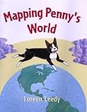
The book Mapping Penny’s World, written and illustrated by Loreen Leedy, is a great way to introduce children to different types of maps, as well as the main components of a map.
In this book, Lisa’s class has been learning about maps. After her teacher says that “we can make a map of anyplace”, Lisa decides to make a map of her bedroom. Her dog, Penny, helps her with the map and then she continues making maps of various places where Penny likes to go around her house, neighborhood, and town.
The locations which Lisa maps include:
- her bedroom,
- her yard, which she labels as “Penny’s Treasure Map” because of all the toys and other items that Penny has hidden there,
- the route to a neighbor’s house,
- nearby bike trails,
- Penny’s favorite places around the town, such as the pond, the park the pet store, and the grocery store,
- and a map of the world showing the many countries that Lisa and Penny would like to visit.
On each map, Lisa includes everything that people will need in order to be able to read the map – a compass rose, a map scale, and a clear, detailed key showing all of the symbols used on the map. While making her maps, Lisa demonstrates using various tools, such as a tape measure, a pedometer, and an odometer, to measure an area before creating its map. She also explains several important aspects of map-making, including that maps show a view from above, maps can be helpful for giving directions, and a map’s scale can be used to determine the real distances of the mapped area:
These are our trails. To make this map, I measured our foot paths with a pedometer, a tool that shows how far a person walks. For the bike trails, I used on an odometer, which shows how far a vehicle travels. The map’s scale shows the real distances in the park.
Leedy’s illustrations help students to understand how maps are made and used. For each map, she has included illustrations of the actual area being mapped followed by a full page copy of the map. All of the maps are simple and easy to follow.
Curriculum Connections
Mapping Penny’s World would be an excellent book to use as part of a geography lesson on maps. This book includes multiple examples of simple maps that include a title, map key, scale and compass rose. After reading this book, students could make their own map of a familiar place, such as their bedroom, classroom, neighborhood, or school.
In Virginia, this book relates to social studies SOLs K.5, 1,4-1.5, and 2.6, which state that students will understand that maps and globes show a view from above, show things in smaller size, and show the position of objects, and that students will construct simple maps using titles, basic map symbols, map legends, and a compass rose.
Additional Resources
- Here is a link to a maps skills lesson plan. This lesson is related to the story Gingerbread Baby and it includes an activity in which students create a 3-D map of the journey the gingerbread boy traveled and then use it to practice giving and following directions. The lesson could also be adapted to use with Mapping Penny’s World by using one of the maps from the book as the basis for creating the 3-D map.
- This United States mini-unit contains several lessons on map skills and directions, in addition to geography lessons about landforms found in the US. The last lesson in the unit teaches students how to use a map legend and its symbols to identify the location of crops, industry, and resources produced in the US.
- This edible map activity would be a fun way to review map-making and the parts of a map.
Book: Mapping Penny’s World
Author: Loreen Leedy
Illustrator: Loreen Leedy
Publisher: Henry Holt and Company
Publication Date: 2000
Pages: 32 pages
Grades: K-3
ISBN: 0-8050-6178-9