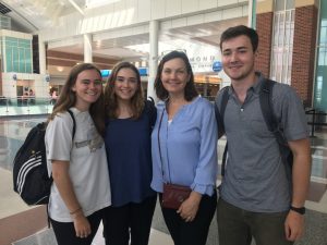
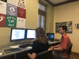
March 26-27, 2019 University of Richmond undergraduate students in the Department of Geography and the Environment, alongside SAL GIS Technicians and research assistants, created posters and web maps to communicate their research at the 2019 VAMLIS GeoConference. Students and SAL Interns Valerie Galati, Matthew Franklin, Griffin Walsh, and Emily Routman presented their research to GIS …
Category: Uncategorized
Jun 18
Kenyan Healthcare Adventure and 1st Day of Work
June 18, 2018 By Griffin Walsh ’20 A few weeks ago I was bit by a tick in Pennsylvania. After arriving in Kenya, I began to develop a rash on the exact spot where I had been bitten so I began to suspect Lyme disease. We decided I should go visit a doctor to confirm …
Jun 11
Week 2 of Crash Course: Preparing for Kenya
June 11, 2018 By Meg Carroll ’20 Jambo, it’s Meg! We’re in the midst of prepping for our trip to Kenya! This week we’ve been holed up in the SAL glued to our desktops while we’ve practiced Swahili, read about African culture, and reviewed/practiced different GIS tools. Our week has included conversations about office etiquette …
Dec 13
ArcGIS Online
Want to check out many of the cool maps, applications, and story maps students, faculty, and staff have created with help from the Spatial Analysis Lab? Click the image above or follow the link below to access the University of Richmond’s ArcGIS Online Organizational Account. https://urichmond.maps.arcgis.com/home/index.html For help getting started using ArcGIS Online click …
Oct 30
How To: Download Open Street Map (OSM) Data
OpenStreetMap (OSM) is a collaborative map of the world where users can edit and update maps of their communities in real time. It was inspired by the success of Wikipedia and has quickly spread to become a force in online mapping world. While local governments in the US and other western countries are rapidly deploying …
Oct 09
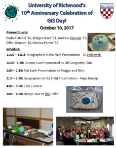
GIS Day 2017
Aug 25
Fall 2018 Walk In Hours
After an exciting summer on the river and in the lab with our high school MSI students, it is time for the school year to start yet again! This year we will be clustering project work days and walk in hours to increase productivity and foster collaboration among various users of geospatial technology across campus. …
Jul 24
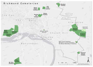
East End Cemetery – Mapping Forgotten Gravestones
By Ethan Burroughs ’18 East End Cemetery is located on the border of Henrico and Richmond, Virginia. It was established in 1897, and an estimated 13,000 people are believed to be buried in East End. The neighboring Evergreen Cemetery often overshadows its presence, which is another African-American cemetery that has fallen into disrepair in Richmond. …
Apr 28
American Association of Geographers (AAG) 2017 Annual Meeting
The American Association of Geographers (AAG) Annual Meeting is a chance once per year for our department’s students, faculty, and staff to present their research to peers and learn about what other universities all across the world are doing with geography. For many of our students, it is an eye opening experience to see the …
Oct 28
GIS Day 2016: ANNEXED
GIS Day 2016: Wednesday November 16 Join us for GIS Day 2016 as students from the Intro to GIS classes explore the Annexation of Chesterfield County by the City of Richmond in 1970, as featured in Dr. John Moeser’s book Politics of Annexation: Oligarchic Power in a Southern City As always we will have our …


