Author's posts
Nov 11
GIS Day 2013 Preview
The Spatial Analysis Lab is excited to host our seventh-annual GIS Day, this Wednesday, November 13, in the SAL from 10:00am to 5:00pm. We have detailed information about the event on our GIS Day page. In addition, you can find more information by following us on Twitter and attending the Facebook event. For now, however, …
Nov 04
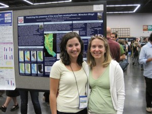
Identify #2: Dr. Carrie Wu and Megan Sebasky ’10
Identify is a monthly series here on the SAL blog, focusing on students, faculty, and alumni of University of Richmond who have used GIS in exciting ways. Come by each month to learn more about the interdisciplinary nature of GIS here at UR. The University of Richmond prides itself on offering plenty of opportunities for …
Sep 11
Identify #1: Justin Madron
Identify is a new, monthly series here on the SAL blog, focusing on students, faculty, and alumni of University of Richmond who have used GIS in exciting ways. Come by each month to learn more about the interdisciplinary nature of GIS here at UR. Over the last few years, the University of Richmond has greatly …
Aug 07
Summer in the SAL 2013
It’s hard to believe, but in exactly two weeks the new students—the Class of 2017—will arrive on campus to begin their University of Richmond experience. But even though the summer is almost over here at UR, the Spatial Analysis Lab has been a busy place for the past few months! Here are some brief highlights …
Jan 31
Student Blogger: Chase Eager
Geography and Health Care Geography and health care are becoming increasingly related, and in a way that can save lives and promote healthy communities. The relationship between geography and medicine dates back to the 1850s, when Dr. John Snow used cartography to map the outbreak of cholera in London and track the source, a water …
Nov 02
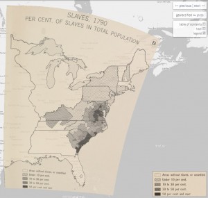
Story maps with ArcGIS Online
“Traditional” maps—those printed on paper and created with GIS software like ArcMap, the software we use in the SAL—are certainly not going away anytime soon. But geographers cannot ignore the fact that Internet-based mapping is quickly exploding in use, allowing virtually everybody to access and to produce their own maps, without requiring any special hardware …
Jan 24
from the director’s desk
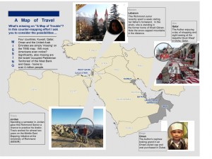
TIME Magazine recently published this disturbing image titled “A Map of Trouble” (TIME, Jan. 3 2012; 26-27). My response and my counter-map are inspired by the work of Mark Monmonier (How to Lie with Maps) and J.B. Harley (Maps, Knowledge and Power). First, the title and the graphic shape of the “region” are linked together …
Nov 14
from the director’s desk
Got GIS? My original plan for this blog entry was to shamelessly promote GIS Day (November 16th) – write something about this year’s t-shirt – and link it somehow to Geography Awareness Week. Fortunately, one chance occurrence has changed all that. Picture this: a Sunday afternoon spent grading and helping students in my lab, and …
Oct 06
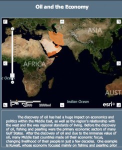
From Numbers to Spatial Analysis: The Possibilities of GIS in an Academic World
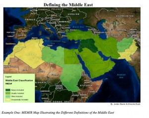
The Middle East definitely receives a substantial amount of global media attention; however, it is often a misunderstood region. Even outlining the Middle East on a world map creates controversy amongst scholars. Should the region’s border be based on common history? Language? Religion? Culture? The fact of the matter is that the Middle East (wherever …
Sep 12
from the director’s desk
September 12, 2011. Today was a great day. I arrived early to make sure all the computers were working and that I had enough handouts for my Human Geography students. Ethan arrived early to make sure the GPS units were charging for an outing with my GIS class. My students arrived and began a lesson …

