Teaching Geography with Children’s Literature: As the Crow Flies: A First Book of Maps

 images4.jpg

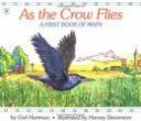
As the Crow Flies written by Gail Hartman and illustrated by Harvey Stevenson is a great way to introduce maps to young children.

The book follows the paths of an eagle, a rabbit, a crow, a horse, and a gull.  At the end of each animal’s journey a simple map illustrates the places the animal has visited.  “AS THE RABBIT HOPS. A path winds around a farmhouse, past a shed, to a garden where the sweet greens grow.” On the facing page the author shows “THE RABBIT’S MAP”, a simply illustrated map with a path from “my house”, to the “farmhouse”, to the “shed”, to the “garden”.  At the end of the book the author follows the moon as it shines on each of the animals paths, including the rabbit, “It shines on the garden near the farmhouse in the country.”  On the last pages the paths of all the animals come together to form one big map titled “THE BIG MAP”.

Curriculum Connections
This book would work well when introducing students to maps as part of a Geography unit.  It is best suited for a kindergarten or 1st grade classroom. The concepts included in the book work with lessons where students will describe the relative location of people, places, and things by using positional words, use simple maps to develop an awareness that a map is a drawing of a place to show where things are located, describe places referenced in stories and real-life situations, and develop an awareness that maps and globes show a view from above, show things in smaller size, and show the position of objects (SOL K.3, K.4a,b and K.5a,b,c).

Additional Resources

Author: Gail Hartman
Illustrator: Harvey Stevenson
Publisher:
Aladdin
Publication Date:
1993
Pages:
32
Grade Range:
K-2
ISBN:
978-0689717628

Posted in book review, geography | Comments Off on Teaching Geography with Children’s Literature: As the Crow Flies: A First Book of Maps

Teaching Geography with Children’s Literature: The Scrambled States of America

images-1.jpg


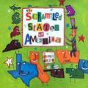
 The Scrambled States of America is a hilarious and adorable book about the fifty states, and their desire for exploring other areas of the United States.  The states have gotten tired of their neighbors and monotonous daily routine, and want to meet other states.  Kansas and Nebraska decide to have a party and invite all of the states.

“So, with a little help from their neighbors, Missouri and Iowa, those wacky little midwestern states planned the biggest party ever… At last the big day came, and little by little the states arrived at the party… Within minutes after their arrival the states began making friends with each other.”

At the party, Virginia and Idaho decide they would like to change places to see other parts of the US.

” ‘ Yes,’ Virginia chimed in. ‘Then we thought maybe all of you might want to try it, too.’  A wave of excitement swept through the room.  They could hardly wait.  Immediately the states made their plans to switch places.  They said their good-byes, and went directly home to pack.”

While the switch and new places were exciting at first, it didn’t take long for the states to miss home.

“Alaska, who had been wanting a little more interaction with the other states, was irritated by Oklahoma’s handle jabbing into his left side and Michigan’s thumb tickling his right.”

Soon enough the states decided they wanted to switch back, and packed their bags and made their way home.

“That night, all the states in the country went to bed feeling happy about the new friends they had made but, most of all, feeling very thankful to be home.”

Curriculum Connections:

 This story is a cute way to introduce the VA Geography SOL 1.4, 1.5, and 1.6 to students, as it will familiarize them with the proper placement of the fifty states on the US Map, as well as some of the characteristics of and products of those states.

Additional Resources:

This lesson plan for sixth graders is a way to incorporate this book into a secondary classroom looking for an interactive way to study the 50 states in depth.

This teacher blog is full of many ideas for teaching the states to your students.

Use this video and song to teach the 50 states to your students!

General Information:
Book:  The Scrambled States of America
Author/Illustrator:  Laurie Keller
Publisher:  Henry Holt and Co.
Publication Date:  October 15, 1998
Pages:  32 pages
Grade Range:  K-2 Grade
ISBN-13:  978-0805058024

Posted in book review, geography | Comments Off on Teaching Geography with Children’s Literature: The Scrambled States of America

Teaching Geography with Children’s Literature: Wake up, World! A Day in the Life of Children Around the World

512qs2fcy1l_bo2204203200_pisitb-sticker-arrow-clicktopright35-76_aa240_sh20_ou01_.jpg


Wake up, World! A Day in the Life of Children Around the World, written by Beatrice Hollyer and map illustration by Tony Robinson is a captivating book that explores different cultures around the world by using actual photographs.


The book begins by providing a short introduction to eight children, all from different regions of the globe. Each child is given a unique symbol that reflects their individual country. Each symbol appears next to the texts, allowing readers to keep track of which child appears in the picture. The book takes you on a journey through the daily lives of the children.  It focuses on the child’s daily schedule of waking up, going to school, eating dinner, playing,  etc. “Children all over the world use what they find around them to invent games, try out new ideas, make their own toys and have fun. Some children work hard to help their families. Other have lots of homework. But there’s always time for play.” The book ends by exploring each child’s dreams for the future and providing some further information on each of the different countries.


Curriculum Connections:

Wake up, World! A Day in the Life of Children Around the World could be used as an introduction tool for learning about basic  geography. This book can be used for a number of SOL’s such as:

History K.4 (b)- describe places referenced in stories and real life situations

History 1.6-Describe how location affects food, clothes, shelter, etc

History 3.5 (a)- locating and labeling the seven continents


Additional Resources: 

* Global Playground Teacher Toolkit– A PDF full of lesson plan ideas for teaching students about culture awareness.


* Play-Doh: Cruising Around the Continents– Lesson plan that uses play-doh to teach the seven continents.


* National Geographic– Explores a wide variety of countries around the world. It provides videos, background information, and a detailed map of each country.


Book: Wake up, World! A Day in the Life of Children Around the World

Author: Beatrice Hollyer

Illustrator: Tony Robinson

Publisher: Oxfam

Publication Date: September 1995

Pages: 48 pages

Grade Range: K-3

ISBN: 978-0805062939


Posted in book review, geography, social studies | Comments Off on Teaching Geography with Children’s Literature: Wake up, World! A Day in the Life of Children Around the World

Teaching Geography With Children’s Literature: The United States of America: A State-By-State Guide

geo-book-2.jpg 

The United States of America: A State-By-State Guide, writen and illustrated by Millie Miller and Cyndi Nelson, is a richly-detailed guide to our fifty states.  Beautiful illustrations and intriguing facts about key points of interest make for an engaging read.  Whether you’re researching a school report or playing trivia games, this book offers tons of interesting facts about the history, geography, archaeology, and other marvels of each state.  Meticulously drawn and labeled maps are an added bonus.  The last two pages are devoted to beautifully-rendered drawings of each of the state flags. 

Curriculum Connections
This book would be a wonderful resource to use for writing reports or drawing maps of the fifty states.  Teachers could use it to formulate assessments to gauge students’ knowledge on a particular state or states.  It would be an awesome addition to any elementary classroom library.  In the state of Virginia, this correlates to SOL 3.6 – developing map skills; VS.2 – locating Virginia and its bordering states on a U. S. Map; and US 1.1 – analyzing and interpreting maps.

Additional Resources
   *  Check out this literature-based elementary geography lesson.
   *  Click here to embark on a mysterious treasure hunt.  
   *  Check out this interactive U. S. map to learn fun state facts. 
   *  Print out a blank map of the fifty states for assessment purposes here.   

Book: The United States of America: A State-By-State Guide
Authors: Millie Miller and Cyndi Nelson
Illustrators: Millie Miller and Cyndi Nelson
Publisher: Scholastic, Inc.
Publication Date: 2006
Pages: 64
Grade Range: 3-5
ISBN: 978-0439827652

Posted in book review, geography, nonfiction | Comments Off on Teaching Geography With Children’s Literature: The United States of America: A State-By-State Guide

Teaching Geography with Children’s Literature: From Here to There

3352142_a.jpg

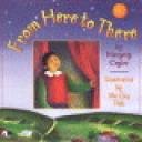
From Here to There , written by Margery Cuyler, is a simple, yet beautifully illustrated, book that shows where a little girl, Maria, lives with her family.  It illuminates the concept that we are all part of a world that is bigger than our own home, town, and state.

Curriculum Connections:  From Here to There is a good book for teaching the concept that we are all part of the solar system we live in, as seen in the beautiful pictures of the progression of where her home fits into this world.  It starts at her home, then moves to her town, her county, her state, then country, hemisphere, planet, solar system, galaxy, and beyond.  Geography SOL 1.4

Additional Resources:
This website provides instructions on setting up a lego station so that children can work as a team to build a community by constructing roads and prominent buildings, such as fire stations, their school, grocery store, etc.  This is a good idea to continue reinforcing the idea of maps and the use of map symbols.

This website offers instructions on how to teach children about maps.  It starts with making a map of the classroom, then a map of the school, then the community, and so forth.  You can make this activity reach as far as you want it to, based on the level of your students…just like the book!

This website is an interactive website that could be done independently, or collectively as a class, projected onto the board or screen.  It is a simple map with questions that help teach basic map symbols, how to follow a map, and use of the compass rose.

General Information:
Book
: From Here to There
Author: Margery Cuyler
Illustrator: Yu Cha Pak
Publisher: Fitzhenry & Whiteside Ltd.
Pages:  32
Grade Range: K-2
ISBN:  0-8050-3191

Posted in book review, geography | Comments Off on Teaching Geography with Children’s Literature: From Here to There

Teaching Geography with Children’s Literature: Alice Ramsey’s Grand Adventure

aliceramseysgrand.jpg

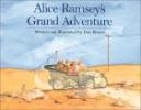
Have you ever heard of Alice Ramsey?  I hadn’t, until I read the book Alice Ramsey’s Grand Adventure, written and illustrated by Don Brown.  This book tells the story of the first woman to drive across the United States!  With its simple text and great illustrations, the book might be used in a geography lesson to teach about different areas of the country, or could also be used as an introduction to a history or biography lesson on Alice Ramsey herself.

The straightforward, informative way this book is written makes it perfect to be read aloud.  The book begins, “On June 9, 1909, Alice Ramsey drove out of New York City and into a grand adventure.  Alice Ramsey wanted to be the first woman to drive across America.”  From there, it goes on to tell, step-by-step, each location Ramsey visited.  The descriptions of each place highlight important things, as well.  For example, Brown describes Chicago’s railway system: “Chicago, Illinois was a railroad center.  The car bounced over mile after mile of rail until the women were dizzy.”   The book ends when the women (Ramsey traveled with her two sisters-in-law and a close friend) reach San Francisco, and goes on to explain that after her first trip, Alice drove across the country more than 30 times by the time she was seventy.  The text provides a lot of information, but presents it in an easy to understand format — this is what makes it great for use in the classroom.

Curriculum Connections

Alice Ramsey’s Grand Adventure could be used to teach a geography lesson about the United States while students also learn about who Alice Ramsey was and what she accomplished.  The states mentioned in the book include New York, Pennsylvania, Ohio, Indiana, Illinois, Nebraska, South Dakota, Wyoming, Utah, and California.  Since Ramsey made her journey in 1909, students could research what the United States was like then and imagine what it might have been like for Ramsey to travel through all of those states.  SOLs USII.1 and USII.2 focus on Social Studies skills and Geograph, and the book could be used to focus on the geography of the states mentioned and to get students thinking about life in the early twentieth century.

Additional Resources

  • AliceRamsey.org is a great resource for more information about our book’s heroine and includes a section just for educators.  The website also contains information about a movie made focusing on Ramsey, as well as more pictures and materials to help students delve deeper into the story.
  • This Digital History website has information about everyday life in the 1900s.  Students can learn how their families and lives today are different from everyday life in the beginning of the 20th century.  Although the information provided is basic, it could serve as a jump-start to a lesson on Geography.
  • MrNussbaum.com contains a huge amount of information about the 50 states in a kid-friendly format.  Each state is featured on his interactive maps, and there are also links to find out more info about the history and traditions of the states.  This site could be useful to collect background information for geography or history lessons, but could also be used by students for individual research!

General Information

Book: Alice Ramsey’s Grand Adventure
Author: Don Brown
Illustrator: Don Brown
Publisher: Houghton Mifflin Company
Publication Date: 1997
Pages: 32
Grade Range: 3-6
ISBN-13: 978-0618073160

Posted in biography, book review, geography, history | Comments Off on Teaching Geography with Children’s Literature: Alice Ramsey’s Grand Adventure

Teaching Geography with Children’s Literature: Somewhere in the World Right Now

 somewhereintheworld.jpg

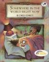
Somewhere in the World Right Now, written and illustrated by Stacey Schuett, shows the reader events taking place around the world at the same time.

“Somewhere, the night wind sighs and murmurs.  The moon shines through a window.  A little girl is dreaming of tomorrow.  But somewhere else, right now, tomorrow is already here.  Dawn is breaking.  A rooster crows and people are waking up.”

Somewhere in the World Right Now takes the reader through events that are happening at the exact same time all around the world.  In  Kenya, elephants are sleeping standing up.  In Madagascar, a little girl is dreaming of tomorrow.  In China, the day has already started – people are going to work and children are heading to school.  Each page has a map of the area being discussed as the background.  This book does a nice job of illustrating different parts of the world and also introduces the topic of time zones.

Curriculum Connections:
Somewhere in the World Right Now is a fun book to read when introducing map concepts to students.  It can be used in lessons discussing the way a community, climate and physical surroundings affect the way people live, basic map recognition and reading, and describing different geographic regions.  These topics correlate with the Virginia History and Social Science Standards of Learning K.4, 1.6, 3.5, 3.6.

Additional Resources:
Continents Lesson Plan: This lesson plan helps students learn the names and locations of each continent by creating their own world map.

Where on Earth are you? Lesson Plan:  This lesson plan introduces basic map skills and map history to students.  It also includes some worksheets and activity ideas.

Time Zone Bulletin Board: This short article includes an idea for creating a bulletin board with clocks made during a time zone lesson.

Literature Mapping: This link provides a month long activity idea for students to plot locations on a world map of different stories as they read them.  There is a nice list of suggested books included.

General Information:
Book: Somewhere in the World Right Now
Author: Stacey Schuett
Illustrator: Stacey Schuett
Publisher: Random House
Publication Date: November 1997
Pages: 40
Grade Range: K-5
ISBN-10: 0679885498
ISBN-13:  9780679885498

Posted in book review, geography | Comments Off on Teaching Geography with Children’s Literature: Somewhere in the World Right Now

Teaching Geography with Children’s Literature: Follow That Map! : A First Look at Mapping Skills

follow-that-map.jpg

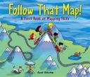
Follow That Map!: A First Look at Mapping Skills written & illustrated by Scot Ritchie, is a great introduction on how to use a map.

Follow That Map starts off with a getting started page. It gives kid friendly examples and definitions of different parts of a map from a compass rose to a legend. “The compass rose on a map will always point north. Some compass roses show all four cardinal directions-north, south, east, west.” Sally and her friends notice that her cat and dog are missing. They decide to find them. They use different types of maps to go searching for the missing pets. Each map focuses on a different part of a map. They start off using a map of the park, proceed to use a trail, city, and a country map. It even incorporates a look at a weather map, treasure map, and topographical map. “A topographical map shows the natural features of the landscape. You can use this kind of map to find rolling hills, low-lying lakes, or high mountains.” It even includes steps on how to create your own map.

Curriculum Connections

Follow That Map is a great resource when you are studying maps. It incorporates different symbols, and gives students a look at different types of maps. It is connected to VA SOL Social Studies Geography 1.4(a) & (b). The student will develop map skills by a.) recognizing basic map skills, including refernces to land water, cities, and roads; b.) using cardinal directions on maps.

Additional Resources

General Information

Book: Follow that Map!: A First Look at Mapping Skills
Author:Scot Ritchie
Illustrator: Scot Ritchie
Publisher:Kids Can Press, Limited
Publication Date: 2009
Pages: 32 pages
Grade Range: 1-5
ISBN: 9781554532742

Posted in geography | Comments Off on Teaching Geography with Children’s Literature: Follow That Map! : A First Look at Mapping Skills

Teaching Geography with Children’s Literature: Land Ho! Fifty Glorious Years in the Age of Exploration


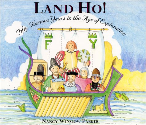
Are you exploring for a good geography book? Look no further!  Before your next geography lesson, read Land Ho!  Fifty Glorious Years in the Age of Exploration, written and illustrated by Nancy Winslow Parker, to learn all about twelve famous explorers.

Did you know that Columbus was not actually searching for America when he found it?  Or that many of the explorers after him were looking for a sea route to China instead?  During the golden age of exploration, men set sail with hopes of finding different travel routes, treasures, and spices.  The fact that they came ashore on uncharted land was not only one of the greatest accidents of all time, it also led to one of the greatest discoveries – the New World!  From Columbus to Cabrillo, this book follows the adventures and misadventures of twelve famous explorers from the fifteenth and sixteenth centuries.  Nancy Winslow Parker has mapped out a truly enjoyable and educational journey filled with dozens of detailed and colorful illustrations depicting the explorers’ ships, equipment, and travel routes.  Parker (2001) writes, “In fifty years, the explorers discovered countless Indian tribes, a new ocean (the Pacific), rivers, plants, animals, and geographical wonders”(pg 3).  So set sail and explore this book!

Curriculum Connections
In the area of geography, the  Virginia History and Social Studies SOL’s for grades 3-5  stresses the importance of  understanding basic geographic maps and concepts.  Land Ho!  Fifty Glorious Years in the Age of Exploration is appropriate for multiple grade levels and could be used to directly address SOL’s 3.3a, 3.3b, 3.5d.

If you would like to create some geography sense in your classroom and find out more about the basics of exploration,  here are a few suggestions for grades 3-5:

  • Play “Who am I”?  Have students draw explorers out of a hat and give out clues.  The rest of the class will guess.  This game can also be played by drawing countries and having the students give directional map clues.   
  • Shower curtain Map – Take a shower curtain and draw a map of the world.  You can use an overhead to project the map onto the shower curtain.  Have the children draw cards from a bowl.  On each card will be a country, or a river, or a compass rose etc…and the students should then take turns labeling the map.  You can also use just a US map and have them take turns labeling the 50 states. 

Additional Resources
Try these websites where you’ll find lesson plans, worksheets, activities and free online games to aid in your geographic education quest.

  • National Geographic– a link that takes you directly to a free online education resource for exploring countries of the world
  • King Tut’s Treasure – an exploration lesson plan for K-2
  • Lewis & Clark – an exploration lesson plan for 3rd-5th
  • National Geographic – a link that takes you directly to a geography game.  Kids can do this at home!
  • Owl & Mouse – a website that offers free maps & free software!
  • TLS Books – a website that offers loads of free printable geography worksheets

Book: Land Ho!  Fifty Glorious Years in the Age of Exploration
Author:  Nancy Winslow Parker
Illustrator:  Nancy Winslow Parker
Publisher:  HarperCollins Publishers
Publication Date:  2001
Pages:  40 pages
Grade Range:  3-5
ISBN-13:  978-0060277598

Posted in geography | Comments Off on Teaching Geography with Children’s Literature: Land Ho! Fifty Glorious Years in the Age of Exploration

Teaching Geography with Children’s Literature: Adventures in Ancient Egypt

adventuresinancientegypt.jpg 

Adventures in Ancient Egypt written by Linda Bailey and illustrated by Bill Slavin is a developmentally appropriate, text within a text approach to teaching children about the geographic and cultural history of ancient Egypt.

Linda Bailey does an excellent job of presenting the factual information alongside a kid-friendly and engaging story line by using a text within a text approach. She begins by instantly engaging students using a comic book-like format and three bored children with nothing to do on a summer day. They end up in a run down travel agency which eventually leads to a trip back in time to ancient Egypt. “There was a terrible, wonderful flash and . . . in one brief moment, everything changed!” The book continues by following the kids’ adventures along the Nile River, visiting an Egyptian town, school, and pyramid along with experiencing other culturally important Egyptian concepts. Bailey pairs this adventure with detailed historical commentary about the locations and cultural features the kids are experiencing along the bottom of each page.

Presenting the information and concepts by using these methods simultaneously allows students to learn about ancient Egypt on two distinct and effective levels.

Curriculum Connections 

Adventures in Ancient Egypt effectively introduces second or third grade students to the relationship between ancient Egypt’s environment and culture (VA SOL 2.4b).

Additional Resources

  • This lesson plan is a great hands-on way for students to interact with hieroglyphs.
  • Teachers can use this coloring sheet to stimulate discussion on pyramids and their importance in ancient Egyptian culture.
  • This website provides extra background material and visuals on ancient Egypt.
  • This website is a conglomeration of on-line ancient Egyptian games and activities to further re-inforce the concepts students are learning.

Book: Adventures in Ancient Egypt
Author: Linda Bailey
Illustrator: Bill Slavin
Publisher: Kids Can Press
Publication Date: September, 1 2000
Pages: 48 pages
Grade Range: 2-3
ISBN: 978-1550745481

Posted in book review, geography | Comments Off on Teaching Geography with Children’s Literature: Adventures in Ancient Egypt