Teaching Geography with Children’s Literature: Are We There Yet?

0670880671.jpg

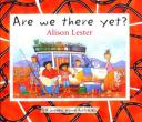
Are We There Yet? by Alison Lester is a book that chronicles the journey of a family around Australia.  The book begins with a map of Australia and the route that the family took around the country.  During the book, the family rides around the country in a camper.  The family travels to many different places and at each place some of the geological features are explained.  Each time they move to a different part of Australia it is represented on a small map of Australia on the top of the page.  At each stop the youngest child asks “are we there yet?”


Curriculum Connections
This book is a way to look at map skills, as well as how geographic features affect clothing, shelter, etc.  This matches to Virginia SOL’s 1.4 and 1.6.

Additional Resources

  • Nullabor Travel Guide has a website with some pictures of the Head of the Bight as well as whale watching that is mentioned in the book.
  • Penguin Publishing provides a number of lesson plans associated with Are We There Yet which touches on reading, science, and geography.
  • The Melbourne Tourist website looks at the Twelve Apostles which is a scenic rock formation that the family visits in the book.

Book: Are We There Yet?
Author and Illustrator: Alison Lester
Publisher: Kane/Miller Book Publishers
Publication Date:
January 2005
Pages: 32 pages
Grade Range: 1-3
ISBN-13:
978-1929132737

Posted in book review, geography | Comments Off on Teaching Geography with Children’s Literature: Are We There Yet?

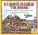
Teaching Geography with Children’s Literature: Dinosaurs Travel

images.jpg

Introduction:

Dinosaurs Travel: A guide for families on the go“, written by Laurie Krasny Brown and Marc Brown, is a wonderful book for young students exploring the many different aspects of traveling. The book is a great resource for young children to learn many important facts and tips about traveling. Each page is filled with important information as well as crammed with interesting, helpful pictures, covering a wide variety of topics.

Summary:

 This story is a compact guide for families when they are getting ready to travel, as well as while they are traveling. The story covers important topics such as getting ready for a trip, getting from place to place and all different modes of transportation, as well as eating and sleeping away from home. Important tips are given throughout the books on things to do and not to do when traveling. For example, when visiting a new place:

“No matter where you travel, it will be different from home. Here’s your chance to try all kinds of new things!”

“Bring maps and guidebooks with you and ask for directions if you get lost.”

 “Some places you visit will give you a chance to speak a new language.”

 The story covers many different ways of traveling, such as on foot, using wheels, by car, riding the bus or subways, as well as by planes and boats. These different modes of transportation discussed help children learn about different geographical characteristics of a specific place. The language of the story is very simple and pictures are very descriptive, yet the information given on each page of the story is extremely important and helpful for young students to learn.

Curriculum Connections:

This story is important to be read by students who are beginning to learn about travel, or who are preparing to take a trip.The book also helps students understand basic uses and skills of maps, including basic references to land, water, cities, and roads (VA SOL1.4 (a)).  Students begin to also understand differences between their home and other places, specifically referring to food, clothing, language, shelter, and transportation (VA SOL 1.6) from reading this book.

Additional Resources:

1. This website provides a song from an education music player. The song provides an interesting way to learn detailed information about planet Earth, including Earth’s composition and other geographic information. The song begins “Our Earth is like a giant Grapefruit..” and tells a lot about the make up of our planet.

2. National Geographic’s website for kids, “Amazing Animals,” explores many different geographic concepts , equipped with intense photos and information about all different animals, including bats, tigers, spiders, etc.

3. This website provides 101 car travel games and tips for kids to use while they are traveling. Some examples listed are creating a travel journal, car sick trips, and games such as “Pirates of the the Caravan.”

General Information:

Book: Dinosaurs Travel

 Author: Laurie Krasny Brown and Marc Brown

Publisher: Little, Brown Books for Young Readers

Publication Date: January 1988

Pages: 32

Grade Range: 1-2 grade

ISBN: 978-0316112536

Posted in book review, geography | Comments Off on Teaching Geography with Children’s Literature: Dinosaurs Travel

Teaching Geography with Children’s Literature: Maps

geography.jpg

Maps, by David L. Stienecker and illustrated by Richard MacCabe, is a book designed to help introduce children to geography with a focus on maps and globes.

This book highlists the many purposes and differences between maps and globes, how to read them, and the many ways in which they can be drawn.  The author and illustrator provide child-friendly text and illustrations to show how maps can be used to visualize and locate specific regions, water features, forests, and landmarks of the world, as well as dicussing that maps can also be created for make believe.  The book offers children a view of North America on both a map and globe, and then slowly zooms out to show the Earth as a whole from the perspective of the sky.  This book also provides children with question prompts they can respond to during or after reading, while providing teachers with hands-on activitiy ideas for further study, a glossary of essential terms, and an index.  Lines of latitude/longitude, projections, compass, hemisphere, equator, and thematic maps are the main topics discussed throughout the book which allows the teacher discretion for how much content to share depending on varying student levels.

Curriculum Connections

Maps serves as an excellent and useful resource to help teach, reinforce, and emphasize several kindergarten – first grade geography learning objectives in accordance with the Virginia Standards of Learning (SOL’s).  Students can enhance their understanding in that a map is a drawing of a place to show where things are located while a globe is a round model of the Earth (SOL K.4a), facilitate identification of land and water features (SOL K.4c), encourage understanding that maps and globes show a view from above the Earth and that features are smaller in size (SOL K.5a/b), develop map skills by identifying map symbols (SOL 1.4a), and facilitate accurate identification of North America and Virginia on maps and globes (SOL 1.4d).

Additional Resources

  • Discovery Education provides a wide range of geography lesson plans from grades kindergarten – 5th grade – lesson plans are organized by topic, and when clicked on,  provides you with a wealth of resource links, extention activity ideas, suggested readings, and evaluation assessments specific to the lesson

  • Kids Geography offers a wide range of fun, interactive games for students to play either at school or home – games are organized into continents, American capitals, latitude/longitude, and the collective Earth so teachers, students, and parents have the ability to select games that are specific to what the student is learning

  • Enchanted Learning is the place for teachers to go for an endless supply of various geography maps, printables, quizzes, and activities – if teachers want to focus on their state geography, there are links to supply you with tons of state maps for students to label, quizzes, and symbol and emblem worksheets specific to your state

Book: Maps
Author: David L. Stienecker
Illustrator: Richard MacCabe
Publisher: Benchmark Books (New York)
Publication Date: January 1998
Pages: 32pp
Grade Range: Kindergarten – 1st Grade
ISBN-13: 978-0761405382

Posted in book review, geography, nonfiction | Comments Off on Teaching Geography with Children’s Literature: Maps

Teaching Geography with Children’s Literature: Looking at Maps and Globes

mapsglobes.jpg

Looking at Maps and Globes is written by Carmen Bredeson. It’s a great book for introducing the concept of maps to students in Kindergarten and First Grade. It explains what maps are and how they differ from photographs. It introduces and explains terms such as symbols, map legend, map scale, directions, equator, map, globe, North and South Pole. The book has real photographs of globes and people using maps. It also has kid-friendly drawings of maps.

Curriculum Connections

This book could be used to help develop an awareness that a map is a drawing of a place and to show where things are located and that a globe is a round model of the Earth. K.4(a). It could be used to introduce students on how to locate land and water features. K.4(c). The book illustrates that maps show things in smaller size and shows the position of objects. K.5(b,c). It will also help students learn to recognize basic map symbols. 1.4(a).

Additional Resources

  • This National Geographic website is a great resource for teachers. It has lesson plans, activities and many printable maps that can be printed without the names so it can be used for assessments.

  • This National Geographic website is for kids and has interactive geography games!

  • This Education World website has lesson plans and activity and project ideas.

  • Ilike2learn has interactive quizzes on all things geography. They seem more like a fun game than a test.

General Information
Book: Looking at Maps and Globes
Author: Carmen Bredeson
Illustrator: Herman Adler Design
Publisher: Children’s Press
Publication Date: 2001
Pages: 31
Grade Range: K-1
ISBN: 0516259822


Posted in book review, geography, social studies | Comments Off on Teaching Geography with Children’s Literature: Looking at Maps and Globes

Teaching Geography with Children’s Literature: Let’s Go Traveling

traveling-book.jpg 

Robin Rector Krupp’s Let’s Go Traveling  is the story of a young girl, Rachel, who journeys around the world, exploring the real-life mysterious landmarks of 6 different countries.  She travels to France to see pre-historic cave drawings, to England for Stonehenge, to Egypt for the pyramids, to China for the Great Wall, to Mexico for Mayan ruins, and Peru to see Machu Picchu. Rachel’s trips are narrated in first person, and the book is designed somewhat like a scrapbook, full of pictures, postcards, and journal entries written by Rachel.  Along with the narration and “scraps,” there are random tid-bits of facts and vocabulary words scattered throughout the book. There is a lot of information in Let’s Go Traveling, so this book would work well for students who just want to quickly flip through pages and still learn something, or for those who are really interested in travel and ancient world cultures.   

Curriculum Connections

Let’s Go Traveling is filled with facts and stories about important locations that are often used when students are learning about geography (VA SOL 2.4, 3.5). In additon to the maps and info about the countries, the author also explains some of the history behind some of the facts included in the book.   Because Let’s Go Traveling covers very different locations, the book could be read for an introductory lesson on how landscapes and cultures vary depending where in the world a person is; or, only certain sections of the book could be used to focus on specific lessons (like Egypt). 

Additional Resources

  • The Children’s Author Network  provides a nice short bio of Robin Rector Krupp and the other books that she’s written.
  • At the National Geographic for Kids website, the People and Places  section supplies a good amount of information in a kid-friendly format about anywhere in the world. I enjoyed the “What school is like in (featured country)” segment, where a video highlights what it is like to be a student in a different country.
  • A fun way to help kids practice their geography and map knowledge is offered at KidsGeo.com, where a student can play games ranging from learning the locations of states and countries, to knowing capitals, to reinforcing latitude and longitude.
  • The National Council for Geographic Education is a good resource for teachers who are looking for additional support with their geography skills and lessons.

Book:  Let’s Go Traveling

Author and Illustrator: Robin Rector Krupp

Publisher: Scholastic

Publication Date: January 1992

Pages: 38 pages

Grade Range: 2-5

ISBN: 0590485768

Posted in book review, geography, nonfiction | Comments Off on Teaching Geography with Children’s Literature: Let’s Go Traveling

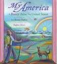
Teaching Geography with Children’s Literature: My America

poetryatlas.jpg

My America A Poetry Atlas of the United States selected by Lee Bennett Hopkins illustrated by Stephen Alcorn is a great book that includes many important facts about each state. This book of poem is a creative way for students to learn about the different states and regions. The illustrations in the book make it appealing to many children. The illustrations make the poems come to life. This book is a great teaching tool for students.

On the east bank of the Potomac,
lies Washington D.C.,
the capital of our Nation
which stands for liberty

Curriculum Connection
This book could be used to read a poem each day about the different regions of the United States. This book can also help the students learn more information about our Nation’s capital and information about Virginia. (SOL 1.4 d) This book could be very useful at a station where the students could take time to look at the illustrations and poems. There is so much for the students to look at so it could take the students some time to go through.
Additional Resources
Teaching ideasis a great resource for teachers to go to when looking for creative ideas about teaching geography. This website has great activities for students to complete.
Activities for kids provides teachers with activities for their students to complete. These activities get the students involved in the learning. This website provides good ideas to introduce geography.
This articleis a great tool for teachers. This article provides many good resources for teachers and excellent ways on implementing activities in the classroom.
General Information
Book
: My America
Author: Lee Bennett Hopkins
Illustrator: Stephen Alcorn
Publisher: Simon and Schuster Children’s Publishing
Publication Date: 2000
Pages:96
Grade Range: 1-5
ISBN: 0-689-81247-7

Posted in book review, geography | Comments Off on Teaching Geography with Children’s Literature: My America

Teaching Geography with Children’s Literature: Beginner’s World Atlas

6th-blog.jpg

Introduction:
Being able to read maps is a strategy that is very important. Maps are in our lives on a daily basis and knowing what the different symbols means is important when it comes to reading the maps. National Geographic has provided an excellent book to help get children develop their math skills. The content presented is age appropriate and provides definations for the different symbols that they will encompass on different maps.

Summary:
Beginner’s World Atlas begins with a description of what a map is and puts the map into the contact of the student by what mapping their background would look like. In addition, it explains what a compass and scale on the map are.  The next 2 pages show earth in several different dimensions to help the student gain a better understanding of their home planet. Their is an example of the physical and political world with descriptions of what they show to follow. Furthermore, the book explains what the students will gain out of their reading. The rest of the map talks about the different contients giving specific information on the land regions, water, climate, plants and animals.

Curriculum Connections:
This book could be used at the end of lesson on map skills to make sure that students understand the basic map skills. In addition, the students could use the book to help them 2.6)when constructing their own map skills using a title, map, legend, and compass rose. In addition, by having this book in their classroom library the students should be able to refer to them when they need to locate the 2.4a) United States, China, and Egypt on world maps. Finally, they will be able to use the maps in the books to help them locating the 2.5a) equator, the seven continents, and five oceans on maps and globes.

Additional Resources:
In order to provide more information on maps and other related Geography topics try visiting Usefulness of Maps.

To help students with their technology skills and provide them a fun game to improve the geopgraphy skills try Geospy.

The article, Are You Map Savvy, provides basic information on other different types of map and why map skills are important. This information could be additional information to provide to your students and help answer the question Why is this important to me?

General Information:
Book: National Geographic Beginner’s World Atlas
Author: Natioanl Geographic Inc.
Illustrator: Tony Stone Images
Publisher: National Geograpic Society
Publication Date: November 2009
Pages: 64
Grade Range: 1-3
ISBN: 9780792242116

Posted in book review, geography | Comments Off on Teaching Geography with Children’s Literature: Beginner’s World Atlas

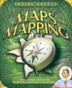
Teaching Geography with Children’s Literature: Maps and Mapping

 images-1.jpeg

Jinny Johnson’s Maps and Mapping explores the world of maps through exciting pages filled with pop-ups and fold-outs.  Throughout the book, the reader is taken on a journey of exploring the job of a cartographer.  The cartographer, Suki West, is a fictional character in the book who loves making all types of maps.  In the process, the reader learns about different types of maps and its importance.  The book explains that maps are needed in order to understand flat surfaces and proportions.  Maps and Mapping explores the first maps, such as, the Roman maps from the A.D. 300s.  The Romans started the tradition of showing roads, distances, and information on maps.  Maps and Mapping introduces sextants and compasses to explain how explorers used these forms of maps to navigate their vessels in the ocean.  The book also discusses the major differences between flat and round maps.  It shows that maps can be used to document any type of area, such as, the sea, mountains, and space.   The book concludes by discussing ways that maps are used today.  Instead of cartographers drawing the maps, satellites are now used to take photographs and produce 3-D maps.  Suki states, “The latest 3-D maps, made by putting together millions of satellite images, can show places in amazing detail-even showing individual houses!” (Johnson 28)  Maps and Mapping is a wonderful introduction to geography in a way that children can relate to and understand.       

Curriculum Connections

Maps and Mapping connects geography and social studies to the world of direction and mapping.  It may be used to introduce a lesson on map making.  Maps and Mapping helps students to develop map skills and construct simple maps (2.5, 2.6, 3.6).  In the book, students are also able to note the changes between ancient maps and the maps that we use today (2.3).  The illustrations include many types of maps that are informative and include examples of maps from all over the world.  The book would make a useful supplement to a lesson on maps.

Additional Resources

  • Geography for Kids– Includes additional online activities and information on the geographical features of earth.
  • Maps and Mapping-Access to the inside of Maps and Mapping and other children’s books that relate to geography.
  • About the Author-Need examples of other books that relate to geography for children? This website contains information on Jinny Johnson and her other jacket flap books.

Book: Maps and Mapping

Author and Illustrator: Jinny Johnson

Publisher: Kingfisher

Publication Date: October 15, 2007

Pages: 29 pages

Grade Range: 2-4

ISBN: 0823417948

Posted in book review, geography, social studies | Comments Off on Teaching Geography with Children’s Literature: Maps and Mapping

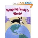
Teaching Geography with Children’s Literature: Mapping Penny’s World

51947hp5ntl__bo2204203200_pisitb-sticker-arrow-clicktopright35-76_aa240_sh20_ou01_.jpg

Mapping Penny’s World by Loreen Leedy is a children’s story about a little girl named Lisa who maps out the places she likes to go with her dog Penny.  She and Penny map out her bedroom, the backyard where Penny hides her toys, the neighborhood, and even places around the world where Penny might like to go.  The maps that Lisa create include the cardinal directions, a key of images found on the map, a title, and a scale for measuring the distances on the map.  The illustrations of the maps are very colorful and they are all displayed from a birds- eye view.

  • “On this map, some of the symbols stand for the goodies she has hidden outside. The rest of the symbols represent the fence, table, and other things that are supposed to be out there.” (pg. 11)
  • “Maps are good for giving directions.  Suppose Penny’s friend Maxine wants to come over.  You could say, ‘Go out your back door, turn right by the trash cans, crawl under the gap in the wooden fence (watch out for the big orange cat!)…’ ” (pg. 13)
  • “The map’s scale shows the real distances in the park.  According to the map, the distance between point A and point B is two- tenths of a mile.” (pg. 20)

Curriculum Connections

This story would be a great way to introduce young students to the skills of map making.  Mapping Penny’s World provides wonderful illustrations of maps which are labeled with all the key elements.  Loreen Leedy also portrays simple, everyday examples of different places that children could map on their own.  This story would be useful when teaching Virginia SOLs 1.4, 1,5, and 2.6 in  geography in which students will develop map skills by recognizing basic map symbols, construct a simple map of a familiar area, and constructing a simple map using a title, legend and compass rose.

Additional Resources

  • This activity allows students to work on their own to create a map of the school yard and directions to a certain place.  After the students are done they exchange their map with another student and each student must use their new map to get to the location that is given.
  • This brief demonstration of peeling an orange provides children with an explaination as to how a map of the is not 100% accurate because the world is round.
  • This lesson plan focuses on political maps and what cities are found on political maps.  Students will discover different size cities on a map, as well as different features of cities that are represented on the map.

General Information
Book: Mapping Penny’s World
Author: Loreen Leedy
Illustrator: Loreen Leedy
Publisher: Owlet Paperbacks
Publication Date: August 2003
Pages: 32
Grade Range: K- 3
ISBN: 9780805072624

Posted in book review, geography, social studies | Comments Off on Teaching Geography with Children’s Literature: Mapping Penny’s World

Teaching Geography with Children’s Literature: There’s a Map on My Lap!


maplap.jpg

The book There’s a Map on My Lap! by Tish Rabe is a great introduction to maps using Dr. Seuss and his catchy rhyming phrases. This book introduces children to a compass rose, a globe, scales, types of maps, directions, and even population. Each topic is covered over a few pages and this book can be split up into different lessons. Key definitions are given on pages where a new mapping term is used and also in the back of the book in the glossary. Kids will enjoy learning about all aspects of mapping with Dr. Seuss as they learn reasons why maps are used and how to use them.

Curriculum Connections:

There’s a Map on My Lap can be used as a great introduction book to many different aspects of maps such as scales, types of maps, making a map, making a legend, etc. The book can be used to cover certain topics at a time instead of reading it all the way through as well. This book covers VA SOLs K.4, 1.4, 1.5, and 2.6.

Additional Resources:

  • The National Geographic website has a page devoted to lesson plan ideas for teachers and they are split into grade levels. The lesson on “Neighborhood Services: Where they are and why?” can be used with this book as students explore their neighborhood and create a map of their own.
  • Global Alliance has a lesson plan where teachers create a map of their room and school with the students. This can work well  with young children entering a new school so they can learn where different rooms are and where everything is in relation to each other.
  • KidsGeo is a website devoted to different aspects of geography for kids. There are different sections devoted to teaching kids about scales, legends, why maps are useful, etc. There are also geography games for children to play.
  • BrainPopJR gives kids great information about the different aspects of a map and some activities parents and teachers can use with kids using maps.

Title: There’s a Map on my Lap!
Author:
  Tish Rabe
Publisher:
Random House
Publication Date
: 2002
Pages:
45
Grade Range:
K-2nd
ISBN:
9780375810992

Posted in book review, geography | Comments Off on Teaching Geography with Children’s Literature: There’s a Map on My Lap!