Teaching Civics with Children’s Literature: Farmer George Plants a Nation

george.jpg 

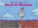
Farmer George Plants a Nation written by Peggy Thomas and illustrated by Layne Johnson, from the maps of Mount Vernon printed on the inside cover of the book to the extra resources found at the end of the book, seeks to teach readers about George Washington from an angle different from that used in most biographies.  

Instead of opening the story by introducing George Washington as the nation’s first president, Peggy Thomas begins by describing Washington as he pursued his primary occupation: farming. Thomas includes this quotation taken from Washington’s 1760 journal, “Spent the greatest part of the day in making a new plow of my own invention” which shows how dedicated he was to improving farming techniques.  The story continues to unfold by explaining Washington’s growing disatisfaction with the British government in terms of the way they handled and taxed the produce he grew and his superb leadership in the Revolutionary War. Even as Washington assumed the presidency of the United States, he continued to look for improvements in agricultural from which all farmers could benefit.

Peggy Thomas does an excellent job of tying George Washington’s political successes with his agricultural contributions. Washington himself also linked these two different spheres in his quote, “Liberty, when it begins to take root, is a plant of rapid growth.”

Curriculum Connections 

 Farmer George Plants a Nation can be used in classrooms ranging from second to fifth grade to provide a look at the life of George Washington and identifies his contributions in the Revolutionary War and his leadership of the United States in its early years. (VA SOL 2.11, VA SOL 3.11b, VA SOL VS.5b, VA SOL VS.6a, VA SOL US1.6c)
 

Additional Resources

  • Teachers can use this lesson plan to reinforce who George Washington was and how we remember his legacy today.
  • These coloring sheets can be used to help students visually recognize George Washington in his various roles.
  • Teachers can use this website to supplement their background knowledge about George Washington, his actions, and contributions.
  • Students can use the time line found on this website to help them remember the sequence of the events of George Washington’s life.

Book: Farmer George Plants a Nation
Author: Peggy Thomas
Illustrator: Layne Johnson
Publisher: Boyds Mills Pr
Publication Date: February 1, 2008
Pages: 40 pages
Grade Range: 2-4
ISBN: 978-1590784600


Posted in book review, civics | Comments Off on Teaching Civics with Children’s Literature: Farmer George Plants a Nation

Teaching Civics with Children’s Literature: Big George

20090608-big-george.JPG

     Most children know that George Washington was the first President of the United States. But can they tell you how he got there? Anne Rockwell’s new book, Big George: How a Shy Boy Became President Washington, takes readers on a journey throughout Washington’s life; from childhood to the battle fields to President. Beautifully illustrated by Matt Phelan, your students will learn not only of Big George’s personal life, but of his contributions to the beginnings of America.

     Instead of beginning the book with what Washington was most known for, Rockwel’s opening page states: “George Washington wasn’t afraid of anything, except making conversation. He was shy.” From there, we learn of George’s early and difficult childhood, his studies, and his brave contributions in battles in fighting for America’s independence. He begins his military career fighting under the English general Edward Braddock, but is eventually elected to General of the American troops against England, for whom he had pledged his allegiance to for his whole life. Students will also learn of his contributions to fight for an independent America, with his signing of the Declaration of Independence, his pleads for help from the French, and his contributions in declaring America an independent state. Only the last page mentions Washington as President. Many students will be surprised to know that the shy George had no interest in being President, but felt he felt it was his duty to do so. Rockwell’s book concludes with this: “As history shows, President George Washington…proved to be as good a leader in peace as in war–and his leadership shaped the nation America was to become.”

Curriculum Connections
This would be a great book to use when beginning a unit on Washington or the American Revolutionary War. It can be introduced in second grade for SOL 2.11, where students identify George Washington in American civics. Additionally, SOL 3.11 focuses on identifying Washington’s contributions to the foundations of our government. Big George may also be used with the United States History SOL USI.6, where students must describe the roles of key individuals such as Washington in the American revolution.

Additional Resources

  • Brandon Marie Miller’s book George Washington for Kids is not only a book with a wealth of kid-friendly information on Washington, but provides directions for 21 activities related to the First President. For example, your students can make a quill pen just like Washington used!
  • This website provides a wealth of lesson plans, activities and kid-friendly articles on Washington.
  • This webquest will challenge your students to learn about some other important people during the American Revolution.

General Information:
Book: Big George
Author: Anne Rockwell
Illustrator: Matt Phelan
Publisher: Harcourt
Publication Date: 2009
Pages: 48
Grade Range: 2-5
ISBN:0152165835

Posted in biography, book review, civics, nonfiction | Comments Off on Teaching Civics with Children’s Literature: Big George

Teaching Geography with Children’s Literature: Virginia: Facts and Symbols

5101rhbst3l__sl500_aa240_.jpg

Summary
Virginia: Facts and Symbols is a fact book all about the great state of Virginia. Bill McAuliffe does a wonderful job presenting children with all the knowledge they need to know. about Virginia. From learning Virginia’s nickname; Old Dominion, to learning that the state dog is the Foxhound, this book describes everything that a person may want to know about Virginia. With the turn of every page the reader learns a fun fact about Virginia. Children may need to know that the “state shell is the oyster shell”, or maybe they wanted to find out that the “state fish is the brook trout”(21). The photography inside the book is bright and colorful and a new picture is displayed with almost every page.

Curriculum Connections
This book would be best utilized for teachers who are studying the Geography SOL 1.4. Teachers can present this book when talking about the state’s capital. Since the book has plenty of pictures of Virginia inside of it, it could also be an excellent resource when teachers ask the students to identify the state by it’s shape. This book could also be presented by teachers who are discussing Geography SOL 1.6; the location of his/her community.

Additional Resources

  • FunTrivia: This website could be used as a fun introduction to studying the state of Virginia. It’s a fun quiz that is based on Virginia.
  • Printables: This is specifically made for teachers. It includes quite a few printables that are all based on the state of Virginia, including games, puzzles and quizzes.
  • Old Dominion: This would be a fun game to play that would challenge the students who have successfully completed all their other assignments. A fun crossword puzzle.

Book: Virginia: Facts and Symbols
Author: Bill McAuliffe
Publisher: Hilltop Books
Publication Date: 1999
Pages: 24
Grade Range: 1-4
ISBN: 978-0736802215

Posted in geography, history, social studies | Comments Off on Teaching Geography with Children’s Literature: Virginia: Facts and Symbols

Teaching Geography With Children’s Literature: Welcome to Greece

                                                                                                                                  greece.jpg                     

Welcome to Greece (Countries of The World), by Meredith Costain and Paul Collins is full of educational information.  Inside the front and back covers are Greek phrases, numbers, and English words that derived from the Greek Language.  There is a table of contents with icons that correspond with the information in the book.  It has great pictures that also go with the text and a map showing the surrounding countries.

Curriculum Connections
This book would work well for 1-4 graders studying geography.  With its real-life pictures and its easy-to-read information students will easily learn from this book.

Additional Resources
This website offers many different types of maps for students to look at. You can pick from world or country maps.

Kidsgeo.com has several different geography games for students to play.  You can pick from the different countries, the U.S. capitals, or lattitude and longitude games.

National Geographic Kids: People and Places In the Spotlight, gives children facts about the country  and also shows pictures.

Book: Welcome to Greece (Countries of the World)
Author: Meredith Costain and Paul Collins
Illustrator: Vaughan Duck
Publisher: Chelsea House
Publication date: 2000
Pages: 32
Grade Range: 1-4
ISBN: 0-7910-6545-6
                                       

Posted in book review, geography | Comments Off on Teaching Geography With Children’s Literature: Welcome to Greece

Teaching Geography With Children’s Literature: Me On The Map

ed35_7.jpg

Me on the Map by Joan Sweeney and illustrated by Annette Cable introduces the idea of maps and explains that they are all around us.

“Just think…in rooms, in houses, on streets, in towns, in countries all over the world, everybody has their own special place on the map.”

Sweeney begins explaining mapping in a very small way, “This is Me. This is me in my room. This is a map of my room.” She continues expanding to house, street, town, state, country, and finally world. With each example there is a map. Sweeney then explains, through the narration of a little girl, how to find her “special place on the map”. The second half of the book is the little girl going from the big picture of a globe and back-tracking all the way to her bedroom. She first finds her country, then her state, then her town, then her street, her house and finally her bedroom.

Curriculum Connections
Me on the Map is suitable for kindergarten through 2nd graders and compliments Virginia SOL 1.4 and 1.5. First grade students can easily read this story, and it is a great story to read to your class before having them draw their own maps. It will help them recognize how maps work and how they can either be large scale and show the whole world or they can be detailed and show a small place such as their bedroom or backyard.

Additional Resources

  • A geography activity that helps students recognize differences in communities.
  • An interactive activity to help students with geographical vocabulary through the use of riddles. Ex: I run but I have no legs. River.
  • Map making lesson/activity. Making a treasure map to find a treasure hidden in the classroom.

Book: Me on the Map
Author: Joan Sweeney
Illustrator: Annette Cable
Publisher: Crown Publishers
Publication Date: 1996
Pages: 32
Grade Range: K-2
ISBN:978-0517700952

Posted in book review, geography | Comments Off on Teaching Geography With Children’s Literature: Me On The Map

Teaching Geography with Children’s Literature: The Journey of Oliver K. Woodman

37957859.JPG

Young Tameka wants her favorite uncle, Ray, to visit her in California.  Ray is too busy with his job in South Carolina to travel to Tameka’s home; so, he sends Oliver K. Woodman, a hand-crafted wooden man, in his place.  The Journey of Oliver K. Woodman, written by Darcy Pattison and illustrated by Joe Cepeda, recounts Oliver’s cross-country trek in which he depends on the kindness of strangers to reach his destination.  Pattison’s whimsical story is wonderfully told through postcards and letters.  Cepeda’s lovely pictures, painted with oil over acrylic on board, make not only Oliver, but the entire story come alive.

Connections

The Journey of Oliver K. Woodman includes a United States map which charts Oliver’s journey from coast to coast.  This creates a good tie-in to geography lessons for any elementary level class (VA SOL’s K.3-5, 1.4-6, 2.4-6, and 3.6).  This book could serve as the inspiration for a joint Social Studies/English project where the student uses correspondence and geographic research to document an imagined trip.

Additional Resources

  • Spark your creativity with ideas from Helping Your Child Learn Geography, a U.S. Department of Education website.
  • Teach letter-writing skills by starting a pen pal program with people across town, across country, or across oceans.  Consider these suggestions before you begin.
  • National Geographic’s Geospy game is a fun way for kids to learn the locations of countinents, countries and states.

BookThe Journey of Oliver K. Woodman
Author:  Darcy Pattison
Illustrator: Joe Cepeda
Publisher:  Harcourt, Inc.
Publication Date: March, 2003
Pages: 56
Grade Range: K-5
ISBN-13: 9780152023294

Posted in African American, book review, diversity, geography, social studies | Comments Off on Teaching Geography with Children’s Literature: The Journey of Oliver K. Woodman

Writing Geography with Children’s Literature:…If You Traveled on the Underground Railroad

10-45156.jpg  

A different time…a different place…What if you were there?

If you travled on the Underground Railroad
-Where was the safest place to go?
-Would you use a disguise when you ran?
-What would you do when you were free?

 …If You Traveled on The Underground Railroad by Ellen Levine and illustrated by Larry Johnson is a book introducing the Underground Railroad, the system of escape routes, safe houses, and individuals who assisted slaves on their journey to freedom.

Curriculum Connections

This book can be presented when talking about the roles of enslaved African Americans during the Civil War (SOL VS.7).

Additional Resources

1. This is a brief biography on Harriet Tubman.

2. Check out this book about Harriet Tubman, A Woman of Courage.

3. This is a map of the Underground Railroad routes.

Book:  …If You Traveled on The Underground Railroad
Author:  Ellen Levine
Illustrator:  Larry Johnson
Publisher:  Scholastic Paperbacks
Publication Date:  1993
Pages:  64
Grade Level:  3-6
ISBN:  0-590-45156-1

Posted in book review, geography, social studies | Comments Off on Writing Geography with Children’s Literature:…If You Traveled on the Underground Railroad

Teaching Geography with Children’s Literature: Buster

buster.jpg

Buster, a book written by Denise Fleming, follows a dig named Buster through his quest to get away from the new family pet, a cat named Betty.  Not only is Buster afraid of cats, but he ruled the roost before Betty came along.  Buster had his own dishes with his name, a large grassy yard with a tall oak tree to nap under, a sandpit for taking dirt baths, an in-and-out flap on the back door, a basketful of toys, and a radio tuned to his favorite station.  However, Betty came along, she took over all of his private spaces and even changed his radio station, so Buster ran away from the house.  He spent the day at a nearby park but could not find his way back home after dark.  He searched for familiar clues or anything he would recognize, but found nothing until he saw Betty waving her paw.  He followed Betty all the way home and realized how nice she was after all.     Buster teaches students  the importance of looking for familiar landmarks when they are lost.  The students will enjoy following Buster as he ventures to and from the park.

Here are a few excerpts from the book.

  • “Not his usual park but a fine park with tall trees, a bubbling fountain, tubs of flowers, large grassy patches, and not a cat in sight.” (pg. 16)
  • “He looked up the street.  He looked down the street.  Nothing looked familiar.” (pg. 27)
  • “Buster ran out of the park, around two corners, over five streets, turned left, and ran up the block.” (pg. 37)

Curriculum Connections:
Buster
is an easy-read with wonderful illustrations to help students in kindergarten and first grade learn about geography. For kindergarten students, this book will help them use simple maps and globes to develop an awareness that a map is a drawing of a place to show where things are located, describe places referenced in stories and real-life situations, and to locate land and water features.  (VA SOL K.4)  For first graders, students will develop map skills by recognizing basic map symbols, including references to land, water, cities and globes.  (VA SOL 1.4) 

Additional Resources

  • This kindergarten map activity is great for teaching both kindergarten and first grade students to how look for familiar landmarks to help them know where they are.  You can use the school or the classroom as a reference point.
  • This Lesson Plan, geared towards first graders but easily adaptable for kindergartners, is a great resource for teachers giving an introductory lesson on maps.
  • This website offers a great idea for a lesson plan on mapping your school yard to help kids understand direction.

Book: Buster
Author: Denise Fleming
Illustrator: N/A
Publisher: Henry Holt and Co. (BYR)
Publication Date: September 2003
Pages: 40 Pages
Grade Range: Kindergarten and First Grade
ISBN: 978-0805062793

Posted in book review, geography | Comments Off on Teaching Geography with Children’s Literature: Buster

Teaching Geography with Children’s Literature: My America: A Poetry Atlas of the United States

9780689812477.jpg

My America: A Poetry Atlas of the United States, selected by Lee Bennett Hopkins and illustrated by Stephen Alcorn, is a collection of 50 poems combined with beautiful art that together create a portrait of the United States. The states are broken down according to their specific region, and a map and facts about each state precede the poems that describe them. The beautiful illustrations and fun poems are sure to keep the attention of students!

It’s here our U.S. Presidents
are sworn into command;
where the courtly U.S. Capitol
and the stately White House stand.”
(excerpt from Washington D.C. by Rebecca Kai Dotlich)

Curriculum Connections
My America: A Poetry Atlas of the United States is a great book for teaching the different states and regions of the United States. It covers the Virginia Social Studies SOL 1.4d, which involves the identification of the United States and Virginia on maps and globes. Teachers can also integrate English into a geography lesson plan by asking students to create their own poems about where they live.

Additional Resources

  • This is an excellent 10-day unit map skills lesson plan. Essential knowledge includes:
    Symbols and cardinal directions are used to show where objects and places are located on maps and globes.
    The United States and Virginia can be identified by their physical shapes on maps and globes.
    The locations of the capital cities of Washington, D.C. and Richmond, Virginia are identified by specific symbols.
  • Using this worksheet, students can practice their map-making skills as well as the identification and usage of the cardinal directions.
  • ThisPowerPoint is a great teaching resource for identifying the United States and Virginia on maps and globes.
  • Watch the My America: A Poetry Atlas of the United States Reading Rainbow episode, and have students compare and contrast the girl from rural Montana and the boy from New York City. As a class, complete a Venn diagram comparing and contrasting the lives of the two children.

Book: My America
Author: Lee Bennett Hopkins
Illustrator: Stephen Alcorn
Publisher: Simon and Schuster Children's Publishing
Publication Date: 2000
Pages:96
Grade Range: 1-5
ISBN: 0-689-81247-7

Posted in book review, geography, poetry | Comments Off on Teaching Geography with Children’s Literature: My America: A Poetry Atlas of the United States

Teaching Geography with Children’s Literature: There’s a Map on My Lap

map-in-my-lap1.jpg

Introduction and Summary:
There's a Map on My Lap (All About Maps), written by Tish Rabe and illustrated by Aristides Ruiz, is a great book to use when teaching about geography.  The book, written in rhyme and illustrated with bright colors, provides a basic overview of many geography concepts including; maps, directions (NSEW), scales, legends and symbols.  One area the book does a particularly good job with is explaining the relationship between globes and maps.

"The map of the earth
that we use most of all
is a globe.  Like the earth,
it is round as a ball.
Peel the skin off an orange
and lay it out flat.
A flat map of the earth
would look something like that,” (pages 24-25).

Additionally, the author does an excellent job explaining different types of maps (topographical maps, dot maps, etc), and explaining why people use/need maps.

Fact boxes inserted throughout the text, including definitions of terms such as cartographer, longitude and latitude, are great items to share with students performing above grade level.

Curriculum Connections:
There’s a Map on My Lap (All about Maps) is appropriate for use in the kindergarten and first grade curriculums, when students are beginning their exploration of geography and maps.  At the kindergarten level, it could be used to satisfy standards involving the purposes of, and the relationship between, maps and globes.  (VA SOL k.4 The student will use simple maps and globes to: A) develop an awareness that a map is a drawing of a place to show where things are located and that a globe is a round model of the Earth. VA SOL k.5-The student will develop an awareness that maps and globes:  B) show things in smaller size; C) show the position of objects).

Since the book also touches on the more advanced concepts of map symbols and cardinal directions, it could also be employed at the first grade level. (VA SOL 1.4-The student will develop map skills by: A) recognizing basic map symbols, including references to land, water, cities, and roads; B) using cardinal directions on maps).

Additional Resources:
-This worksheet is a great activity to use when teaching about cardinal directions.
-This is a fun, hands-on activity which helps familiarize students with maps.
-This worksheet is a great tool to use when teaching students about basic map symbols.
-This site provides two great ideas for activities (creating a classroom map and creating a treasure map).

General Information
Book:
There’s a Map on My Lap (All About Maps)
Author: Tish Rabe
Illustrator: Aristides Ruiz
Publisher: Random House
Publication Date: 2002
Pages: 41
Grade Range: K-1
ISBN: 0-375-81099-4

Posted in book review, geography, social studies | Comments Off on Teaching Geography with Children’s Literature: There’s a Map on My Lap