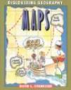
Maps, by David L. Stienecker and illustrated by Richard MacCabe, is a book designed to help introduce children to geography with a focus on maps and globes.
This book highlists the many purposes and differences between maps and globes, how to read them, and the many ways in which they can be drawn. The author and illustrator provide child-friendly text and illustrations to show how maps can be used to visualize and locate specific regions, water features, forests, and landmarks of the world, as well as dicussing that maps can also be created for make believe. The book offers children a view of North America on both a map and globe, and then slowly zooms out to show the Earth as a whole from the perspective of the sky. This book also provides children with question prompts they can respond to during or after reading, while providing teachers with hands-on activitiy ideas for further study, a glossary of essential terms, and an index. Lines of latitude/longitude, projections, compass, hemisphere, equator, and thematic maps are the main topics discussed throughout the book which allows the teacher discretion for how much content to share depending on varying student levels.
Curriculum Connections
Maps serves as an excellent and useful resource to help teach, reinforce, and emphasize several kindergarten – first grade geography learning objectives in accordance with the Virginia Standards of Learning (SOL’s). Students can enhance their understanding in that a map is a drawing of a place to show where things are located while a globe is a round model of the Earth (SOL K.4a), facilitate identification of land and water features (SOL K.4c), encourage understanding that maps and globes show a view from above the Earth and that features are smaller in size (SOL K.5a/b), develop map skills by identifying map symbols (SOL 1.4a), and facilitate accurate identification of North America and Virginia on maps and globes (SOL 1.4d).
Additional Resources
-
Discovery Education provides a wide range of geography lesson plans from grades kindergarten – 5th grade – lesson plans are organized by topic, and when clicked on, provides you with a wealth of resource links, extention activity ideas, suggested readings, and evaluation assessments specific to the lesson
-
Kids Geography offers a wide range of fun, interactive games for students to play either at school or home – games are organized into continents, American capitals, latitude/longitude, and the collective Earth so teachers, students, and parents have the ability to select games that are specific to what the student is learning
-
Enchanted Learning is the place for teachers to go for an endless supply of various geography maps, printables, quizzes, and activities – if teachers want to focus on their state geography, there are links to supply you with tons of state maps for students to label, quizzes, and symbol and emblem worksheets specific to your state
Book: Maps
Author: David L. Stienecker
Illustrator: Richard MacCabe
Publisher: Benchmark Books (New York)
Publication Date: January 1998
Pages: 32pp
Grade Range: Kindergarten – 1st Grade
ISBN-13: 978-0761405382

