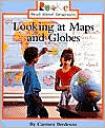
Looking at Maps and Globes is written by Carmen Bredeson. It’s a great book for introducing the concept of maps to students in Kindergarten and First Grade. It explains what maps are and how they differ from photographs. It introduces and explains terms such as symbols, map legend, map scale, directions, equator, map, globe, North and South Pole. The book has real photographs of globes and people using maps. It also has kid-friendly drawings of maps.
Curriculum Connections
This book could be used to help develop an awareness that a map is a drawing of a place and to show where things are located and that a globe is a round model of the Earth. K.4(a). It could be used to introduce students on how to locate land and water features. K.4(c). The book illustrates that maps show things in smaller size and shows the position of objects. K.5(b,c). It will also help students learn to recognize basic map symbols. 1.4(a).
Additional Resources
-
This National Geographic website is a great resource for teachers. It has lesson plans, activities and many printable maps that can be printed without the names so it can be used for assessments.
-
This National Geographic website is for kids and has interactive geography games!
-
This Education World website has lesson plans and activity and project ideas.
-
Ilike2learn has interactive quizzes on all things geography. They seem more like a fun game than a test.
General Information
Book: Looking at Maps and Globes
Author: Carmen Bredeson
Illustrator: Herman Adler Design
Publisher: Children’s Press
Publication Date: 2001
Pages: 31
Grade Range: K-1
ISBN: 0516259822

