![]()
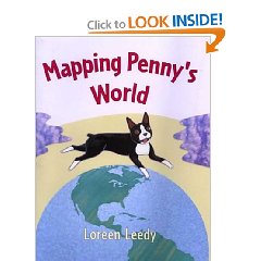
Mapping Penny’s World by Loreen Leedy is a children’s story about a little girl named Lisa who maps out the places she likes to go with her dog Penny. She and Penny map out her bedroom, the backyard where Penny hides her toys, the neighborhood, and even places around the world where Penny might like to go. The maps that Lisa create include the cardinal directions, a key of images found on the map, a title, and a scale for measuring the distances on the map. The illustrations of the maps are very colorful and they are all displayed from a birds- eye view.
- “On this map, some of the symbols stand for the goodies she has hidden outside. The rest of the symbols represent the fence, table, and other things that are supposed to be out there.” (pg. 11)
- “Maps are good for giving directions. Suppose Penny’s friend Maxine wants to come over. You could say, ‘Go out your back door, turn right by the trash cans, crawl under the gap in the wooden fence (watch out for the big orange cat!)…’ ” (pg. 13)
- “The map’s scale shows the real distances in the park. According to the map, the distance between point A and point B is two- tenths of a mile.” (pg. 20)
Curriculum Connections
This story would be a great way to introduce young students to the skills of map making. Mapping Penny’s World provides wonderful illustrations of maps which are labeled with all the key elements. Loreen Leedy also portrays simple, everyday examples of different places that children could map on their own. This story would be useful when teaching Virginia SOLs 1.4, 1,5, and 2.6 in geography in which students will develop map skills by recognizing basic map symbols, construct a simple map of a familiar area, and constructing a simple map using a title, legend and compass rose.
Additional Resources
- This activity allows students to work on their own to create a map of the school yard and directions to a certain place. After the students are done they exchange their map with another student and each student must use their new map to get to the location that is given.
- This brief demonstration of peeling an orange provides children with an explaination as to how a map of the is not 100% accurate because the world is round.
- This lesson plan focuses on political maps and what cities are found on political maps. Students will discover different size cities on a map, as well as different features of cities that are represented on the map.
General Information
Book: Mapping Penny’s World
Author: Loreen Leedy
Illustrator: Loreen Leedy
Publisher: Owlet Paperbacks
Publication Date: August 2003
Pages: 32
Grade Range: K- 3
ISBN: 9780805072624