
Link –
https://s3.amazonaws.com/uploads.knightlab.com/storymapjs/08d434d3fc129d380db9cf27d52dc13e/richmond-football-away-games-2015/index.html
Storymap – D.J. Helkowski
Posted in Assignment 9
Comments Off on Storymap – D.J. Helkowski
Richmond Spider Football Away Games 2015
Link – https://s3.amazonaws.com/uploads.knightlab.com/storymapjs/08d434d3fc129d380db9cf27d52dc13e/richmond-football-away-games-2015/index.html
Posted in Assignment 9
Comments Off on Richmond Spider Football Away Games 2015
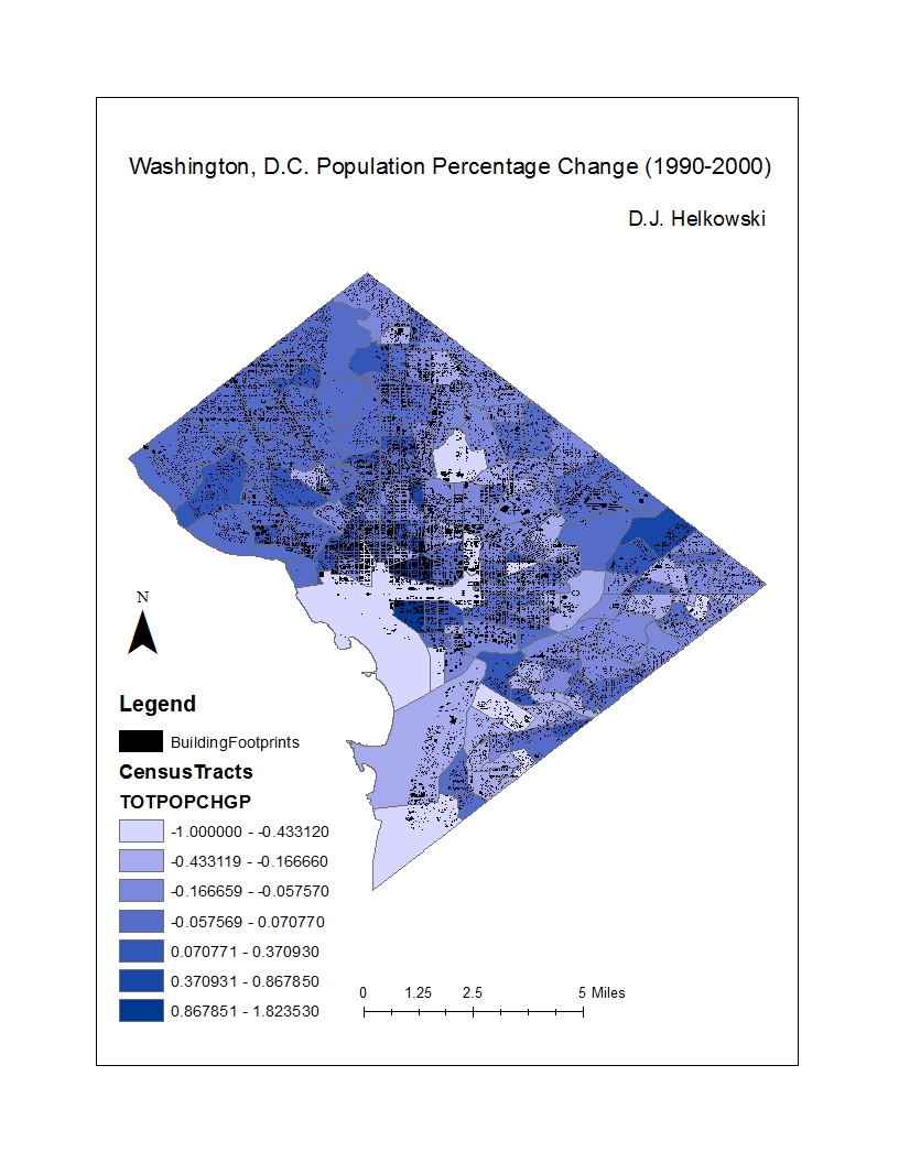
Final Map Assignment

The map I created displays population change as a percentage in Washington, D.C. from 1990-2000. I also added a layer for waterways through the city. The population change areas are the given census tracts. During this time period, Washington, D.C.’s overall population decreased by 5.7%. This would be the final decade of declining population in D.C. since.
Posted in Assignment 6
Comments Off on Final Map Assignment
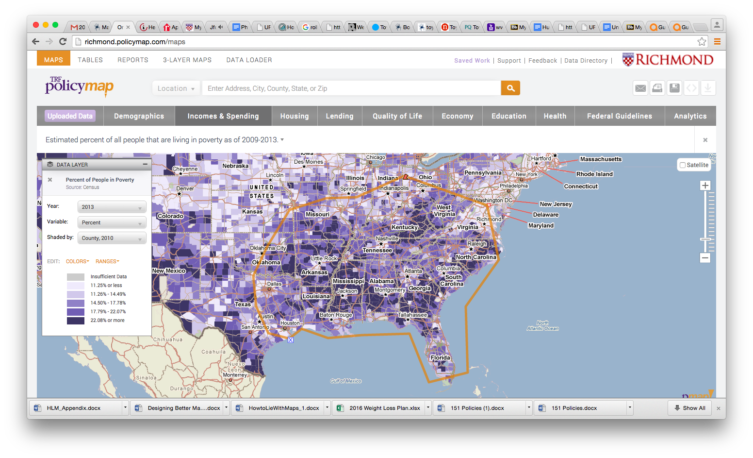
Paragraph for Project
I have decided to create a map displaying poverty levels in Washington, D.C.. In doing this, I will show the regions of DC with the highest and lowest poverty levels, and how they have changed in the past 20 years. Therefor, I will show a percent change on one map. Each region will show a percentage change (positive or negative), which will show whether poverty levels have gone up or down overall in D.C. The point of this is to see whether or not Washington is going in the right direction when it comes to poverty.
Posted in Assignment 4
Comments Off on Paragraph for Project
Alabama Counties and Cities Map, 2011

Posted in Uncategorized
Comments Off on Alabama Counties and Cities Map, 2011
Motro Article – D.J. Helkowski
I found this article on the Israel-Palestine peace talks very interesting. It explains just how crucial mapmaking is in critical situations. So much was put forth into creating a map in order to speed up peace between Israel and Palestine. The mapmakers needed to focus on their audience, and use certain colors, formats, and cropping in order to make a perfect map for said audience. I found it very interesting how much attention to detail was needed to map area C. Four different draft maps were created just so one of them could be chosen to officially represent area C. I didn’t know much about this subject before I read the article, but it was very interesting to find out how vital maps were in the peace talks between Israel and Palestine.
Posted in Assignment 3
Comments Off on Motro Article – D.J. Helkowski
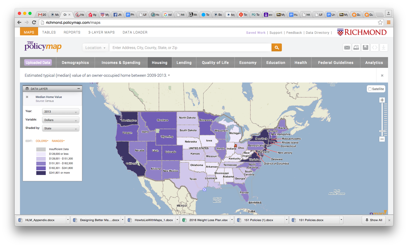
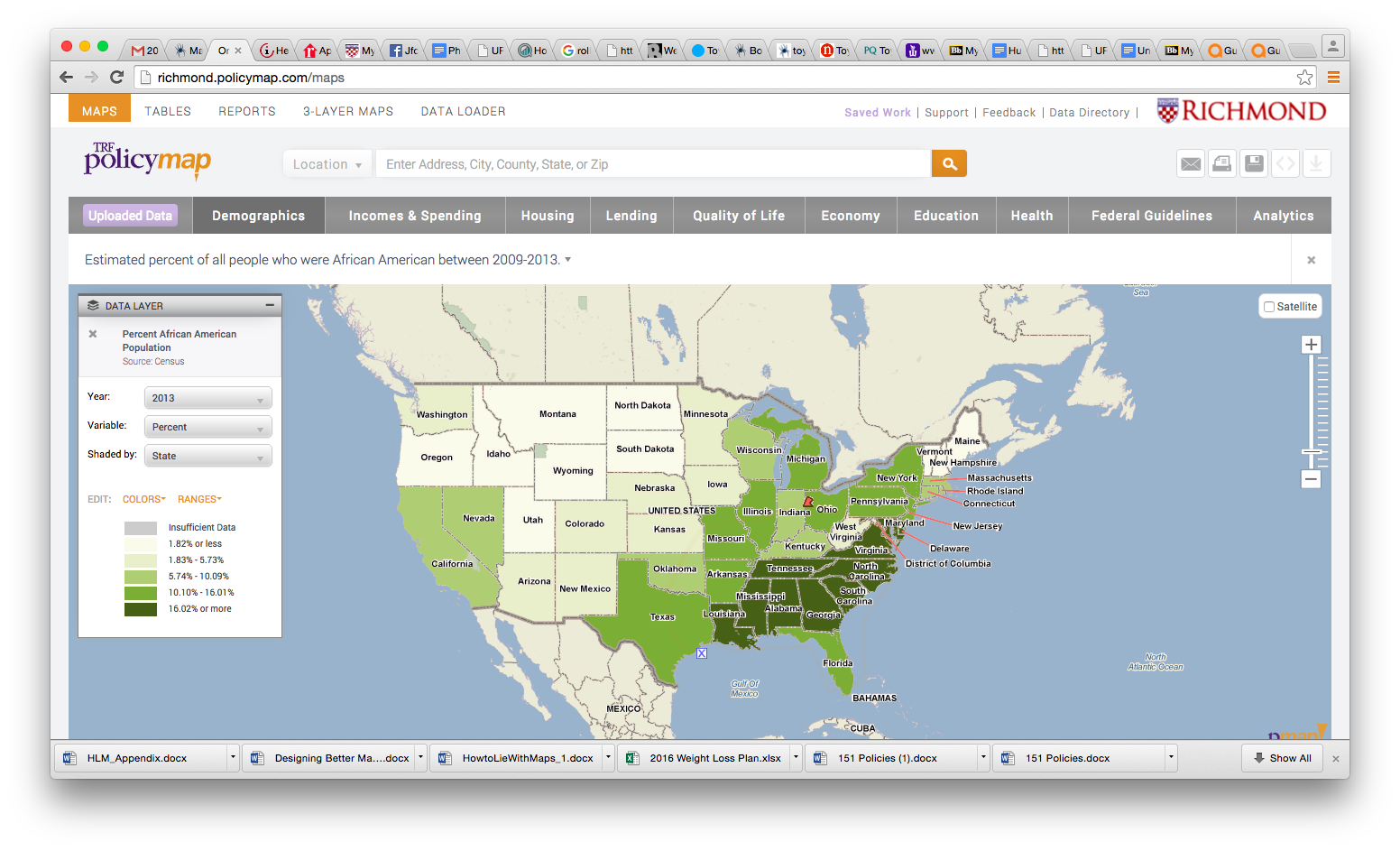
Maps from PolicyMap – D.J. Helkowski
Posted in Assignment 2
Comments Off on Maps from PolicyMap – D.J. Helkowski
Why I’m Taking Maps & Geovisualization
My name is D.J. Helkowski, and I am a Geography major here at the University of Richmond. I’m also the punter on the football team. I am from Warrenton, Virginia, and Geography has been a favorite subject of mine since I can remember. I find maps to be a very good way of displaying information to an audience. Maps not only are intriguing, but they give the audience a fast and easy way of viewing data. If I had to chose between reading a dictionary or looking at an atlas, I chose the latter any day.
The reason I took this class is because I thoroughly enjoyed Intro to GIS, which I took last semester. Being able to create digital maps is something that I’ve never done before, and I could definitely see myself doing it in the workforce. When I found out this class was being offered, I immediately became intrigued. Professor Browne described this course to my Intro to GIS as an add on to what we were currently learning, but with an emphasis on making maps aesthetically pleasing. I also really liked Professor Browne, and when I found out that she would co-teach this course, I knew I had to take it. As a geography major, I’m hoping that gaining a better understanding of GIS software will allow me to take these skills to a job in the field.
What I expect to get out of this course is a better understanding of GIS software. Towards the end of the end of the GIS class I took last semester, I finally felt like I was getting the hang of it. I’m hoping that by the end of this semester I will have at least partially mastered ArcGIS. I’m also hoping to pick up tips on how to make maps look as good as possible. I believe that doing this will allow me to amplify my GIS skills as well as my interest in GIS. I’m hoping that this course will help bring out everything that I love about Geography.
Posted in Assignment 1
Comments Off on Why I’m Taking Maps & Geovisualization
Hello world!
Welcome to blog.richmond.edu. This is your first post. Edit or delete it, then start blogging!
Posted in Uncategorized
Comments Off on Hello world!